Venedocia, Ohio
| Venedocia, Ohio | |
|---|---|
| Village | |
|
Main Street scene | |
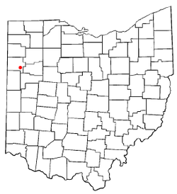 Location of Venedocia, Ohio | |
 Location of Venedocia in Van Wert County | |
| Coordinates: 40°47′9″N 84°27′24″W / 40.78583°N 84.45667°WCoordinates: 40°47′9″N 84°27′24″W / 40.78583°N 84.45667°W | |
| Country | United States |
| State | Ohio |
| County | Van Wert |
| Government | |
| • Mayor | Larry Eustler |
| Area[1] | |
| • Total | 0.13 sq mi (0.34 km2) |
| • Land | 0.13 sq mi (0.34 km2) |
| • Water | 0 sq mi (0 km2) |
| Population (2010)[2] | |
| • Total | 124 |
| • Estimate (2012[3]) | 124 |
| • Density | 953.8/sq mi (368.3/km2) |
| Time zone | Eastern (EST) (UTC-5) |
| • Summer (DST) | EDT (UTC-4) |
| ZIP code | 45894 |
| Area code(s) | 419 |
| Website | http://www.venedocia.org/ |

Venedocia is a village in Van Wert County, Ohio, United States. The population was 124 at the 2010 census. It is included within the Van Wert, Ohio Micropolitan Statistical Area and the Lima-Van Wert-Wapakoneta, OH Combined Statistical Area.
History
A post office called Venedocia has been in operation since 1866.[4] The village was originally built up chiefly by Welsh settlers.[5]
Geography
Venedocia is located at 40°47′9″N 84°27′24″W / 40.78583°N 84.45667°W (40.785830, -84.456686).[6]
According to the United States Census Bureau, the village has a total area of 0.13 square miles (0.34 km2), all land.[1]
Demographics
| Historical population | |||
|---|---|---|---|
| Census | Pop. | %± | |
| 1900 | 199 | — | |
| 1910 | 247 | 24.1% | |
| 1920 | 180 | −27.1% | |
| 1930 | 164 | −8.9% | |
| 1940 | 174 | 6.1% | |
| 1950 | 170 | −2.3% | |
| 1960 | 200 | 17.6% | |
| 1970 | 202 | 1.0% | |
| 1980 | 161 | −20.3% | |
| 1990 | 158 | −1.9% | |
| 2000 | 160 | 1.3% | |
| 2010 | 124 | −22.5% | |
| Est. 2015 | 122 | [7] | −1.6% |
2010 census
As of the census[2] of 2010, there were 124 people, 53 households, and 30 families residing in the village. The population density was 953.8 inhabitants per square mile (368.3/km2). There were 58 housing units at an average density of 446.2 per square mile (172.3/km2). The racial makeup of the village was 97.6% White, 0.8% African American, and 1.6% from two or more races.
There were 53 households of which 24.5% had children under the age of 18 living with them, 47.2% were married couples living together, 7.5% had a female householder with no husband present, 1.9% had a male householder with no wife present, and 43.4% were non-families. 39.6% of all households were made up of individuals and 15.1% had someone living alone who was 65 years of age or older. The average household size was 2.34 and the average family size was 3.10.
The median age in the village was 42 years. 20.2% of residents were under the age of 18; 7.9% were between the ages of 18 and 24; 24.2% were from 25 to 44; 33% were from 45 to 64; and 14.5% were 65 years of age or older. The gender makeup of the village was 54.0% male and 46.0% female.
2000 census
As of the census[9] of 2000, there were 160 people, 59 households, and 43 families residing in the village. The population density was 1,196.7 people per square mile (475.2/km²). There were 63 housing units at an average density of 471.2 per square mile (187.1/km²). The racial makeup of the village was 98.12% White, and 1.88% from two or more races. Hispanic or Latino of any race were 0.62% of the population.
There were 59 households out of which 40.7% had children under the age of 18 living with them, 57.6% were married couples living together, 13.6% had a female householder with no husband present, and 27.1% were non-families. 23.7% of all households were made up of individuals and 13.6% had someone living alone who was 65 years of age or older. The average household size was 2.71 and the average family size was 3.12.
In the village the population was spread out with 27.5% under the age of 18, 8.1% from 18 to 24, 28.8% from 25 to 44, 17.5% from 45 to 64, and 18.1% who were 65 years of age or older. The median age was 40 years. For every 100 females there were 77.8 males. For every 100 females age 18 and over, there were 78.5 males.
The median income for a household in the village was $31,250, and the median income for a family was $41,250. Males had a median income of $26,667 versus $20,000 for females. The per capita income for the village was $11,761. About 10.0% of families and 13.0% of the population were below the poverty line, including 6.5% of those under the age of eighteen and 23.1% of those sixty five or over.
References
- 1 2 "US Gazetteer files 2010". United States Census Bureau. Retrieved 2013-01-06.
- 1 2 "American FactFinder". United States Census Bureau. Retrieved 2013-01-06.
- ↑ "Population Estimates". United States Census Bureau. Retrieved 2013-06-17.
- ↑ "Van Wert County". Jim Forte Postal History. Retrieved 13 December 2015.
- ↑ Gilliland, Thaddeus Stephens (1906). History of Van Wert County, Ohio and Representative Citizens. Windmill Publications. p. 171.
- ↑ "US Gazetteer files: 2010, 2000, and 1990". United States Census Bureau. 2011-02-12. Retrieved 2011-04-23.
- ↑ "Annual Estimates of the Resident Population for Incorporated Places: April 1, 2010 to July 1, 2015". Retrieved July 2, 2016.
- ↑ "Census of Population and Housing". Census.gov. Retrieved June 4, 2015.
- ↑ "American FactFinder". United States Census Bureau. Retrieved 2008-01-31.
Municipalities and communities of Van Wert County, Ohio, United States | ||
|---|---|---|
| Cities | 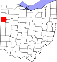 | |
| Villages | ||
| Townships | ||
| Unincorporated communities | ||
| Footnotes | ‡This populated place also has portions in an adjacent county or counties | |