Valley Head, West Virginia
| Valley Head, West Virginia | |
|---|---|
| Census-designated place (CDP) | |
|
Outside Valley Head | |
 Valley Head, West Virginia | |
| Coordinates: 38°32′42″N 80°02′09″W / 38.54500°N 80.03583°WCoordinates: 38°32′42″N 80°02′09″W / 38.54500°N 80.03583°W | |
| Country | United States |
| State | West Virginia |
| County | Randolph |
| Area[1] | |
| • Total | 0.975 sq mi (2.53 km2) |
| • Land | 0.975 sq mi (2.53 km2) |
| • Water | 0 sq mi (0 km2) |
| Elevation | 2,372 ft (723 m) |
| Population (2010)[2] | |
| • Total | 267 |
| • Density | 270/sq mi (110/km2) |
| Time zone | Eastern (EST) (UTC-5) |
| • Summer (DST) | EDT (UTC-4) |
| ZIP code | 26294 |
| Area code(s) | 304 & 681 |
| GNIS feature ID | 1555870[3] |
.jpg)
Valley Head is a census-designated place (CDP) in Randolph County, West Virginia, United States. Valley Head is located on U.S. Route 219 12 miles (19 km) south-southwest of Huttonsville. Valley Head has a post office with ZIP code 26294.[4] As of the 2010 census, its population was 267.[2]
The community was named for the nearby headwaters of the Tygart Valley River.[5]
Notable people
- Country musician and Grand Ole Opry member Wilma Lee Cooper was born in Valley Head in 1921.
- Banking executive Jean Yokum was born in Valley Head in 1931.[6]
Climate
The climate in this area has mild differences between highs and lows, and there is adequate rainfall year round. According to the Köppen Climate Classification system, Valley Head has a marine west coast climate, abbreviated "Cfb" on climate maps.[7]
References
- ↑ "US Gazetteer files: 2010, 2000, and 1990". United States Census Bureau. 2011-02-12. Retrieved 2011-04-23.
- 1 2 "American FactFinder". United States Census Bureau. Retrieved 2011-05-14.
- ↑ U.S. Geological Survey Geographic Names Information System: Valley Head, West Virginia
- ↑ ZIP Code Lookup
- ↑ Kenny, Hamill (1945). West Virginia Place Names: Their Origin and Meaning, Including the Nomenclature of the Streams and Mountains. Piedmont, WV: The Place Name Press. p. 644.
- ↑ Krewatch, Mark (October 28, 1996). "High Profile: Jean Yokum". Daily Press.
- ↑ Climate Summary for Valley Head, West Virginia
External links
Municipalities and communities of Randolph County, West Virginia, United States | ||
|---|---|---|
| City | 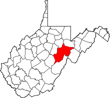 | |
| Towns | ||
| CDPs | ||
| Unincorporated communities |
| |
| Ghost towns | ||
| Footnotes | ‡This populated place also has portions in an adjacent county or counties | |
This article is issued from Wikipedia - version of the 11/17/2016. The text is available under the Creative Commons Attribution/Share Alike but additional terms may apply for the media files.