Utah State Route 65
| ||||
|---|---|---|---|---|
| Route information | ||||
| Defined by Utah Code §72-4-112 | ||||
| Maintained by UDOT | ||||
| Length: | 28.315 mi[1] (45.569 km) | |||
| Existed: | 1931 – present | |||
| Major junctions | ||||
| South end: |
| |||
|
| ||||
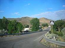
| North end: | End State Maintenance sign in Henefer | |||
| Highway system | ||||
| ||||

State Route 65 is a highway in northern Utah connecting I-80 near the Mountain Dell Dam to I-84 in Henefer.
Route description
From its southern terminus east of Salt Lake City and west of Park City, the highway goes north, crossing the Mountain Dell Golf Course. It partially circumnavigates the Little Dell Reservoir before it makes another turn for the north. Right before the Morgan County line the route turns northwest. When it reaches East Canyon State Park, SR-65 heads north-northwest, continuing this general direction until its northern terminus in Henefer.
History
State Route 65 was added to the state highway system in 1931, following the historic Mormon Trail as closely as practicable from SR-5 (US-30S, now I-84) in Henefer over Big Mountain Pass and through Emigration Canyon to Salt Lake City (later meeting SR-186 there).[2] A branch to Pinecrest, State Route 172, was created in 1935[3] and existed until 1969.[4] The portion of SR-65 east of Mountain Dell was removed from the route in 1945 in favor of a connection with SR-4 (US-40, now I-80) in Parley's Canyon. (The connecting SR-66 was truncated at the same time, and has since been reconnected.)[5] Two years later, this law was essentially repealed, as SR-65 was moved back to the full Henefer-Salt Lake City route; the connection to SR-4 became a new State Route 239. Roads within This Is The Place Monument near the west end were also added to the route for the state to maintain.[6] The state legislature removed the western portion in 1969, rerouting SR-65 to its current alignment between I-80 in Parley's Canyon and I-84 in Henefer and replacing SR-239. However, at the same time, SR-3 (which had replaced SR-5) was moved to I-84, and the old route through Henefer became an extension of SR-65 - in both directions. The western connection to I-84 was renumbered State Route 86 in 1975.[7]
Major intersections
| County | Location[8] | mi[1] | km | Destinations | Notes |
|---|---|---|---|---|---|
| Salt Lake | Summit Park | 0.000 | 0.000 | Southern terminus | |
| Morgan | East Canyon State Park | 19.427 | 31.265 | ||
| Summit | Henefer | 27.417 | 44.123 | ||
| 28.240 | 45.448 | ||||
| 28.315 | 45.569 | End State Maintenance | |||
| 1.000 mi = 1.609 km; 1.000 km = 0.621 mi | |||||
References
- 1 2 "State Route 65 Highway reference". Utah Department of Transportation.
- ↑ Utah State Legislature (1931). Chapter 55: Designation of State Roads. Session Laws of Utah.
(65) From Salt Lake City easterly via Emigration canyon and along old Mormon trail as near as practicable to Henefer.
- ↑ Utah State Legislature (1935). Chapter 37: Designation of State Roads. Session Laws of Utah.
Route 172. From route 65 in Emigration Canyon to Pinecrest.
- ↑ Utah Department of Transportation, Highway Resolutions: "Route 172". (838 KB), updated November 2007, accessed May 2008
- ↑ Utah State Legislature (1945). Chapter 61: State Roads and Routes. Session Laws of Utah.
Route 65. From Salt Lake City on route 186 easterly via Emigration Canyon and Little Mountain to route 4 in Parley's Canyon. Route 66. From Morgan on route 5 via Porterville to Hardscrabble.
- ↑ Utah State Legislature (1947). Chapter 48. Session Laws of Utah.
Route 65. From Salt Lake City on route 186 easterly via Emigration Canyon along the route designated as the Brigham Young Memorial Highway to Henefer on route 5, and including roads at This Is The Place Monument." "Route 239. From route 65 in Parley's Canyon southerly to route 4.
- ↑ Utah Department of Transportation, Highway Resolutions: "Route 65". (4.78 MB), updated November 2007, accessed May 2008
- ↑ "State Highway Map". Utah Department of Transportation. Retrieved 14 April 2008.
External links
![]() Media related to Utah State Route 65 at Wikimedia Commons
Media related to Utah State Route 65 at Wikimedia Commons