List of Interstate and U.S. Highways in Utah
- This list covers Interstate and U.S. highways in Utah. For state routes, see List of state highways in Utah.
|
Highway markers for Interstates and U.S. Highways in Utah | |
| Highway names | |
|---|---|
| Interstates: | Interstate nn (I-nn) |
| US Highways: | US Highway nn (US-nn) |
| System links | |
| |
.svg.png)
.svg.png)


Three numbered highway systems are present in the U.S. state of Utah: the Interstate Highway System, the United States Numbered Highways system (more commonly known as "U.S. Routes") and the state route system. Both the Interstate and U.S. Highway system are nationwide systems with only a small portion of these routes entering Utah. The Utah Department of Transportation is responsible for maintaining all of the Interstate, U.S. Routes and state highways in the state. Originally, the State Road Commission of Utah, created on March 23, 1909 was responsible for maintenance, but these duties were rolled into the new Department of Transportation in 1975.[1]
There are 3,039.643 miles (4,891.831 km).[2] of Interstates and U.S. Routes in Utah, comprising 977.664 miles (1,573.398 km)[3] of Interstate highways and 2,061.979 miles (3,318.434 km)[4] of U.S. Routes. The longest Interstate is Interstate 15 at 400.592 miles (644.690 km) and the shortest being Interstate 215 at 28.946 miles (46.584 km). The longest U.S. Route is U.S. Route 89 at 502.577 miles (808.819 km) and the shortest being U.S. Route 89A at 2.94 miles (4.73 km).
Five former U.S. Routes exist in the state of Utah, as well as two former interstate highways, all of which have been replaced by current interstate and U.S. Routes, with the most recent change being U.S. Route 666 changing to U.S. Route 491 in 2003.[5] One unique former route would be Interstate 415, which was never signed as such, and was only used as a temporary designation for the eastern portion of what is now the Interstate 215 belt loop around Salt Lake City.[6]
Interstate highways
| Route number | Length | Western / southern terminus | Eastern / northern terminus | Counties | Description | Map | Ref. |
|---|---|---|---|---|---|---|---|
| 400.592 miles (644.690 km) | Washington, Iron, Beaver, Millard, Juab, Utah, Salt Lake, Davis, Weber, Box Elder | Interstate 15 crosses through the entire state, starting in the south from Saint George, up through the middle of the state where it intersects I-70, and into the Salt Lake Valley to meet with I-215 and I-80. After leaving the valley, I-15 continues north, where it becomes concurrent with I-84 until the split in Tremonton, where I-15 heads north into Idaho. | _map.svg.png) |
[7][8] | |||
| 231.673 miles (372.842 km) | Millard, Sevier, Emery, Grand | Interstate 70 begins in Utah near Cove Fort, not passing through any major metropolitan areas of Utah, and serves as a long-haul route to Denver and the east coast. A stretch of 110 miles (180 km) exists on the highway without any services available. | _map_2.svg.png) |
[9][10] | |||
| 196.680 miles (316.526 km) | Tooele, Salt Lake, Summit | Interstate 80 enters from Wendover and crosses the Bonneville Salt Flats before entering the Salt Lake Valley, briefly becoming concurrent with I-15 before leaving the valley through Parley's Canyon, meeting the end of I-84 and enters Wyoming. | _map_2.svg.png) |
[11][12] | |||
| 119.773 miles (192.756 km) | Box Elder. Weber, Davis, Morgan, Summit | I-84 enters in Snowville and soon becomes concurrent with I-15 until it splits off in Roy, and enters Weber Canyon before ending at I-80 in Echo | _map_2.svg.png) |
[13][14] [notes 1] | |||
| 28.946 miles (46.584 km) | Salt Lake, Davis | 270 degree belt route around Salt Lake City | _map_2.svg.png) |
[15][16] | |||
Former routes
| Route number | Western / southern terminus | Eastern / northern terminus | Years active | Replaced by |
|---|---|---|---|---|
| 1958–1977 | ||||
| 1959–1969 |
 I-15 in Salt Lake City
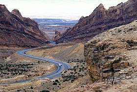 I-70 through Spotted Wolf Canyon
 I-80 approaching road construction in Salt Lake City
U.S. Highways
| Route number | Length | Western / southern terminus | Eastern / northern terminus | Counties | Description | Map | Ref. |
|---|---|---|---|---|---|---|---|
| 373.963 miles (601.835 km) | Millard, Juab, Utah, Wasatch, Carbon, Emery | US-6 enters Utah through Delta, joined with US-50 until just after Delta and crosses across the middle of the state before joining I-70 and US-50 again to enter into Colorado, east of Cisco. | _map.svg.png) |
[17][18] | |||
| 174.624 miles (281.030 km) | Summit, Wasatch, Duchesne, Uintah | US-40 starts at I-80 outside of Park City and heads through Heber City and Duchense before passing into Colorado near the Dinosaur National Monument. | _map.svg.png) |
[19][20] | |||
| 334.920 miles (539.001 km) | Millard, Sevier | US-50 enters Utah joined with US-6 until just outside Delta, crossing the midsection of Utah, before joining with I-70 for its final 174 miles (280 km) to Colorado. | _map.svg.png) |
[21][22] [notes 1] | |||
| 502.577 miles (808.819 km) | Kane, Garfield, Piute, Sevier, Sanpete, Utah, Salt Lake, Davis, Weber, Box Elder, Cache, Rich | US-89 is the longest U.S. Highway in Utah, going from the Arizona border to Idaho, paralleling I-15 for a good majority of the route, but it does split off at the north and south end of the route. | _map.svg.png) |
[14][23] | |||
| 2.94 miles (4.73 km) | Kane | The original routing of US-89 prior to the construction of the Glen Canyon Dam. After construction was demoted to an auxiliary route listed as State Route 11 until 2008, and provides access to Grand Canyon National Park from Utah. | [14][24] | ||||
| 45.271 miles (72.857 km) | Box Elder, Cache | The highway currently serves as a connection between the Cache Valley area of Utah and Idaho to the Salt Lake and Pocatello population centers. | _map.svg.png) |
[25][26] | |||
| 41.405 miles (66.635 km) | San Juan | US-163 enters Utah in Monument Valley in the southeastern part of the state, across the San Juan River towards Bluff. | _map.svg.png) |
[27][28] | |||
| 29.216 miles (47.019 km) | Utah, Wasatch | From I-15 in Provo northeast through Provo Canyon to Heber City. From this point it overlaps US-40 until it intersects I-80, at which point it overlaps I-80 until the Wyoming border near Evanston. | _map.svg.png) |
[29][30] | |||
| 404.168 miles (650.445 km) | San Juan, Grand, Duchesne, Daggett, | US-191 enters Utah in the southeastern part of the state and travels northward through Moab, veers to the northwest to Price, and back to the northeast through Vernal, before exiting into Wyoming near Flaming Gorge Reservoir. | _map.svg.png) |
[31][32] [notes 1] | |||
| 17.020 miles (27.391 km) | San Juan | From US-191 in Monticello eastward until it exits the state into Colorado. | _map.svg.png) |
[33][34] | |||
Former routes
| Route number | Western / southern terminus | Eastern / northern terminus | Years active | Replaced by |
|---|---|---|---|---|
| Idaho state line near Snowville | Wyoming state line towards Evanston | 1926 - 1970s | ||
| Colorado state line near Monticello | 1930s - 1970 | |||
| Colorado state line near Monticello | 1926 - 1930s | |||
| US-40 near Park City | US-30S near Echo | 1926 - 1930s | ||
| 1970–2003 |
 US-50 descending from Skull Rock Pass in western Utah
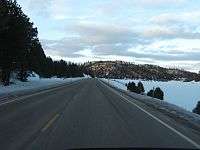 US-89 near Long Valley Junction, a Utah Scenic Byway
 Navajo Bridge along US-89A
Notes
References
- ↑ "Utah State Archives Catalog". Retrieved 2008-07-29.
- ↑ This is the sum of all of the mileages listed in the "Length" section of all of the tables.
- ↑ This is the sum of the mileages from the Interstate and Auxiliary Interstate tables "Length" section
- ↑ This is the sum of the mileages from the U.S. Route table "Length" section.
- 1 2 Linthicum, Leslie (2003-07-31). "It's Now U.S. 491, Not U.S. 666". Albuquerque Journal. Retrieved 2008-07-29.
- 1 2 "SR-215 History" (PDF). State Road Commission of Utah. 1968-10-14. Retrieved 2008-07-29.
- ↑ "Highway Reference - 0015 P" (PDF). Utah Department of Transportation. 2008-05-01. Retrieved 2008-07-26.
- ↑ "Utah Code §72-4-107". Utah State Legislature. Retrieved 2008-07-29.
- ↑ "Highway Reference - 0070 P" (PDF). Utah Department of Transportation. 2008-05-01. Retrieved 2008-07-26.
- ↑ "Utah Code §72-4-112". Utah State Legislature. Retrieved 2008-07-29.
- ↑ "Highway Reference - 0080 P" (PDF). Utah Department of Transportation. 2008-05-01. Retrieved 2008-07-26.
- ↑ "Utah Code §72-4-113". Utah State Legislature. Retrieved 2008-07-29.
- ↑ "Highway Reference - 0084 P" (PDF). Utah Department of Transportation. 2008-05-01. Retrieved 2008-07-26.
- 1 2 3 "Utah Code §72-4-114". Utah State Legislature. Retrieved 2008-07-29.
- ↑ "Highway Reference - 0215 P" (PDF). Utah Department of Transportation. 2008-05-01. Retrieved 2008-07-26.
- ↑ "Utah Code §72-4-127". Utah State Legislature. Retrieved 2008-07-29.
- ↑ "Highway Reference - 0006 P" (PDF). Utah Department of Transportation. 2008-05-01. Retrieved 2008-07-26.
- ↑ "Utah Code §72-4-106". Utah State Legislature. Retrieved 2008-07-29.
- ↑ "Highway Reference - 0040 P" (PDF). Utah Department of Transportation. 2008-05-01. Retrieved 2008-07-26.
- ↑ "Utah Code §72-4-109". Utah State Legislature. Retrieved 2008-07-29.
- ↑ "Highway Reference - 0050 P" (PDF). Utah Department of Transportation. 2008-05-01. Retrieved 2008-07-26.
- ↑ "Utah Code §72-4-110". Utah State Legislature. Retrieved 2008-07-29.
- ↑ "Highway Reference - 0089 P" (PDF). Utah Department of Transportation. 2008-05-01. Retrieved 2008-07-26.
- ↑ "Highway Reference - 089A P" (PDF). Utah Department of Transportation. 2008-05-01. Retrieved 2008-07-26.
- ↑ "Highway Reference - 0091 P" (PDF). Utah Department of Transportation. 2008-05-01. Retrieved 2008-07-26.
- ↑ "Utah Code §72-4-115". Utah State Legislature. Retrieved 2008-07-29.
- ↑ "Highway Reference - 0163 P" (PDF). Utah Department of Transportation. 2008-05-01. Retrieved 2008-07-26.
- ↑ "Utah Code §72-4-122". Utah State Legislature. Retrieved 2008-07-29.
- ↑ "Highway Reference - 0189 P" (PDF). Utah Department of Transportation. 2008-05-01. Retrieved 2008-07-26.
- ↑ "Utah Code §72-4-124". Utah State Legislature. Retrieved 2008-07-29.
- ↑ "Highway Reference - 0191 P" (PDF). Utah Department of Transportation. 2008-05-01. Retrieved 2008-07-26.
- ↑ "Utah Code §72-4-125". Utah State Legislature. Retrieved 2008-07-29.
- ↑ "Highway Reference - 0491 P" (PDF). Utah Department of Transportation. 2008-05-01. Retrieved 2008-07-26.
- ↑ "Utah Code §72-4-137". Utah State Legislature. Retrieved 2008-07-29.
External links
| Wikimedia Commons has media related to Roads in Utah. |