Ulysses, Nebraska
| Ulysses, Nebraska | |
|---|---|
| Village | |
|
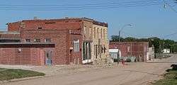
Downtown Ulysses: C Street | |
 Location of Ulysses, Nebraska | |
| Coordinates: 41°4′21″N 97°12′10″W / 41.07250°N 97.20278°WCoordinates: 41°4′21″N 97°12′10″W / 41.07250°N 97.20278°W | |
| Country | United States |
| State | Nebraska |
| County | Butler |
| Area[1] | |
| • Total | 0.20 sq mi (0.52 km2) |
| • Land | 0.20 sq mi (0.52 km2) |
| • Water | 0 sq mi (0 km2) |
| Elevation | 1,526 ft (465 m) |
| Population (2010)[2] | |
| • Total | 171 |
| • Estimate (2012[3]) | 169 |
| • Density | 855.0/sq mi (330.1/km2) |
| Time zone | Central (CST) (UTC-6) |
| • Summer (DST) | CDT (UTC-5) |
| ZIP codes | 68667, 68669 |
| Area code(s) | 402 |
| FIPS code | 31-49460[4] |
| GNIS feature ID | 0834254[5] |
Ulysses is a village in Butler County, Nebraska, United States. The population was 171 at the 2010 census.
History
The first post office in Ulysses was established in 1869.[6] The village is named for Ulysses S. Grant.[7]
Geography
Ulysses is located at 41°4′21″N 97°12′10″W / 41.07250°N 97.20278°W (41.072375, -97.202762).[8]
According to the United States Census Bureau, the village has a total area of 0.20 square miles (0.52 km2), all of it land.[1]
Demographics
| Historical population | |||
|---|---|---|---|
| Census | Pop. | %± | |
| 1880 | 305 | — | |
| 1890 | 621 | 103.6% | |
| 1900 | 563 | −9.3% | |
| 1910 | 551 | −2.1% | |
| 1920 | 460 | −16.5% | |
| 1930 | 492 | 7.0% | |
| 1940 | 429 | −12.8% | |
| 1950 | 374 | −12.8% | |
| 1960 | 357 | −4.5% | |
| 1970 | 312 | −12.6% | |
| 1980 | 270 | −13.5% | |
| 1990 | 256 | −5.2% | |
| 2000 | 276 | 7.8% | |
| 2010 | 171 | −38.0% | |
| Est. 2015 | 165 | [9] | −3.5% |
2010 census
As of the census[2] of 2010, there were 171 people, 74 households, and 50 families residing in the village. The population density was 855.0 inhabitants per square mile (330.1/km2). There were 105 housing units at an average density of 525.0 per square mile (202.7/km2). The racial makeup of the village was 98.8% White and 1.2% from two or more races. Hispanic or Latino of any race were 2.3% of the population.
There were 74 households of which 32.4% had children under the age of 18 living with them, 54.1% were married couples living together, 8.1% had a female householder with no husband present, 5.4% had a male householder with no wife present, and 32.4% were non-families. 31.1% of all households were made up of individuals and 13.6% had someone living alone who was 65 years of age or older. The average household size was 2.31 and the average family size was 2.84.
The median age in the village was 43.8 years. 25.1% of residents were under the age of 18; 2.9% were between the ages of 18 and 24; 22.7% were from 25 to 44; 31.5% were from 45 to 64; and 17.5% were 65 years of age or older. The gender makeup of the village was 50.9% male and 49.1% female.
2000 census
As of the census[4] of 2000, there were 276 people, 107 households, and 78 families residing in the village. The population density was 1,378.3 people per square mile (532.8/km²). There were 123 housing units at an average density of 614.2 per square mile (237.5/km²). The racial makeup of the village was 96.74% White, 0.36% Native American, 0.36% Asian, and 2.54% from two or more races. Hispanic or Latino of any race were 2.54% of the population.
There were 107 households out of which 31.8% had children under the age of 18 living with them, 59.8% were married couples living together, 10.3% had a female householder with no husband present, and 27.1% were non-families. 21.5% of all households were made up of individuals and 14.0% had someone living alone who was 65 years of age or older. The average household size was 2.58 and the average family size was 3.05.
In the village the population was spread out with 29.3% under the age of 18, 5.1% from 18 to 24, 30.4% from 25 to 44, 20.7% from 45 to 64, and 14.5% who were 65 years of age or older. The median age was 34 years. For every 100 females there were 93.0 males. For every 100 females age 18 and over, there were 85.7 males.
As of 2000 the median income for a household in the village was $31,500, and the median income for a family was $39,306. Males had a median income of $27,321 versus $20,000 for females. The per capita income for the village was $14,022. About 4.9% of families and 10.5% of the population were below the poverty line, including 13.0% of those under the age of eighteen and 5.7% of those sixty five or over.
Notable people
- George E. Waldo, New York politician
- Chester Hardy Aldrich, 16th Governor of Nebraska and Justice of the Nebraska Supreme Court.[11]
References
- 1 2 "US Gazetteer files 2010". United States Census Bureau. Retrieved 2012-06-24.
- 1 2 "American FactFinder". United States Census Bureau. Retrieved 2012-06-24.
- ↑ "Population Estimates". United States Census Bureau. Retrieved 2013-05-29.
- 1 2 "American FactFinder". United States Census Bureau. Retrieved 2008-01-31.
- ↑ "US Board on Geographic Names". United States Geological Survey. 2007-10-25. Retrieved 2008-01-31.
- ↑ "Ulysses, Butler County". Center for Advanced Land Management Information Technologies. University of Nebraska. Retrieved 31 July 2014.
- ↑ Fitzpatrick, Lillian L. (1960). Nebraska Place-Names. University of Nebraska Press. p. 30.
- ↑ "US Gazetteer files: 2010, 2000, and 1990". United States Census Bureau. 2011-02-12. Retrieved 2011-04-23.
- ↑ "Annual Estimates of the Resident Population for Incorporated Places: April 1, 2010 to July 1, 2015". Retrieved July 2, 2016.
- ↑ "Census of Population and Housing". Census.gov. Retrieved June 4, 2015.
- ↑ "Nebraska Governor Chester Hardy Aldrich". National Governors Association. Retrieved September 29, 2012.
Municipalities and communities of Butler County, Nebraska, United States | ||
|---|---|---|
| City | ||
| Villages | ||
| Townships | ||
| Unincorporated communities | ||
| Ghost town | ||