Brainard, Nebraska
| Brainard, Nebraska | |
|---|---|
| Village | |
|
Downtown Brainard | |
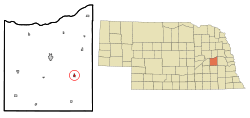 Location of Brainard, Nebraska | |
| Coordinates: 41°11′1″N 97°0′10″W / 41.18361°N 97.00278°WCoordinates: 41°11′1″N 97°0′10″W / 41.18361°N 97.00278°W | |
| Country | United States |
| State | Nebraska |
| County | Butler |
| Area[1] | |
| • Total | 0.33 sq mi (0.85 km2) |
| • Land | 0.33 sq mi (0.85 km2) |
| • Water | 0 sq mi (0 km2) |
| Elevation | 1,673 ft (510 m) |
| Population (2010)[2] | |
| • Total | 330 |
| • Estimate (2012[3]) | 328 |
| • Density | 1,000.0/sq mi (386.1/km2) |
| Time zone | Central (CST) (UTC-6) |
| • Summer (DST) | CDT (UTC-5) |
| ZIP code | 68626 |
| Area code(s) | 402 |
| FIPS code | 31-06120[4] |
| GNIS feature ID | 0827616[5] |
| Website | brainardnebraska.com |

Brainard is a village in Butler County, Nebraska, United States. The population was 330 at the 2010 census.
History
Brainard was laid out in 1878 when the railroad was extended to that point.[6] It was named for David Brainerd, an American missionary to the Native Americans, although the spelling is different.[6][7]
Geography
Brainard is located at 41°11′1″N 97°0′10″W / 41.18361°N 97.00278°W (41.183725, -97.002832).[8]
According to the United States Census Bureau, the village has a total area of 0.33 square miles (0.85 km2), all of it land.[1]
Demographics
| Historical population | |||
|---|---|---|---|
| Census | Pop. | %± | |
| 1880 | 61 | — | |
| 1890 | 306 | 401.6% | |
| 1900 | 384 | 25.5% | |
| 1910 | 465 | 21.1% | |
| 1920 | 468 | 0.6% | |
| 1930 | 400 | −14.5% | |
| 1940 | 444 | 11.0% | |
| 1950 | 373 | −16.0% | |
| 1960 | 300 | −19.6% | |
| 1970 | 309 | 3.0% | |
| 1980 | 275 | −11.0% | |
| 1990 | 326 | 18.5% | |
| 2000 | 351 | 7.7% | |
| 2010 | 330 | −6.0% | |
| Est. 2015 | 322 | [9] | −2.4% |
2010 census
As of the census[2] of 2010, there were 330 people, 152 households, and 90 families residing in the village. The population density was 1,000.0 inhabitants per square mile (386.1/km2). There were 174 housing units at an average density of 527.3 per square mile (203.6/km2). The racial makeup of the village was 99.7% White and 0.3% from other races. Hispanic or Latino of any race were 0.9% of the population.
There were 152 households of which 23.7% had children under the age of 18 living with them, 54.6% were married couples living together, 3.9% had a female householder with no husband present, 0.7% had a male householder with no wife present, and 40.8% were non-families. 38.8% of all households were made up of individuals and 17.1% had someone living alone who was 65 years of age or older. The average household size was 2.17 and the average family size was 2.91.
The median age in the village was 45.5 years. 22.1% of residents were under the age of 18; 6.7% were between the ages of 18 and 24; 20.2% were from 25 to 44; 31.3% were from 45 to 64; and 19.7% were 65 years of age or older. The gender makeup of the village was 51.5% male and 48.5% female.
2000 census
As of the census[4] of 2000, there were 351 people, 148 households, and 100 families residing in the village. The population density was 1,252.1 people per square mile (484.0/km²). There were 162 housing units at an average density of 577.9 per square mile (223.4/km²). The racial makeup of the village was 99.43% White, and 0.57% from two or more races.
There were 148 households out of which 37.2% had children under the age of 18 living with them, 56.8% were married couples living together, 9.5% had a female householder with no husband present, and 31.8% were non-families. 29.7% of all households were made up of individuals and 12.8% had someone living alone who was 65 years of age or older. The average household size was 2.37 and the average family size was 2.95.
In the village the population was spread out with 28.5% under the age of 18, 4.6% from 18 to 24, 24.5% from 25 to 44, 24.5% from 45 to 64, and 17.9% who were 65 years of age or older. The median age was 40 years. For every 100 females there were 105.3 males. For every 100 females age 18 and over, there were 91.6 males.
As of 2000 the median income for a household in the village was $35,000, and the median income for a family was $44,375. Males had a median income of $29,722 versus $21,667 for females. The per capita income for the village was $17,713. About 2.9% of families and 4.5% of the population were below the poverty line, including 5.9% of those under age 18 and none of those age 65 or over.
Education
Brainard Public Schools are part of the East Butler Public Schools School District. There is one elementary school and one high school in the district.[11]
Notable natives
- Jerome Hanus - Roman Catholic Archbishop of Dubuque.
- Joel Makovicka - American football player.
- Lyle Talbot - Actor.
References
- 1 2 "US Gazetteer files 2010". United States Census Bureau. Archived from the original on 2012-01-24. Retrieved 2012-06-24.
- 1 2 "American FactFinder". United States Census Bureau. Retrieved 2012-06-24.
- ↑ "Population Estimates". United States Census Bureau. Archived from the original on 2013-06-17. Retrieved 2013-05-29.
- 1 2 "American FactFinder". United States Census Bureau. Archived from the original on 2013-09-11. Retrieved 2008-01-31.
- ↑ "US Board on Geographic Names". United States Geological Survey. 2007-10-25. Retrieved 2008-01-31.
- 1 2 "Brainard, Butler County". Center for Advanced Land Management Information Technologies. University of Nebraska. Retrieved 31 July 2014.
- ↑ Chicago and North Western Railway Company (1908). A History of the Origin of the Place Names Connected with the Chicago & North Western and Chicago, St. Paul, Minneapolis & Omaha Railways. p. 46.
- ↑ "US Gazetteer files: 2010, 2000, and 1990". United States Census Bureau. 2011-02-12. Retrieved 2011-04-23.
- ↑ "Annual Estimates of the Resident Population for Incorporated Places: April 1, 2010 to July 1, 2015". Retrieved July 2, 2016.
- ↑ "Census of Population and Housing". Census.gov. Archived from the original on May 11, 2015. Retrieved June 4, 2015.
- ↑ "East Butler Public Schools". East Butler Public Schools. Retrieved 2012-06-27.
External links
Municipalities and communities of Butler County, Nebraska, United States | ||
|---|---|---|
| City | ||
| Villages | ||
| Townships | ||
| Unincorporated communities | ||
| Ghost town | ||