U.S. Route 77 in Texas
| ||||
|---|---|---|---|---|
| Blue Star Memorial Highway | ||||
_map.svg.png) | ||||
| Route information | ||||
| Maintained by TxDOT | ||||
| Length: | 471.296 mi[1] (758.477 km) | |||
| Existed: | 1927[1] – present | |||
| Major junctions | ||||
| south end: | United States-Mexico border in Brownsville | |||
|
| ||||
| north end: |
| |||
| Location | ||||
| Counties: | Cameron, Willacy, Kenedy, Kleberg, Nuecess, San Patricio, Refugio, Victoria, De Witt, Lavaca, Fayette, Lee, Milam, Falls, McLennan, Hill, Ellis, Dallas, Denton, Cooke | |||
| Highway system | ||||
| ||||

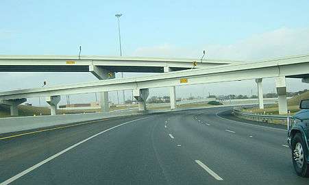
U.S. Route 77 (US 77) is a major highway that is part of the United States Numbered Highway System that runs from the Veterans International Bridge in Brownsville to Sioux City, Iowa. In Texas, the road runs south-north for 471.3 miles (758.5 km) from the International border with Mexico to the Oklahoma state line north of Gainesville. The highway is being upgraded to a freeway near Corpus Christi to connect to the freeway part of the highway in Raymondville as part of future I-69. A freeway in Robstown is already signed as part of I-69. From Waco to the Oklahoma state line, US 77 overlaps or runs parallel to I-35/I-35E.
Route description
US 77 crosses the Rio Grande with US 83 on the Veterans International Bridge. The two highways run together concurrent with I-69E until Harlingen. US 83 runs west (north) along I-2 to McAllen while US 77 runs north along with I-69E to Raymondville. The highway is only one to pass through Kenedy County. In Raymondville, I-69E temporarily ends.
In Robstown, US 77 again picks up the I-69E designation until the interchange with I-37 in north Corpus Christi. US 77 shares a short overlap with I-37 before leaving the highway. US 77 runs through many small to mid-size communities before arriving in Waco. Here, US 77 begins its overlap with I-35 that lasts until Hillsboro, where the highway then parallels I-35E until Red Oak.
US 77 has an unsigned overlap with I-35E until US 77 leaves the interstate in Corinth to serve Denton. The highway then returns to I-35 in north Denton until the two highways cross into Oklahoma together north of Gainesville.
History
Major intersections
| County | Location | mi | km | Destinations | Notes | |||
|---|---|---|---|---|---|---|---|---|
| Cameron | Brownsville | Veterans International Bridge at Los Tomates over the Rio Grande south end of US 83 overlap | ||||||
| University Boulevard / East Avenue - UT-Brownsville, Texas Southmost College | at-grade intersection | |||||||
| overlap; see I-69E | ||||||||
| Kenedy | | La Parra Avenue - Sarita | interchange | |||||
| Kleberg | Riviera | |||||||
| | ||||||||
| | ||||||||
| Ricardo | ||||||||
| | ||||||||
| Kingsville | ||||||||
| interchange | ||||||||
| interchange | ||||||||
| interchange | ||||||||
| interchange | ||||||||
| Nueces | Bishop | |||||||
| | interchange | |||||||
| | ||||||||
| | ||||||||
| Driscoll | ||||||||
| | ||||||||
| overlap; see I-69E | ||||||||
| Corpus Christi | north end of I-69E overlap; south end of I-37 overlap; US 77 south follows exit 14 | |||||||
| Sharpsburg Road / Redbird Lane | I-37 exit 15 | |||||||
| Labonte Park | I-37 exit 16 | |||||||
| San Patricio | | north end of I-37 overlap; US 77 north follows exit 17 | ||||||
| Odem | ||||||||
| | ||||||||
| | interchange | |||||||
| | interchange | |||||||
| | interchange | |||||||
| | interchange | |||||||
| | ||||||||
| Refugio | Woodsboro | |||||||
| | ||||||||
| Refugio | ||||||||
| | interchange | |||||||
| Victoria | | |||||||
| | interchange; northbound exit and southbound entrance; future I-69 north | |||||||
| | interchange; south end of US 59 overlap | |||||||
| | ||||||||
| | interchange; north end of US 59 overlap | |||||||
| | interchange | |||||||
| | interchange; no direct northbound exit (signed at FM 236) | |||||||
| Victoria | interchange | |||||||
| Briggs Boulevard / Nursery Drive | interchange; no direct northbound exit | |||||||
| Mallette Drive / Invitational Drive | interchange | |||||||
| interchange | ||||||||
| | ||||||||
| | ||||||||
| DeWitt |
No major junctions | |||||||
| Lavaca | | interchange | ||||||
| | ||||||||
| | ||||||||
| Hallettsville | south end of US 90 Alt. overlap | |||||||
| north end of US 90 Alt. overlap | ||||||||
| | south end of FM 532 overlap | |||||||
| | north end of FM 532 overlap | |||||||
| Fayette | Schulenburg | |||||||
| I-10 exit 674 | ||||||||
| | ||||||||
| | ||||||||
| | ||||||||
| | ||||||||
| | ||||||||
| | ||||||||
| La Grange | ||||||||
| interchange | ||||||||
| | ||||||||
| | ||||||||
| Warda | ||||||||
| Lee | Giddings | |||||||
| | ||||||||
| | interchange | |||||||
| | ||||||||
| | south end of FM 696 overlap | |||||||
| Lexington | north end of FM 696 overlap | |||||||
| Milam | | |||||||
| | ||||||||
| Rockdale | interchange | |||||||
| | ||||||||
| | south end of US 190 / SH 36 overlap | |||||||
| | ||||||||
| Cameron | north end of US 190 / SH 36 overlap | |||||||
| Splawn | ||||||||
| Ben Arnold | ||||||||
| | ||||||||
| Falls | | |||||||
| Rosebud | ||||||||
| | ||||||||
| Travis | south end of FM 431 overlap | |||||||
| north end of FM 431 overlap | ||||||||
| Lott | ||||||||
| | ||||||||
| | south end of SH 7 overlap | |||||||
| | ||||||||
| | interchange; north end of SH 7 overlap | |||||||
| Golinda | ||||||||
| McLennan | | south end of FM 2643 overlap | ||||||
| | north end of FM 2643 overlap | |||||||
| Robinson | ||||||||
| interchange | ||||||||
| Waco | traffic circle | |||||||
| south end of I-35 overlap; US 77 south follows exit 334 | ||||||||
| see I-35 | ||||||||
| Hill | | north end of I-35 overlap; US 77 north follows exit 370 | ||||||
| Carl's Corner | ||||||||
| Midway | ||||||||
| | ||||||||
| Ellis | Milford | south end of FM 308 overlap | ||||||
| | north end of FM 308 overlap | |||||||
| Italy | ||||||||
| Forreston | ||||||||
| Nena | ||||||||
| Waxahachie | I-35E exit 397 | |||||||
| interchange | ||||||||
| Red Oak | ||||||||
| south end of I-35E overlap; US 77 south follows exit 408 | ||||||||
| see I-35E | ||||||||
| Denton | Denton | north end of I-35E overlap; US 77 north follows exit 464 | ||||||
| south end of US 377 overlap | ||||||||
| north end of US 377 overlap | ||||||||
| interchange | ||||||||
| south end of I-35 overlap; US 77 south follows exit 471 | ||||||||
| see I-35 | ||||||||
| Cooke | | Oklahoma state line (bridge over Red River) | ||||||
| 1.000 mi = 1.609 km; 1.000 km = 0.621 mi | ||||||||
References
- 1 2 Transportation Planning and Programming Division (n.d.). "U.S. Highway No. 77". Highway Designation Files. Texas Department of Transportation.
| Previous state: Terminus |
Texas | Next state: Oklahoma |