Maypearl, Texas
| Maypearl, Texas | |
|---|---|
| City | |
|
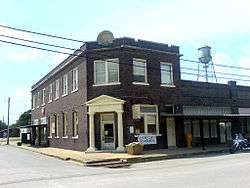
A former bank in Maypearl | |
| Motto: "A pearl in the heart of North Texas" | |
 Location of Maypearl, Texas | |
 | |
| Coordinates: 32°18′57″N 97°0′25″W / 32.31583°N 97.00694°WCoordinates: 32°18′57″N 97°0′25″W / 32.31583°N 97.00694°W | |
| Country | United States |
| State | Texas |
| County | Ellis |
| Incorporated (city) | 1910 |
| Area | |
| • Total | 0.83 sq mi (2.14 km2) |
| • Land | 0.81 sq mi (2.10 km2) |
| • Water | 0.02 sq mi (0.05 km2) |
| Elevation | 531 ft (162 m) |
| Population (2010) | |
| • Total | 934 |
| • Density | 1,154/sq mi (445.4/km2) |
| Time zone | Central (CST) (UTC-6) |
| • Summer (DST) | CDT (UTC-5) |
| ZIP code | 76064 |
| Area code(s) | 972 |
| FIPS code | 48-47268[1] |
| GNIS feature ID | 1341124[2] |
| Website |
ci |
Maypearl is a city in Ellis County, Texas, United States. The population was 934 at the 2010 census,[3] up from 746 at the 2000 census.
Geography
Maypearl is located in western Ellis County at 32°18′57″N 97°0′25″W / 32.31583°N 97.00694°W (32.315701, -97.006839).[4] It is 11 miles (18 km) southwest of Waxahachie, the county seat, 13 miles (21 km) south of Midlothian, and 39 miles (63 km) southwest of downtown Dallas.
According to the United States Census Bureau, Maypearl has a total area of 0.81 square miles (2.1 km2), of which 0.02 square miles (0.05 km2), or 2.16%, is water.[3]
Demographics
| Historical population | |||
|---|---|---|---|
| Census | Pop. | %± | |
| 1920 | 417 | — | |
| 1930 | 410 | −1.7% | |
| 1940 | 377 | −8.0% | |
| 1950 | 373 | −1.1% | |
| 1960 | 359 | −3.8% | |
| 1970 | 462 | 28.7% | |
| 1980 | 626 | 35.5% | |
| 1990 | 781 | 24.8% | |
| 2000 | 746 | −4.5% | |
| 2010 | 934 | 25.2% | |
| Est. 2015 | 981 | [5] | 5.0% |
As of the census[1] of 2000, there were 746 people, 245 households, and 185 families residing in the city. The population density was 1,590.2 people per square mile (612.8/km²). There were 263 housing units at an average density of 560.6/sq mi (216.1/km²). The racial makeup of the city was 81.37% White, 6.97% African American, 0.40% Native American, 0.67% Asian, 9.79% from other races, and 0.80% from two or more races. Hispanic or Latino of any race were 21.05% of the population.
There were 245 households out of which 42.9% had children under the age of 18 living with them, 60.4% were married couples living together, 9.8% had a female householder with no husband present, and 24.1% were non-families. 20.8% of all households were made up of individuals and 9.4% had someone living alone who was 65 years of age or older. The average household size was 3.04 and the average family size was 3.53.
In the city the population was spread out with 32.3% under the age of 18, 10.9% from 18 to 24, 30.8% from 25 to 44, 18.5% from 45 to 64, and 7.5% who were 65 years of age or older. The median age was 32 years. For every 100 females there were 95.8 males. For every 100 females age 18 and over, there were 104.5 males.
The median income for a household in the city was $41,417, and the median income for a family was $53,750. Males had a median income of $40,156 versus $21,750 for females. The per capita income for the city was $14,883. About 4.7% of families and 8.3% of the population were below the poverty line, including 7.6% of those under age 18 and 10.7% of those age 65 or over.

Education
The community is served by the Maypearl Independent School District and is home to the Maypearl High School Panthers. The district received a recognized status by the Texas Education Agency for the 2008-2009 academic year
Climate
The climate in this area is characterized by hot, humid summers and generally mild to cool winters. According to the Köppen Climate Classification system, Maypearl has a humid subtropical climate, abbreviated "Cfa" on climate maps.[7]
References
- 1 2 "American FactFinder". United States Census Bureau. Archived from the original on September 11, 2013. Retrieved 2008-01-31.
- ↑ "US Board on Geographic Names". United States Geological Survey. 2007-10-25. Retrieved 2008-01-31.
- 1 2 "Geographic Identifiers: 2010 Census Summary File 1 (G001): Maypearl city, Texas". American Factfinder. U.S. Census Bureau. Retrieved March 25, 2016.
- ↑ "US Gazetteer files: 2010, 2000, and 1990". United States Census Bureau. 2011-02-12. Retrieved 2011-04-23.
- ↑ "Annual Estimates of the Resident Population for Incorporated Places: April 1, 2010 to July 1, 2015". Retrieved July 2, 2016.
- ↑ "Census of Population and Housing". Census.gov. Archived from the original on May 11, 2015. Retrieved June 4, 2015.
- ↑ Climate Summary for Maypearl, Texas
External links
Municipalities and communities of Ellis County, Texas, United States | ||
|---|---|---|
| Cities |  | |
| Towns | ||
| CDP | ||
| Unincorporated communities | ||
| Footnotes | ‡This populated place also has portions in an adjacent county or counties | |