Tuttle, California
| Tuttle | |
|---|---|
| census-designated place | |
 Tuttle Location in California | |
| Coordinates: 37°17′46″N 120°22′44″W / 37.29611°N 120.37889°WCoordinates: 37°17′46″N 120°22′44″W / 37.29611°N 120.37889°W | |
| Country |
|
| State |
|
| County | Merced |
| Area[1] | |
| • Total | 1.759 sq mi (4.555 km2) |
| • Land | 1.759 sq mi (4.555 km2) |
| • Water | 0 sq mi (0 km2) 0% |
| Elevation[2] | 207 ft (63 m) |
| Population (2010) | |
| • Total | 103 |
| • Density | 59/sq mi (23/km2) |
| Time zone | Pacific (PST) (UTC-8) |
| • Summer (DST) | PDT (UTC-7) |
| ZIP Code | 95340 |
| Area code(s) | 209 |
| GNIS feature IDs | 1660046; 2583170 |
| U.S. Geological Survey Geographic Names Information System: Tuttle, California; U.S. Geological Survey Geographic Names Information System: Tuttle, California | |
Tuttle (formerly, Turner)[3] is a census-designated place[4] in Merced County, California.[2] It is located on the Atchison, Topeka and Santa Fe Railroad 5.5 miles (8.9 km) east of Merced,[3] at an elevation of 207 feet (63 m).[2] The population was 103 at the 2010 census.
The town was named for R.H. Tuttle, an official of the railroad.[3]
Geography
According to the United States Census Bureau, the CDP covers an area of 1.8 square miles (4.6 km²), all of it land.
Demographics
The 2010 United States Census[5] reported that Tuttle had a population of 103. The population density was 58.6 people per square mile (22.6/km²). The racial makeup of Tuttle was 77 (74.8%) White, 6 (5.8%) African American, 0 (0.0%) Native American, 6 (5.8%) Asian, 0 (0.0%) Pacific Islander, 9 (8.7%) from other races, and 5 (4.9%) from two or more races. Hispanic or Latino of any race were 31 persons (30.1%).
The Census reported that 103 people (100% of the population) lived in households, 0 (0%) lived in non-institutionalized group quarters, and 0 (0%) were institutionalized.
There were 35 households, out of which 11 (31.4%) had children under the age of 18 living in them, 21 (60.0%) were opposite-sex married couples living together, 3 (8.6%) had a female householder with no husband present, 4 (11.4%) had a male householder with no wife present. There were 4 (11.4%) unmarried opposite-sex partnerships, and 0 (0%) same-sex married couples or partnerships. 6 households (17.1%) were made up of individuals and 3 (8.6%) had someone living alone who was 65 years of age or older. The average household size was 2.94. There were 28 families (80.0% of all households); the average family size was 3.14.
The population was spread out with 21 people (20.4%) under the age of 18, 10 people (9.7%) aged 18 to 24, 23 people (22.3%) aged 25 to 44, 31 people (30.1%) aged 45 to 64, and 18 people (17.5%) who were 65 years of age or older. The median age was 43.5 years. For every 100 females there were 128.9 males. For every 100 females age 18 and over, there were 134.3 males.
There were 39 housing units at an average density of 22.2 per square mile (8.6/km²), of which 24 (68.6%) were owner-occupied, and 11 (31.4%) were occupied by renters. The homeowner vacancy rate was 0%; the rental vacancy rate was 14.3%. 77 people (74.8% of the population) lived in owner-occupied housing units and 26 people (25.2%) lived in rental housing units.
References
- ↑ U.S. Census
- 1 2 3 U.S. Geological Survey Geographic Names Information System: Tuttle, California
- 1 2 3 Durham, David L. (1998). California's Geographic Names: A Gazetteer of Historic and Modern Names of the State. Clovis, Calif.: Word Dancer Press. p. 840. ISBN 1-884995-14-4.
- ↑ U.S. Geological Survey Geographic Names Information System: Tuttle, California
- ↑ "2010 Census Interactive Population Search: CA - Tuttle CDP". U.S. Census Bureau. Retrieved July 12, 2014.
Municipalities and communities of Merced County, California, United States | ||
|---|---|---|
| Cities | 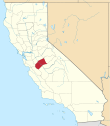 | |
| CDPs | ||
| Unincorporated communities | ||
| Ghost towns |
| |