Winton, California
| Winton | |
|---|---|
| census-designated place | |
 Location in Merced County and the state of California | |
 Winton Location in the United States | |
| Coordinates: 37°23.3′N 120°36.8′W / 37.3883°N 120.6133°WCoordinates: 37°23.3′N 120°36.8′W / 37.3883°N 120.6133°W | |
| Country |
|
| State |
|
| County | Merced |
| Area[1] | |
| • Total | 3.041 sq mi (7.876 km2) |
| • Land | 3.041 sq mi (7.876 km2) |
| • Water | 0 sq mi (0 km2) 0% |
| Elevation[2] | 177 ft (54 m) |
| Population (2010) | |
| • Total | 10,613 |
| • Density | 3,500/sq mi (1,300/km2) |
| Time zone | Pacific (PST) (UTC-8) |
| • Summer (DST) | PDT (UTC-7) |
| ZIP code | 95388 |
| Area code(s) | 209 |
| FIPS code | 06-86076 |
| GNIS feature ID | 1660195 |
Winton (formerly, Merced Colony No. 1, Merced Colony No. 2, and Windfield)[3] is a census-designated place (CDP) in Merced County, California, United States. Winton is located 2.5 miles (4 km) north of Atwater,[3] at an elevation of 177 feet (54 m).[2] The population was 10,613 at the 2010 census, up from 8,832 at the 2000 census.
Winton was established along the original Santa Fe Rail Road and has grown only a very small amount since it was established. At one time, passenger trains would stop at this location.
Winton was mentioned by Johnny Carson on The Tonight Show Starring Johnny Carson in the early 1970s while reading information from a magazine. It was noted that, at the time, Winton had the highest crime rate for a city its size in the nation.
Another note to some fame was the old Wagon Wheel Bar, which for years was a Hells Angels bar.
Geography
Winton is located at 37°23.3′N 120°36.8′W / 37.3883°N 120.6133°W.[2]
According to the United States Census Bureau, the CDP has a total area of 3.0 square miles (7.8 km2), all of it land.
History
The Winton post office, transferred from Yam, opened in 1912.[3] The name honors J.E. Winton, county surveyor.[3]
Demographics
2010
The 2010 United States Census[4] reported that Winton had a population of 10,613. The population density was 3,490.1 people per square mile (1,347.5/km²). The racial makeup of Winton was 5,696 (53.7%) White, 175 (1.6%) African American, 140 (1.3%) Native American, 701 (6.6%) Asian, 8 (0.1%) Pacific Islander, 3,455 (32.6%) from other races, and 438 (4.1%) from two or more races. Hispanic or Latino of any race were 7,566 persons (71.3%).
The Census reported that 10,613 people (100% of the population) lived in households, 0 (0%) lived in non-institutionalized group quarters, and 0 (0%) were institutionalized.
There were 2,718 households, out of which 1,645 (60.5%) had children under the age of 18 living in them, 1,563 (57.5%) were opposite-sex married couples living together, 472 (17.4%) had a female householder with no husband present, 266 (9.8%) had a male householder with no wife present. There were 203 (7.5%) unmarried opposite-sex partnerships, and 24 (0.9%) same-sex married couples or partnerships. 316 households (11.6%) were made up of individuals and 137 (5.0%) had someone living alone who was 65 years of age or older. The average household size was 3.90. There were 2,301 families (84.7% of all households); the average family size was 4.19.
The population was spread out with 3,934 people (37.1%) under the age of 18, 1,261 people (11.9%) aged 18 to 24, 2,823 people (26.6%) aged 25 to 44, 1,926 people (18.1%) aged 45 to 64, and 669 people (6.3%) who were 65 years of age or older. The median age was 25.6 years. For every 100 females there were 100.9 males. For every 100 females age 18 and over, there were 99.7 males.
There were 3,056 housing units at an average density of 1,005.0 per square mile (388.0/km²), of which 1,450 (53.3%) were owner-occupied, and 1,268 (46.7%) were occupied by renters. The homeowner vacancy rate was 4.3%; the rental vacancy rate was 10.4%. 5,366 people (50.6% of the population) lived in owner-occupied housing units and 5,247 people (49.4%) lived in rental housing units.
2000
As of the census[5] of 2000, there were 8,832 people, 2,343 households, and 1,949 families residing in the CDP. The population density was 3,073.8 people per square mile (1,188.2/km²). There were 2,514 housing units at an average density of 875.0 per square mile (338.2/km²). The racial makeup of the CDP was 44.28% White, 2.33% African American, 1.08% Native American, 5.36% Asian, 0.34% Pacific Islander, 41.00% from other races, and 5.62% from two or more races. Hispanic or Latino of any race were 62.19% of the population.
There were 2,343 households out of which 54.5% had children under the age of 18 living with them, 60.4% were married couples living together, 15.5% had a female householder with no husband present, and 16.8% were non-families. 12.6% of all households were made up of individuals and 4.7% had someone living alone who was 65 years of age or older. The average household size was 3.77 and the average family size was 4.11.
In the CDP the population was spread out with 39.1% under the age of 18, 12.0% from 18 to 24, 27.6% from 25 to 44, 15.3% from 45 to 64, and 6.0% who were 65 years of age or older. The median age was 24 years. For every 100 females there were 100.2 males. For every 100 females age 18 and over, there were 100.1 males.
The median income for a household in the CDP was $19,787, and the median income for a family was $19,834. Males had a median income of $16,832 versus $11,676 for females. The per capita income for the CDP was $10,451. About 23.5% of families and 28.8% of the population were below the poverty line, including 38.8% of those under age 18 and 13.5% of those age 65 or over.
Politics
In the state legislature Winton is located in the 12th Senate District, represented by Republican Anthony Cannella, and in the 21st Assembly District, represented by Democrat Adam Gray.
In the United States House of Representatives, Winton is in California's 16th congressional district, represented by Democrat Jim Costa.[6]
Notable residents
- Bernard Berrian, NFL receiver for the Minnesota Vikings[7]
- Charlie Guerra, Folk artist[8]
References
- ↑ "2010 Census U.S. Gazetteer Files – Places – California". United States Census Bureau.
- 1 2 3 U.S. Geological Survey Geographic Names Information System: Winton, California
- 1 2 3 4 Durham, David L. (1998). California's Geographic Names: A Gazetteer of Historic and Modern Names of the State. Clovis, Calif.: Word Dancer Press. p. 847. ISBN 1-884995-14-4.
- ↑ "2010 Census Interactive Population Search: CA - Winton CDP". U.S. Census Bureau. Retrieved July 12, 2014.
- ↑ "American FactFinder". United States Census Bureau. Retrieved 2008-01-31.
- ↑ "California's 16th Congressional District - Representatives & District Map". Civic Impulse, LLC. Retrieved October 1, 2014.
- ↑ "Bernard Berrian Stats (ESPN)".
- ↑ "Charlie Guerra".Unofficial website (musician)
Municipalities and communities of Merced County, California, United States | ||
|---|---|---|
| Cities | 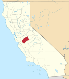 | |
| CDPs | ||
| Unincorporated communities | ||
| Ghost towns |
| |