Turner, Montana
| Turner, Montana | |
|---|---|
| Census-designated place & Unincorporated community | |
 Turner, Montana  Turner, Montana | |
| Coordinates: 48°50′37″N 108°24′25″W / 48.84361°N 108.40694°WCoordinates: 48°50′37″N 108°24′25″W / 48.84361°N 108.40694°W | |
| Country | United States |
| State | Montana |
| County | Blaine |
| Area[1] | |
| • Total | 0.445 sq mi (1.15 km2) |
| • Land | 0.445 sq mi (1.15 km2) |
| • Water | 0 sq mi (0 km2) |
| Elevation | 3,041 ft (927 m) |
| Population (2010)[2] | |
| • Total | 61 |
| • Density | 140/sq mi (53/km2) |
| Time zone | Mountain (MST) (UTC-7) |
| • Summer (DST) | MDT (UTC-6) |
| ZIP code | 59542 |
| Area code(s) | 406 Exchange: 379 |
| GNIS feature ID | 777808[3] |
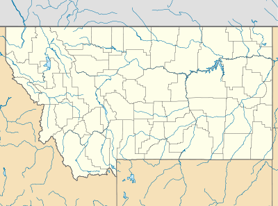
Turner is a census-designated place and unincorporated community in Blaine County, Montana, United States. Turner is located on Montana State Highway 241 41.5 miles (66.8 km) east-northeast of Chinook.[4] Its population was 61 as of the 2010 census.[2] Turner has a post office with ZIP code 59542;[5] it also has an airport, Turner Airport. Turner is the farthest community in the continental U.S. from a Major League Baseball park; it lies 646.93 miles (1,041.13 km) from Safeco Field in Seattle, the nearest park.[6]
Climate
According to the Köppen Climate Classification system, Turner has a semi-arid climate, abbreviated "BSk" on climate maps.[7]
References
- ↑ "US Gazetteer files: 2010, 2000, and 1990". United States Census Bureau. 2011-02-12. Retrieved 2011-04-23.
- 1 2 "American FactFinder". United States Census Bureau. Retrieved 2011-05-14.
- ↑ "Turner". Geographic Names Information System. United States Geological Survey.
- ↑ Blaine (PDF) (Map). Montana Department of Transportation. 2010. p. 2. Retrieved April 27, 2012.
- ↑ United States Postal Service (2012). "USPS - Look Up a ZIP Code". Retrieved 2012-02-15.
- ↑ Robinson, Craig. "Turner, Montana: The American Town Farthest From a Major League Team". Flip Flop Fly Ball. Retrieved April 27, 2012.
- ↑ Climate Summary for Turner, Montana
External links
Municipalities and communities of Blaine County, Montana, United States | ||
|---|---|---|
| Cities | 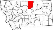 | |
| CDPs | ||
| Unincorporated communities | ||
| Indian reservations | ||
| Footnotes | ‡This populated place also has portions in an adjacent county or counties | |
This article is issued from Wikipedia - version of the 8/8/2016. The text is available under the Creative Commons Attribution/Share Alike but additional terms may apply for the media files.