Chinook, Montana
| Chinook, Montana | |
|---|---|
| City | |
 | |
 Location of Chinook, Montana | |
| Coordinates: 48°35′N 109°14′W / 48.583°N 109.233°WCoordinates: 48°35′N 109°14′W / 48.583°N 109.233°W | |
| Country | United States |
| State | Montana |
| County | Blaine |
| Area[1] | |
| • Total | 0.51 sq mi (1.32 km2) |
| • Land | 0.51 sq mi (1.32 km2) |
| • Water | 0 sq mi (0 km2) |
| Elevation | 2,428 ft (740 m) |
| Population (2010)[2] | |
| • Total | 1,203 |
| • Estimate (2015)[3] | 1,228 |
| • Density | 2,358.8/sq mi (910.7/km2) |
| Time zone | Mountain (MST) (UTC-7) |
| • Summer (DST) | MDT (UTC-6) |
| ZIP codes | 59523, 59535 |
| Area code(s) | 406 |
| FIPS code | 30-14575 |
| GNIS feature ID | 0769848 |
| Website | www.chinookmontana.com |
Chinook is a city in and the county seat of Blaine County, Montana, United States.[4] The population was 1,203 at the 2010 census. Points of interest are the Bear Paw Battlefield Museum located in the small town's center and the Bear Paw Battlefield, located just twenty miles south of Chinook.
Geography
Chinook is located at 48°35′N 109°14′W / 48.583°N 109.233°W (48.5894, -109.2321).[5]
According to the United States Census Bureau, the city has a total area of 0.51 square miles (1.32 km2), all of it land.[1]
Demographics
| Historical population | |||
|---|---|---|---|
| Census | Pop. | %± | |
| 1910 | 780 | — | |
| 1920 | 1,217 | 56.0% | |
| 1930 | 1,320 | 8.5% | |
| 1940 | 2,051 | 55.4% | |
| 1950 | 2,307 | 12.5% | |
| 1960 | 2,326 | 0.8% | |
| 1970 | 1,813 | −22.1% | |
| 1980 | 1,660 | −8.4% | |
| 1990 | 1,512 | −8.9% | |
| 2000 | 1,386 | −8.3% | |
| 2010 | 1,203 | −13.2% | |
| Est. 2015 | 1,228 | [6] | 2.1% |
| U.S. Decennial Census[7] 2015 Estimate[3] | |||
2010 census
As of the census[2] of 2010, there were 1,203 people, 599 households, and 313 families residing in the city. The population density was 2,358.8 inhabitants per square mile (910.7/km2). There were 697 housing units at an average density of 1,366.7 per square mile (527.7/km2). The racial makeup of the city was 88.4% White, 9.3% Native American, 0.3% Asian, 0.1% from other races, and 1.9% from two or more races. Hispanic or Latino of any race were 1.2% of the population.
There were 599 households of which 23.7% had children under the age of 18 living with them, 39.9% were married couples living together, 9.2% had a female householder with no husband present, 3.2% had a male householder with no wife present, and 47.7% were non-families. 43.9% of all households were made up of individuals and 21.2% had someone living alone who was 65 years of age or older. The average household size was 2.01 and the average family size was 2.79.
The median age in the city was 46.7 years. 21.4% of residents were under the age of 18; 5.6% were between the ages of 18 and 24; 20.4% were from 25 to 44; 29.1% were from 45 to 64; and 23.4% were 65 years of age or older. The gender makeup of the city was 48.9% male and 51.1% female.
2000 census
As of the census[8] of 2000, there were 1,386 people, 657 households, and 375 families residing in the city. The population density was 2,693.2 people per square mile (1,049.3/km²). There were 732 housing units at an average density of 1,422.4 per square mile (554.2/km²). The racial makeup of the city was 91.34% White, 0.36% African American, 6.35% "Native American", 0.07% Asian, 0.29% from other races, and 1.59% from two or more races. Hispanic or Latino of any race were 0.58% of the population.
There were 657 households out of which 26.3% had children under the age of 18 living with them, 45.4% were married couples living together, 9.9% had a female householder with no husband present, and 42.9% were non-families. 39.6% of all households were made up of individuals and 21.6% had someone living alone who was 65 years of age or older. The average household size was 2.10 and the average family size was 2.84.
In the city the population was spread out with 23.6% under the age of 18, 5.3% from 18 to 24, 24.0% from 25 to 44, 23.4% from 45 to 64, and 23.7% who were 65 years of age or older. The median age was 43 years. For every 100 females there were 89.6 males. For every 100 females age 18 and over, there were 86.8 males.
The median income for a household in the city was $25,461, and the median income for a family was $35,577. Males had a median income of $26,667 versus $20,179 for females. The per capita income for the city was $16,038. About 12.1% of families and 17.3% of the population were below the poverty line, including 20.8% of those under age 18 and 20.1% of those age 65 or over.
Climate
Chinook experiences a semi-arid climate (Köppen BSk) with long, cold, dry winters and hot, wetter summers.
| Climate data for Chinook, Montana | |||||||||||||
|---|---|---|---|---|---|---|---|---|---|---|---|---|---|
| Month | Jan | Feb | Mar | Apr | May | Jun | Jul | Aug | Sep | Oct | Nov | Dec | Year |
| Record high °F (°C) | 67 (19) |
75 (24) |
82 (28) |
92 (33) |
96 (36) |
104 (40) |
105 (41) |
109 (43) |
104 (40) |
90 (32) |
79 (26) |
66 (19) |
109 (43) |
| Average high °F (°C) | 25.9 (−3.4) |
33.4 (0.8) |
45.1 (7.3) |
58.9 (14.9) |
69.1 (20.6) |
77.8 (25.4) |
84.0 (28.9) |
83.7 (28.7) |
72.1 (22.3) |
59.2 (15.1) |
40.3 (4.6) |
29.7 (−1.3) |
56.6 (13.66) |
| Daily mean °F (°C) | 12.7 (−10.7) |
19.8 (−6.8) |
30.9 (−0.6) |
44.4 (6.9) |
55.0 (12.8) |
63.9 (17.7) |
68.6 (20.3) |
67.6 (19.8) |
55.4 (13) |
43.2 (6.2) |
26.9 (−2.8) |
16.7 (−8.5) |
42.09 (5.61) |
| Average low °F (°C) | −0.5 (−18.1) |
6.2 (−14.3) |
16.7 (−8.5) |
29.9 (−1.2) |
40.8 (4.9) |
49.9 (9.9) |
53.1 (11.7) |
51.4 (10.8) |
38.6 (3.7) |
27.2 (−2.7) |
13.4 (−10.3) |
3.7 (−15.7) |
27.53 (−2.48) |
| Record low °F (°C) | −50 (−46) |
−44 (−42) |
−36 (−38) |
−10 (−23) |
11 (−12) |
28 (−2) |
36 (2) |
29 (−2) |
13 (−11) |
−24 (−31) |
−38 (−39) |
−50 (−46) |
−50 (−46) |
| Average precipitation inches (mm) | 0.54 (13.7) |
0.32 (8.1) |
0.56 (14.2) |
0.99 (25.1) |
2.29 (58.2) |
2.29 (58.2) |
1.66 (42.2) |
1.34 (34) |
1.43 (36.3) |
0.66 (16.8) |
0.47 (11.9) |
0.51 (13) |
13.06 (331.7) |
| Source #1: NOAA (normals, 1971–2000) [9] | |||||||||||||
| Source #2: The Weather Channel (Records) [10] | |||||||||||||
Notable people
- Elliott Blackstone, sergeant of the San Francisco Police Department and longtime advocate for LGBT rights, was born here.
- Chet Blaylock, former member of the Montana State Senate, taught school here.
- U.S. Grant Sharp, Jr., former United States Navy four star admiral and Commander in Chief of the United States Pacific Fleet, was born here.
- Mike Tilleman, NFL defensive tackle, was born here.
- Ken Overcast, Montana Cowboy award winning singer, author, story teller and song writer lives on their ranch near here with his wife, Dawn.
References
- 1 2 "US Gazetteer files 2010". United States Census Bureau. Archived from the original on 2012-01-24. Retrieved 2012-12-18.
- 1 2 "American FactFinder". United States Census Bureau. Retrieved 2012-12-18.
- 1 2 "Population Estimates". United States Census Bureau. Retrieved July 15, 2016.
- ↑ "Find a County". National Association of Counties. Archived from the original on 2015-05-10. Retrieved 2011-06-07.
- ↑ "US Gazetteer files: 2010, 2000, and 1990". United States Census Bureau. 2011-02-12. Retrieved 2011-04-23.
- ↑ "Annual Estimates of the Resident Population for Incorporated Places: April 1, 2010 to July 1, 2015". Retrieved July 2, 2016.
- ↑ "Census of Population and Housing". Census.gov. Archived from the original on May 11, 2015. Retrieved June 4, 2015.
- ↑ "American FactFinder". United States Census Bureau. Archived from the original on 2013-09-11. Retrieved 2008-01-31.
- ↑ "Climatography of the United States NO.81" (PDF). National Oceanic and Atmospheric Administration. Retrieved January 15, 2011.
- ↑ "Monthly Averages for Chinook, MT". The Weather Channel. Retrieved January 15, 2011.
Municipalities and communities of Blaine County, Montana, United States | ||
|---|---|---|
| Cities | 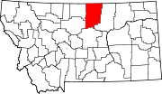 | |
| CDPs | ||
| Unincorporated communities | ||
| Indian reservations | ||
| Footnotes | ‡This populated place also has portions in an adjacent county or counties | |