Turški Vrh
| Turški Vrh | |
|---|---|
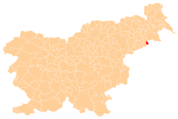
 Turški Vrh Location in Slovenia | |
| Coordinates: 46°21′44.68″N 16°3′8.69″E / 46.3624111°N 16.0524139°ECoordinates: 46°21′44.68″N 16°3′8.69″E / 46.3624111°N 16.0524139°E | |
| Country |
|
| Traditional region | Styria |
| Statistical region | Drava |
| Municipality | Zavrč |
| Area | |
| • Total | 4.21 km2 (1.63 sq mi) |
| Elevation | 287.4 m (942.9 ft) |
| Population (2002) | |
| • Total | 280 |
| [1] | |
Turški Vrh (pronounced [ˈtuːɾʃki ˈʋəɾx]) is a settlement in the Municipality of Zavrč in the Haloze area of eastern Slovenia. The area traditionally belonged to the Styria region. It is now included in the Drava Statistical Region.[2]
The local church on a hill in the south of the settlement, right on the border with Croatia, is dedicated to Saints Hermagoras and Fortunatus and belongs to the Parish of Zavrč. It dates to the second half of the 17th century.[3]
References
External links
| Settlements | Administrative centre: Zavrč
|  |
|---|---|---|
| Landmarks |
| |
This article is issued from Wikipedia - version of the 1/26/2016. The text is available under the Creative Commons Attribution/Share Alike but additional terms may apply for the media files.