Tug Fork Wildlife Management Area
| Tug Fork Wildlife Management Area | |
| West Virginia Wildlife Management Area | |
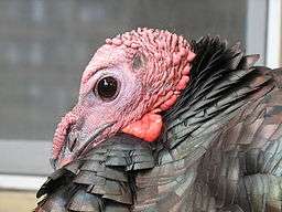 Wild turkey (Meleagris gallopavo) may be found at the Tug Fork WMA | |
| Country | United States |
|---|---|
| State | West Virginia |
| Counties | McDowell |
| Elevation | 1,440 ft (438.9 m) [1] |
| Coordinates | 37°25′16″N 81°38′54″W / 37.42111°N 81.64833°WCoordinates: 37°25′16″N 81°38′54″W / 37.42111°N 81.64833°W |
| Area | 2,165 acres (876.1 ha) [2] |
| Management | Wildlife Resources Section, WV Division of Natural Resources |
| Owner | WVDNR |
| IUCN category | IV - Habitat/Species government Area |
| Nearest town | Welch, West Virginia |
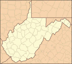 Location of Tug Fork Wildlife Management Area in West Virginia | |
Tug Fork Wildlife Management Area (WMA) is located about 10 miles northwest of Welch, West Virginia in McDowell County. Tug Fork WMA is located on 2,165 acres (876 ha) of steep terrain along hills above the Tug Fork River. The WMA is heavily forested, primarily with mixed hardwoods and yellow poplar/black cherry forests in the coves.[2] The WMA is accessed from U.S. Route 52 at Premier. Several tracks and jeep trails provide walking access into the Tug Fork WMA from U.S. Route 52.
Hunting and fishing
Hunting opportunities in Tug Fork WMA include bear, deer, grouse, squirrel, and turkey.[2]
Tug Fork provides fishing opportunities for warm-water species.
Camping is not available at the WMA.[2]
See also
References
- ↑ Acme Mapper 2.0, Tug Fork WMA, retrieved January 18, 2009
- 1 2 3 4 "Tug Fork WMA page". West Virginia DNR website. WV Division of Natural Resources. Retrieved January 12, 2009.
External links
- West Virginia DNR District 4 Wildlife Management Areas
- West Virginia hunting regulations
- West Virginia Fishing Regulations
This article is issued from Wikipedia - version of the 6/25/2015. The text is available under the Creative Commons Attribution/Share Alike but additional terms may apply for the media files.