Valley Falls State Park
| Valley Falls State Park | |
| West Virginia State Park | |
 | |
| Country | United States |
|---|---|
| State | West Virginia |
| Counties | Marion, Taylor |
| Elevation | 1,558 ft (474.9 m) |
| Coordinates | 39°23′38″N 80°04′56″W / 39.39389°N 80.08222°WCoordinates: 39°23′38″N 80°04′56″W / 39.39389°N 80.08222°W |
| Area | 1,145 acres (463.4 ha) |
| Established | 1964 [1] |
| Owner | West Virginia Division of Natural Resources |
| Nearest city | Grafton, West Virginia |
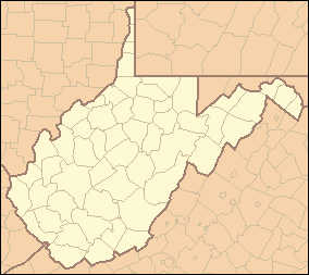 Location of Valley Falls State Park in West Virginia | |
| Website: Valley Falls State Park | |
Valley Falls State Park is a 1,145 acre (4.63 km²) day use facility sited along both banks of the Tygart Valley River. The park is located about 7 miles (11 km) south of exit 137 of I-79, near Fairmont, West Virginia.
The park's main feature is a half-mile long set of waterfalls that separate Marion and Taylor County, West Virginia. The park and river provide a popular and risky kayaking run.[2]
Although the falls are an inviting spot, swimming is not allowed. [3]
In the 19th century a small community thrived along the river at the current state park's location. The ruins of a sawmill and a gristmill are still visible along the river.[3]
Features
- Mountain Biking
- Hiking trails
- Playground
- Picnic area
- Volleyball court
- Fishing
- Kayaking
See also
References
- ↑ Where People and Nature Meet: A History of the West Virginia State Parks. Charleston, West Virginia: Pictorial Histories Publishing Company. April 1988. ISBN 0-933126-91-3.
- ↑ In Life and Death, a Reminder of Whitewater's Power, Washington Post, July 31, 2005, Page E03, accessed September 6, 2005.
- 1 2 "Recreation Page". Valley Falls State Park web site. West Virginia State Parks. Retrieved December 25, 2008.
External links
This article is issued from Wikipedia - version of the 9/6/2014. The text is available under the Creative Commons Attribution/Share Alike but additional terms may apply for the media files.