Touchet, Washington
| Touchet, Washington | |
|---|---|
| CDP | |
 | |
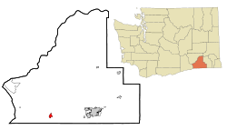 Location of Touchet, Washington | |
| Coordinates: 46°2′22″N 118°40′15″W / 46.03944°N 118.67083°WCoordinates: 46°2′22″N 118°40′15″W / 46.03944°N 118.67083°W | |
| Country | United States |
| State | Washington |
| County | Walla Walla |
| Area | |
| • Total | 1.2 sq mi (3.1 km2) |
| • Land | 1.2 sq mi (3.1 km2) |
| • Water | 0.0 sq mi (0.0 km2) |
| Elevation | 443 ft (135 m) |
| Population (2010) | |
| • Total | 421 |
| • Density | 326.1/sq mi (125.9/km2) |
| Time zone | Pacific (PST) (UTC-8) |
| • Summer (DST) | PDT (UTC-7) |
| ZIP code | 99360 |
| Area code | 509 |
| FIPS code | 53-72030[1] |
| GNIS feature ID | 1509053[2] |
Touchet (TOO-SHEE) is a census-designated place (CDP) in Walla Walla County, Washington, United States. The population was 421 at the 2010 census.
History
The original inhabitants of the Walla Walla valley were the Nimi'ipuu people. These people, which originally included bands of Palouse, Yakamas, Umatilla, Walla Walla and Wanapum, were collectively renamed Nez Perce by Lewis and Clark when they passed through the Walla Walla Valley on their return journey in 1806.[3][4]
Settlers from the east came to the valley in the early 1850s, but shortly left due to conflicts with the Native people. Homesteaders returned to the valley in 1859.[5]
The Walla Walla & Columbia River Railroad from Wallula to Walla Walla was not completed until 1875, but by March 1874, 16 miles of track were completed up to Touchet. By the end of that year Touchet farmers shipped 4,000 tons of wheat and received 1,100 tons of merchandise.[6]
Touchet has never been officially incorporated.
Geography
Touchet is located at 46°2′22″N 118°40′15″W / 46.03944°N 118.67083°W (46.039402, -118.670971).[7]
According to the United States Census Bureau, the CDP has a total area of 1.2 square miles (3.1 km²), all of it land.
Climate
According to the Köppen Climate Classification system, Touchet has a warm-summer Mediterranean climate, abbreviated "Csa" on climate maps.[8]
Demographics
As of the census[1] of 2000, there were 396 people, 135 households, and 112 families residing in the CDP. The population density was 326.1 people per square mile (126.4/km²). There were 140 housing units at an average density of 115.3/sq mi (44.7/km²). The racial makeup of the CDP was 92.68% White, 0.76% Native American, 4.29% from other races, and 2.27% from two or more races. Hispanic or Latino of any race were 15.66% of the population.
There were 135 households out of which 48.1% had children under the age of 18 living with them, 71.9% were married couples living together, 8.1% had a female householder with no husband present, and 16.3% were non-families. 15.6% of all households were made up of individuals and 6.7% had someone living alone who was 65 years of age or older. The average household size was 2.93 and the average family size was 3.27.
In the CDP the age distribution of the population shows 34.6% under the age of 18, 4.3% from 18 to 24, 30.1% from 25 to 44, 22.5% from 45 to 64, and 8.6% who were 65 years of age or older. The median age was 34 years. For every 100 females there were 107.3 males. For every 100 females age 18 and over, there were 100.8 males.
The median income for a household in the CDP was $37,500, and the median income for a family was $50,278. Males had a median income of $37,031 versus $22,115 for females. The per capita income for the CDP was $15,684. About 10.9% of families and 13.4% of the population were below the poverty line, including 18.8% of those under age 18 and 27.0% of those age 65 or over.
See also
| Wikimedia Commons has media related to Touchet River and Formation. |
References
- 1 2 "American FactFinder". United States Census Bureau. Retrieved 2008-01-31.
- ↑ "US Board on Geographic Names". United States Geological Survey. 2007-10-25. Retrieved 2008-01-31.
- ↑ http://historylink.org/index.cfm?DisplayPage=output.cfm&file_id=7801
- ↑ https://web.archive.org/web/20080528205728/http://www.wwvchamber.com/index.html?s=1&c=59&p=224. Archived from the original on May 28, 2008. Retrieved October 10, 2008. Missing or empty
|title=(help) - ↑ http://historylink.org/index.cfm?DisplayPage=output.cfm&file_id=8482
- ↑ http://historylink.org/index.cfm?DisplayPage=output.cfm&file_id=7630
- ↑ "US Gazetteer files: 2010, 2000, and 1990". United States Census Bureau. 2011-02-12. Retrieved 2011-04-23.
- ↑ "Touchet, Washington Köppen Climate Classification (Weatherbase)". Weatherbase. Retrieved March 19, 2016.
Municipalities and communities of Walla Walla County, Washington, United States | ||
|---|---|---|
| Cities | 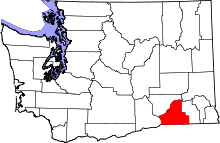 | |
| CDPs | ||
| Unincorporated communities | ||
| Ghost towns | ||