Tin Hau Station
Tin Hau 天后 | |||||||||||||
|---|---|---|---|---|---|---|---|---|---|---|---|---|---|
| MTR rapid transit station | |||||||||||||
 Platform 2 | |||||||||||||
| Chinese name | |||||||||||||
| Chinese | 天后 | ||||||||||||
| Literal meaning | Heavenly queen | ||||||||||||
| |||||||||||||
| General information | |||||||||||||
| Location |
Intersection between King's Road and Causeway Road, Causeway Bay Wan Chai District, Hong Kong | ||||||||||||
| Coordinates | 22°16′58″N 114°11′30″E / 22.2827°N 114.1917°ECoordinates: 22°16′58″N 114°11′30″E / 22.2827°N 114.1917°E | ||||||||||||
| Operated by | MTR Corporation | ||||||||||||
| Line(s) | |||||||||||||
| Platforms | 2 (split level side platforms) | ||||||||||||
| Connections | Bus, public light bus, tram | ||||||||||||
| Construction | |||||||||||||
| Structure type | Underground | ||||||||||||
| Platform levels | 2 | ||||||||||||
| Disabled access | Yes | ||||||||||||
| Other information | |||||||||||||
| Station code | TIN | ||||||||||||
| History | |||||||||||||
| Opened |
| ||||||||||||
| Services | |||||||||||||
| |||||||||||||
| Location | |||||||||||||
|
Tin Hau Location within the MTR system | |||||||||||||
Tin Hau (Chinese: 天后) is a station on the Island Line of the Hong Kong MTR rapid transit system.
Location
Like all other Island Line stations, Tin Hau is located along the northern shore of Hong Kong Island. Named after the nearby Tin Hau Temple, the station is actually within the Causeway Bay neighbourhood; the station's presence has caused the surrounding area to be called "Tin Hau."
The station lies to the east of Victoria Park, with the Citicorp Centre to the north. The Hong Kong Central Library and Lin Fa Kung Garden are to the south of the station, as is the Causeway Bay Sports Ground.[1]
History
Tin Hau station was part of the original plan for the MTR, dating back to the Hong Kong Mass Transport Study in 1967.[2] It was not, however, in the Modified Initial System, which laid out the first few phases of the MTR system. Construction on the Island Line began in 1981, with the first section of the line, which included Tin Hau, opening on 31 May 1985. The Causeway Bay Magistracy was demolished to make way for the station.[3] From 2000, MTR retrofitted platform screen doors at thirty underground stations, one of them being Tin Hau; the project was finished in 2006.[4]
Future
In order to relieve overcrowding on the Island Line, the only rapid transit to serve the north shore of the Island, the MTR Corporation and Highways Department have proposed the North Island Line, which would extend the Tung Chung Line underneath Hong Kong Island, eventually connecting to the Island Line at Fortress Hill, one stop east of Tin Hau. This would effectively split the current Island Line in two, with a new rail tunnel built from Tin Hau to North Point, sending trains from Sheung Wan onto the Tseung Kwan O Line.[5] However, delays and controversy over the proposed line have delayed a possible construction start to 2016 at the minimum.
Station layout
Due to the limited space beneath Causeway Road and Hennessy Road, under which the Island Line runs, Tin Hau utilises a stacked platform layout. Eastbound trains using platform 1 stop on the upper level, while westbound trains using platform 2 stop on the lower level. In addition, there are two underground levels above the platforms: the concourse containing faregates and shops and the walkway which connects Exits A1-A2 and B.
| G | Ground level | Exits, Transportation Interchange |
| Walkway | Walkway | MTRShops Walkways to exits |
| C | Concourse | Customer Service |
| Hang Seng Bank, vending machines, ATM | ||
| P1 Platform |
Side platform, doors will open on the left | |
| Platform 1 | Island Line towards Chai Wan (Fortress Hill) → | |
| P2 Platform |
Side platform, doors will open on the right | |
| Platform 2 | ← Island Line towards Kennedy Town (Causeway Bay) | |
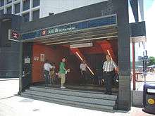
Entrances and exits
- A1: King's Road
- A2: Victoria Park
- B: Hong Kong Central Library[1]
Services
Tin Hau station acts as an interchange between MTR rapid transit and local buses.
Gallery
|


References
- 1 2 "Tin Hau Station street map" (PDF). MTR Corporation. Retrieved 31 July 2014.
- ↑ Hong Kong Mass Transport Study Freeman, Fox, Wilbur Smith & Associates (1967)
- ↑ Su, Victor (2 March 1981). "MTR looks at dozens of proposals: $billions in bid for Island Line". South China Morning Post. p. 1.
- ↑ Retrofitting of PSDs at MTR stations to be completed by 2006
- ↑ North Island Line Highways Department Retrieved 27 July 2010
- ↑ "Tin Hau Station layout" (PDF). MTR Corporation. Retrieved 31 July 2014.
| Wikimedia Commons has media related to Tin Hau Station. |