Thatcher, Utah
| Thatcher, Utah | |
|---|---|
| Census-designated place | |
 Location in Box Elder County and the state of Utah | |
 Location of Utah in the United States | |
| Coordinates: 41°40′52″N 112°19′11″W / 41.68111°N 112.31972°WCoordinates: 41°40′52″N 112°19′11″W / 41.68111°N 112.31972°W | |
| Country | United States |
| State | Utah |
| County | Box Elder |
| Settled | 1890 |
| Named for | Moses Thatcher |
| Area | |
| • Total | 11.7 sq mi (30.3 km2) |
| • Land | 11.7 sq mi (30.3 km2) |
| • Water | 0.0 sq mi (0.0 km2) |
| Elevation[1] | 5,003 ft (1,525 m) |
| Population (2010)[2] | |
| • Total | 789 |
| • Density | 67/sq mi (26.0/km2) |
| Time zone | Mountain (MST) (UTC-7) |
| • Summer (DST) | MDT (UTC-6) |
| ZIP code | 84337 |
| Area code(s) | 435 |
| GNIS feature ID | 2584779[1] |
Thatcher is a census-designated place in Box Elder County, Utah, United States. It is a small farming community, located 3 miles (5 km) southwest of Bothwell and 7 miles (11 km) west of Tremonton. The population was 789 at the 2010 census.
The community was named for Moses Thatcher, an apostle for the Church of Jesus Christ of Latter-day Saints.[3] Thatcher was first settled in 1890.[4]
Thatcher Mountain, 2 miles (3 km) to the west, is named after the community.
Demographics
As of the census[2] of 2010, there were 789 people residing in the CDP. There were 230 housing units. The racial makeup of the town was 95.9% White, 0.5% Black or African American, 0.1% American Indian and Alaska Native, 0.1% Asian, 0.1% Native Hawaiian and Other Pacific Islander, 1.6% from some other race, and 1.5% from two or more races. Hispanic or Latino of any race were 2.4% of the population.
References
- 1 2 U.S. Geological Survey Geographic Names Information System: Thatcher, Utah. Retrieved May 19, 2011.
- 1 2 "American FactFinder". United States Census Bureau. Retrieved May 19, 2011.
- ↑ Van Cott, John W. (1990). Utah Place Names. Salt Lake City, Utah: University of Utah Press. p. 41. ISBN 0-87480-345-4.
- ↑ Andrew Jenson. Encyclopedic History of the Church. (Salt Lake City: Deseret Book, 1941) p. 872
Municipalities and communities of Box Elder County, Utah, United States | ||
|---|---|---|
| Cities | 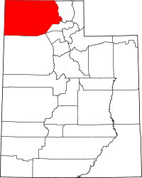 | |
| Towns | ||
| CDPs | ||
| Unincorporated areas | ||
| Ghost towns | ||