Fielding, Utah
| Fielding, Utah | |
|---|---|
| Town | |
|
Welcome sign | |
 Location in Box Elder County and the state of Utah. | |
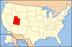 Location of Utah in the United States | |
| Coordinates: 41°48′43″N 112°7′2″W / 41.81194°N 112.11722°WCoordinates: 41°48′43″N 112°7′2″W / 41.81194°N 112.11722°W | |
| Country | United States |
| State | Utah |
| County | Box Elder |
| Founded | 1892 |
| Incorporated | 1911 |
| Named for | Mary Fielding Smith |
| Area | |
| • Total | 0.4 sq mi (1.1 km2) |
| • Land | 0.4 sq mi (1.1 km2) |
| • Water | 0.0 sq mi (0.0 km2) |
| Elevation[1] | 4,373 ft (1,333 m) |
| Population (2012) | |
| • Total | 444 |
| • Density | 1,014.3/sq mi (391.6/km2) |
| Time zone | Mountain (MST) (UTC-7) |
| • Summer (DST) | MDT (UTC-6) |
| ZIP code | 84311 |
| Area code(s) | 435 |
| FIPS code | 49-25290[2] |
| GNIS feature ID | 1441035[1] |

Fielding is a town in Box Elder County, Utah, United States. The population was 455 at the 2010 census.
History
A post office called Fielding has been in operation since 1892.[3] The town was named after Joseph Fielding Smith (1838–1918), sixth president of the LDS Church.[4]
Geography
According to the United States Census Bureau, the town has a total area of 0.4 square miles (1.1 km²), all of it land.
Demographics
| Historical population | |||
|---|---|---|---|
| Census | Pop. | %± | |
| 1910 | 485 | — | |
| 1920 | 374 | −22.9% | |
| 1930 | 333 | −11.0% | |
| 1940 | 324 | −2.7% | |
| 1950 | 249 | −23.1% | |
| 1960 | 270 | 8.4% | |
| 1970 | 254 | −5.9% | |
| 1980 | 325 | 28.0% | |
| 1990 | 422 | 29.8% | |
| 2000 | 448 | 6.2% | |
| 2010 | 455 | 1.6% | |
| Est. 2015 | 452 | [5] | −0.7% |
As of the census[2] of 2000, there were 448 people, 139 households, and 119 families residing in the town. The population density was 1,014.3 people per square mile (393.1/km²). There were 142 housing units at an average density of 321.5 per square mile (124.6/km²). The racial makeup of the town was 97.77% White, 0.45% Native American, 0.67% from other races, and 1.12% from two or more races. Hispanic or Latino of any race were 2.23% of the population.
There were 139 households out of which 50.4% had children under the age of 18 living with them, 79.9% were married couples living together, 5.8% had a female householder with no husband present, and 13.7% were non-families. 12.2% of all households were made up of individuals and 5.8% had someone living alone who was 65 years of age or older. The average household size was 3.22 and the average family size was 3.48.
In the town the population was spread out with 36.4% under the age of 18, 10.9% from 18 to 24, 24.1% from 25 to 44, 19.4% from 45 to 64, and 9.2% who were 65 years of age or older. The median age was 27 years. For every 100 females there were 100.0 males. For every 100 females age 18 and over, there were 102.1 males.
The median income for a household in the town was $44,000, and the median income for a family was $46,563. Males had a median income of $37,885 versus $22,708 for females. The per capita income for the town was $14,222. None of the families and 0.9% of the population were living below the poverty line, including no under eighteens and none of those over 64.
References
- 1 2 U.S. Geological Survey Geographic Names Information System: Fielding
- 1 2 "American FactFinder". United States Census Bureau. Archived from the original on September 11, 2013. Retrieved 2008-01-31.
- ↑ "Box Elder County". Jim Forte Postal History. Retrieved 18 October 2015.
- ↑ Van Atta, Dale (Jan 22, 1977). "You name it - there's a town for it". The Deseret News. p. 15. Retrieved 18 October 2015.
- ↑ "Annual Estimates of the Resident Population for Incorporated Places: April 1, 2010 to July 1, 2015". Retrieved July 2, 2016.
- ↑ "Census of Population and Housing". Census.gov. Archived from the original on May 11, 2015. Retrieved June 4, 2015.
 |
Portage | Plymouth | Clarkston | |
| Howell | |
Newton | ||
| ||||
| | ||||
| Garland | Deweyville | Mendon |
Municipalities and communities of Box Elder County, Utah, United States | ||
|---|---|---|
| Cities | 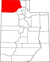 | |
| Towns | ||
| CDPs | ||
| Unincorporated areas | ||
| Ghost towns | ||