Terras Salgadas

Terras Salgadas (Portuguese meaning "salty lands") is a flat terrain covering the northwestern part of the island of Maio, Cape Verde. It is a protected area as a nature reserve, where salty marshes, sand dunes, lava formations and marine ecosystems are found. The area is rich in endemic species of sea birds, fish and sea turtles.[1] The nearest settlements are Morrinho and Cascabulho.
During the Last Ice Age, Terras Salgadas probably spread 10 to 60 km north of the modern northernmost point of the island. It was once a semi-narrow isthmus that was located 40 km north and attached to the area that is today Boa Vista Islands, it was likely the southern part was dominated by salt marshes. About 5,000 BC as the sea levels rose, the Eastern Island split into islands now called Boa Vista and Maio, Terras Salgadas covered the north of the island, probably in areas that are now underwater, Ponta Cais at the time was further north and small hills covered the eastern part.
The area were once used for salt mining, the slaves were mining salt and the Portuguese were exporting to Portugal through the port of Calheta as it was also called as Porto Português up to the early 19th century.
See also
References
The island of Maio and the surrounding islands | ||
|---|---|---|
| Communities and settlements | 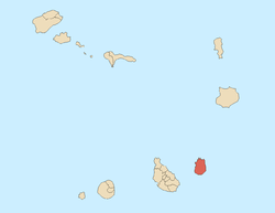 | |
| Parishes | ||
| Mountains | ||
| Other geographical features | ||
Coordinates: 15°17′N 23°11′W / 15.29°N 23.18°W