Farol da Ponta do Sinó
|
Farol da Ponta do Sinó | |
 Farol da Ponta do Sinó Cape Verde | |
| Location | Santa Maria, Sal, Cape Verde |
|---|---|
| Coordinates | 16°35′N 22°55′W / 16.583°N 22.917°WCoordinates: 16°35′N 22°55′W / 16.583°N 22.917°W |
| Year first constructed | 1892 |
| Tower shape | square parallelepiped tower |
| Height | 9 metres (30 ft) |
| Focal height | 11 metres (36 ft) |
| Range | 8 nautical miles (15 km; 9.2 mi) |
| Characteristic | Fl(2+1) W 15s |
| Admiralty number | D-2922[1] |
| NGA number | 113-24164 |
| Cape Verde number | 2080 |
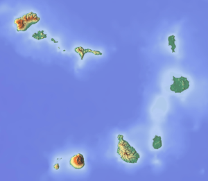
Farol da Ponta do Sinó (the Farol da Ponta do Sinó Lighthouse), is a lighthouse in the southernmost point of the island of Sal in northeastern Cape Verde, it is located 400 meters north of Ponta do Sinó and around 2 km southwest of the center of Santa Maria.[2] Until 2003, the area featured nothing but small bushes and dirt roads, in the early 2010s, new hotels and villas (the nearest being Hotel Funana (titled as Riu Funana, the Creole form, the name is African etymology named after the music genre) popped up north of the lighthouse and its communal limits spread to include the lighthouse and the whole portion.
The tower is quadrangular and is 9 meters tall and is made out of concrete, it has an outer staircase and features a lantern. All of the exterior are painted in white.[3]
About the lighthouse
- Usage today: Active to navigation
- Access: a small road, section remaining a dirt road, linked with a road connecting through Hotel Riu Funana.
- Public use: Area open, lighthouse closed
See also
Notes
- ↑ "Ponta Norte". Lighthouses in Cape Verde. Direcção Geral da Marinha e Portos (DGMP). Retrieved September 11, 2010.
- ↑ "ARLHS World List of Lights (WLOL)". Amateur Radio Lighthouse Society. 8 April 2009. Retrieved 13 April 2009.
- ↑ "Ponta Norte (Reguinho Fiúra)". University of North Carolina at Chapel Hill The Lighthouse Directory. 2 September 2005. Retrieved 25 February 2016.
References
- Russ Rowlett (2 September 2005). "Pedra de Lume Second Range Near". The Lighthouse Directory. UNC at Chapel Hill. Retrieved 25 February 2016.

