Teixeira de Freitas
| Teixeira de Freitas | |
|---|---|
| Municipality | |
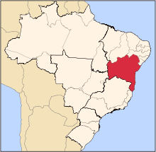
 Teixeira de Freitas Location in Brazil | |
| Coordinates: 17°32′19″S 39°44′38″W / 17.53861°S 39.74389°WCoordinates: 17°32′19″S 39°44′38″W / 17.53861°S 39.74389°W | |
| Country |
|
| Region | Northeast Region |
| State | Bahia |
| Time zone | BRT (UTC-3) |
Teixeira de Freitas is a city in the extreme south of the Brazilian state of Bahia, on the margins of BR-101 highway, it is one of the largest cities in the state with a population estimated as of 2015 at 157,804 inhabitants in an area of 1,166 km².[1]
History
The city had its origin as a crossroads, and has always maintained its character as a place that draws entrepreneurs from other regions. Major expansion of industry in the area, combined with the growth of eucalyptus plantations, has adversely impacted small-scale agriculture in the surrounding rural areas, resulting in declining population in those rural areas. Teixeira de Freitas has also a busy commercial district and the economy has developed a lot lately thanks to the migration of the population from surrounding towns.
Economy
It has an agricultural economy, based in cattle ranching and raising crops. There is also a large production of Eucalyptus destined to the extraction of cellulose on factories in the region. The city is a regional commercial center, serving approximately 14 municipalities.
Transportation
Teixeira de Freitas has a regional airport, with flights to Belo Horizonte every Monday, Wednesday and Friday.
References
- ↑ "IBGE | Cidades | Bahia | Teixeira de Freitas". cidades.ibge.gov.br. Retrieved 2016-06-15.
External links
 Teixeira de Freitas travel guide from Wikivoyage