Feira da Mata
| Feira da Mata Município de Feira da Mata | |
|---|---|
| Municipality | |
 Location of Feira da Mata in Bahia | |
 Feira da Mata Location of Feira da Mata in Brazil | |
| Coordinates: 14°12′25″S 44°16′51″W / 14.20694°S 44.28083°WCoordinates: 14°12′25″S 44°16′51″W / 14.20694°S 44.28083°W | |
| Country |
|
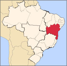
| Region | Northeast |
| State |
|
| Founded | 1989 |
| Government | |
| • Mayor | Alex Ronan Viana Mota |
| Area | |
| • Total | 1,176.105 km2 (454.097 sq mi) |
| Elevation | 497 m (1,631 ft) |
| Population (2014) | |
| • Total | 5,911 |
| • Density | 5.0/km2 (13/sq mi) |
| Demonym(s) | Matense |
| Time zone | BRT (UTC-3) |
Feira da Mata is a municipality in the state of Bahia in the North-East region of Brazil. Feira da Mata covers 1,176.105 km2 (454.097 sq mi), and has a population of 5,911 with a population density of 5 inhabitants per square kilometer. It was originally part of Carinhanha, but became an independent municipality in 1989.[1]
Feira da Mata is located at the junction of BA-601 and BA-594. It is 964 kilometres (599 mi) from the state capital of Bahia, Salvador. The Carinhanha River forms the southern border of the municipality, which is also the border between the states of Bahia and Minas Gerais.[1]
Feira da Mata was originally home to the Kayapo people. Manuel Nunes Viana expelled the Kayapo population in the early 18th century and settled in the area.[1]
See also
References
- 1 2 3 "Feira da Mata" (in Portuguese). Brasília, Brazil: Instituto Brasileiro de Geografia e Estatística. 2015. Retrieved 2015-08-16.