Tarangnan, Samar
| Tarangnan | ||
|---|---|---|
| Municipality | ||
|
Town of Tarangnan | ||
| ||
 Map of Samar showing the location of Tarangnan | ||
.svg.png) Tarangnan Location within the Philippines | ||
| Coordinates: 11°54′N 124°45′E / 11.900°N 124.750°ECoordinates: 11°54′N 124°45′E / 11.900°N 124.750°E | ||
| Country |
| |
| Region | Eastern Visayas (Region VIII) | |
| Province | Samar | |
| Congr. district | 1st district of Samar | |
| Founded | April 1, 1884 | |
| Barangays | 41 | |
| Government[1] | ||
| • Mayor | Danilo V. Tan | |
| • Vice Mayor | Marivic Maymay | |
| Area[2] | ||
| • Total | 132.49 km2 (51.15 sq mi) | |
| Population (2010)[3] | ||
| • Total | 24,146 | |
| • Density | 180/km2 (470/sq mi) | |
| Time zone | PST (UTC+8) | |
| ZIP code | 6704 | |
| Dialing code | 55 | |
| Income class | 4th class | |


Tarangnan is a fourth class municipality in the province of Samar, Philippines. According to the 2010 census, it has a population of 24,146 people.[3]
Tarangnan is situated on the western coast of Samar Island, to the south-east of the ancient town of Bangahon (now Gandara) and to the north of Samar's capital Catbalogan. Tarangnan is found near the former ancient pueblo Tinago, the first town to be Christianized and was made a center or cabecera.[4]
Tarangnan has its own municipal hospital which was inaugurated in 1982, with a 10-bed capacity. It caters primarily to health services. It is augmented by Rural Health Unit extension workers. It has daycare centers which also cater the needs of pre-schoolers.
Geography
The municipality is geographically situated in the west portion of the island of Samar, bounded on the north by the municipality of Pagsanghan, in the south by the capital city of Catbalogan and on the west by the Samar Sea or Maqueda Bay. The distance of the poblacion to Catbalogan is about 36 kilometres (22 mi) and 60 kilometres (37 mi) away from Calbayog City. It can be reached via an 11 kilometres (6.8 mi) road from the Maharlika Highway crossing Barangay Balugo by a provincial road.
Barangays
Tarangnan is politically subdivided into 41 barangays.[2]
- Alcazar
- Awang
- Bahay
- Balonga-as
- Balugo
- Bangon Gote
- Baras
- Binalayan
- Bisitahan
- Bonga
- Cabunga-an
- Cagtutulo
- Cambatutay Nuevo
- Cambatutay Viejo
- Canunghan
- Catan-agan
- Dapdap
- Gallego
- Imelda Pob. (Posgo)
- Lucerdoni (Irong-irong)
- Lahong
- Libucan Dacu
- Libucan Gote
- Majacob
- Mancares
- Marabut
- Oeste - A
- Oeste - B
- Pajo
- Palencia
- Poblacion A
- Poblacion B
- Poblacion C
- Poblacion D
- Poblacion E
- San Vicente
- Santa Cruz
- Sugod
- Talinga
- Tigdaranao
- Tizon
History
During the earlier part of the 17th century, Tarangnan or Tinago was the first settlement of Jesuit missionaries on the island of Samar. Tinago was the first cabecera on Samar where the first Jesuits have arrived, that is October 15, 1596. When Tinago was devastated by the Moro attack in 1616, the Jesuits decided to transfer the cabecera to Catbalogan. Since that time Tinago had not came back to life as pueblo until 1725.[5] The poblacion was established at Dapdap but for access and sanitation it was moved to tarangnan in 1883-1884.[6]
The attempted transfer of the pueblo from Dapdap to Tarangnan in 1882 became highly celebrated case. It was a struggle or a fight between the parish priest of Dapdap, fr. Angel Pulido, OFM and the governadorcillo of Dapdap.[7]

The town of Dapdap was transferred in 1884 to a barrio called Tarangnan, from which it derived its name today. At first the church and convento were constructed of light materials which means bamboo and nipa. The new church was constructed in 1894 by P. Venancio Palencia, OFM and completed in 1897.[8]
In the second half of the nineteenth century, the island of Samar experienced a commercial boom, especially in abaca, with imports and exports of abaca products. Moro raids in the island declined due to the presence of Spaniards. As the Spaniards settled in Samar, they saw the need of all-weather seaports and easy communications for their commercial activities and political administration. This development paved the way for the convergence of the inhabitants into the old town site of Tarangnan, where transport was relatively accessible. The settlement of Tarangnan was growing at a much faster pace than the pueblo of Dapdap.
Taking into consideration the island's commercial boom, with prospects of Tarangnan as a trading center and its religious vigilance over Dapdap, on June 21, 1881, Gov. Enrique Chacon wrote to his superiors. He recommended the transfer of the Poblacion from Dapdap to Tarangnan due to the former's poor accessibility, unavailability of land area for expansion, and its unsanitary environment.
On April 1, 1884, Tarangnan was declared as one of the municipalities of the Province of Samar by means of Royal Decree by the King of Spain, King Alfonso I.
In 1957, the following sitios were declared barrios: Cabunga-an,[9] Tigdaranao,[10] and Binalayan.[11]
Religions
ROMAN CATHOLIC St.Francis Of Assisi Parish PROTESTANTS Iglesia Ni Cristo Jehova's Witnesses Faith Bible Baptist Church
Demographics
| Population census of Tarangnan | ||
|---|---|---|
| Year | Pop. | ±% p.a. |
| 1990 | 15,894 | — |
| 1995 | 18,791 | +3.19% |
| 2000 | 20,538 | +1.92% |
| 2007 | 22,767 | +1.43% |
| 2010 | 24,146 | +2.16% |
| Source: National Statistics Office[3][12] | ||
Education
Some years back, Tarangnan was estimated to have a low literacy rate. But, with the opening of primary education in some barangays and expansion of secondary education (Tarangnan National High School) in Brgy. Oeste, its literacy rose dramatically to 89.95%, as recorded in the NSO 1995 survey.
Gallery
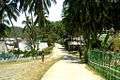 Entering Tarangnan Town Proper
.jpg) Going To Pantalan (small pier)
Going To Pantalan (small pier) Town Hall
 High School
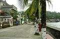 Sea Side
 Panapukan Beach (one of the beaches)
Notes
- ↑ "Municipalities". Quezon City, Philippines: Department of the Interior and Local Government. Retrieved 15 May 2013.
- 1 2 "Province: Samar (Western Samar)". PSGC Interactive. Makati City, Philippines: National Statistical Coordination Board. Retrieved 15 May 2013.
- 1 2 3 "Total Population by Province, City, Municipality and Barangay: as of May 1, 2010" (PDF). 2010 Census of Population and Housing. National Statistics Office. Retrieved 15 May 2013.
- ↑ Kobak, Cantius (2002). Historical Sketches of the Pueblos of Samar and Leyte: 1580-1900. Milwaukee, Wisconsin: Unpublished. p. 721 - 723.
- ↑ ARSI, Catalogi, Phil. 4. fol. 127, Central Archives of Rome
- ↑ Cruikshank, Robert Bruce (1975). A History of Samar Island, 1768 - 1898. pp. 271.
- ↑ Cruikshank: pp. 169 - 186
- ↑ Martin y Morales, Ensayo de una sintesis de los trabajos realizados por las corporaciones religiosas espanolas de Filipinas 1901 p. 493,
- ↑ "An Act to Convert the Sitio of Cabunga-an in the Municipality of Tarangnan, Province of Samar, into a Regular Barrio". LawPH.com. Retrieved 2011-04-12.
- ↑ "An Act to Convert the Sitio of Tigdaranao in the Municipality of Tarangnan, Province of Samar, into a Regular Barrio". LawPH.com. Retrieved 2011-04-13.
- ↑ "An Act to Convert the Sitio of Binalayan in the Municipality of Tarangnan, Province of Samar, into a Regular Barrio". LawPH.com. Retrieved 2011-04-13.
- ↑ "Province of Western Samar". Municipality Population Data. LWUA Research Division. Retrieved 21 August 2013.
External links
| Wikimedia Commons has media related to Tarangnan, Samar. |
- Visit Tarangnan & Comment Page
- Philippine Standard Geographic Code
- Philippine Census Information
- Local Governance Performance Management System
 |
Pagsanghan | Gandara | San Jorge | |
| Santo Niño / Samar Sea | |
|||
| ||||
| | ||||
| Daram / Samar Sea | |
Catbalogan |
Catbalogan (capital) | |
| Municipalities | |
| Component cities | |