Tallmadge, Ohio
| Tallmadge, Ohio | |
|---|---|
| City | |
|
Aerial photo of the Tallmadge Circle, a traffic circle located in the center of Tallmadge | |
| Motto: "History Moving Forward" | |
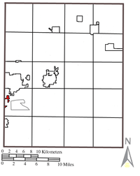
 Location in Summit County and the state of Ohio. | |
| Coordinates: 41°5′49″N 81°25′27″W / 41.09694°N 81.42417°WCoordinates: 41°5′49″N 81°25′27″W / 41.09694°N 81.42417°W | |
| Country | United States |
| State | Ohio |
| Counties | Summit, Portage |
| Government | |
| • Mayor | David Kline |
| Area[1] | |
| • Total | 14.02 sq mi (36.31 km2) |
| • Land | 14.00 sq mi (36.26 km2) |
| • Water | 0.02 sq mi (0.05 km2) |
| Elevation[2] | 1,115 ft (340 m) |
| Population (2010)[3] | |
| • Total | 17,537 |
| • Estimate (2012[4]) | 17,515 |
| • Density | 1,252.6/sq mi (483.6/km2) |
| Time zone | Eastern (EST) (UTC-5) |
| • Summer (DST) | EDT (UTC-4) |
| ZIP code | 44278 |
| Area code(s) | 330 |
| FIPS code | 39-76106[5] |
| GNIS feature ID | 1061671[2] |
| Website | http://www.tallmadge-ohio.org/ |

Tallmadge /ˈtælmᵻdʒ/ (often mispronounced /ˈtɔːlmᵻdʒ/) is a city in Summit and Portage counties in Ohio, United States. It is a suburb of Akron and part of the Akron Metropolitan Statistical Area. The population was 17,537 at the 2010 census. Tallmadge was founded in 1807 and is the second-oldest city in Summit County, following Hudson, which was founded in 1799.
History
Historically, Tallmadge was a part of the Connecticut Western Reserve, which was a three million acre plot of land in northeast Ohio. Prior to being named Tallmadge, it was part of Town 2, Range 10 in the Western Reserve. In 1807, the Reverend David Bacon founded and organized Tallmadge, placing a square road in the center of town where several other roads met, modeled after New England designs of the time period.[6] The town was named after Benjamin Tallmadge, an American Revolutionary War figure and local landowner.[7]
In the nineteenth century, Tallmadge continued to develop around the square as its centerpiece, which years later became a traffic circle named "Tallmadge Circle" (or simply "the Circle"). The Circle as it is today represents New England's role in the settlement of the Ohio Western Reserve.[8] The rest of the city was designed in a grid pattern, with industry tending to develop near the railroad.[9]
No alcohol could be bought or consumed in public in Tallmadge until the early 1990s, when the law was amended to allow the retail sale of alcohol in stores, but public consumption was still illegal. In 2001, the law was repealed and alcohol could be sold and consumed in restaurants, provided that alcohol not account for more than 30% of any establishment's revenue. The first restaurant to offer alcohol in Tallmadge was Delanie's on West Avenue.
Tallmadge lies within two counties. While the vast majority of the city lies in Summit County, portions on the east side protrude into neighboring Portage County. This phenomenon resulted from the annexation of small portions of a neighboring township, Brimfield.
Geography
Tallmadge is at 41°05′49″N 81°25′27″W / 41.096956°N 81.424033°W (41.096956, -81.424033).[10]
According to the United States Census Bureau, the city has a total area of 14.02 square miles (36.31 km2), of which, 14.00 square miles (36.26 km2) is land and 0.02 square miles (0.05 km2) is water.[1]
Demographics
| Historical population | |||
|---|---|---|---|
| Census | Pop. | %± | |
| 1880 | 376 | — | |
| 1940 | 3,452 | — | |
| 1950 | 5,821 | 68.6% | |
| 1960 | 10,246 | 76.0% | |
| 1970 | 15,274 | 49.1% | |
| 1980 | 15,238 | −0.2% | |
| 1990 | 14,870 | −2.4% | |
| 2000 | 16,390 | 10.2% | |
| 2010 | 17,537 | 7.0% | |
| Est. 2015 | 17,512 | [11] | −0.1% |
| U.S. Decennial Census 2012 estimate | |||
2010 census
As of the census[3] of 2010, there were 17,537 people, 7,026 households, and 4,932 families residing in the city. The population density was 1,252.6 inhabitants per square mile (483.6/km2). There were 7,413 housing units at an average density of 529.5 per square mile (204.4/km2). The racial makeup of the city was 93.6% White, 3.3% African American, 0.3% Native American, 1.0% Asian, 0.1% Pacific Islander, 0.3% from other races, and 1.5% from two or more races. Hispanic or Latino of any race were 1.0% of the population.
There were 7,026 households, of which 28.7% had children under age 18 living with them, 55.5% were married couples living together, 10.7% had a female householder with no husband present, 4.0% had a male householder with no wife present, and 29.8% were non-families. 25.5% of all households were made up of individuals and 11.7% had someone living alone who was 65 years of age or older. The average household size was 2.45 and the average family size was 2.94.
The median age in the city was 45.1 years. 21.6% of residents were under the age of 18; 7.4% were between the ages of 18 and 24; 20.7% were from 25 to 44; 30.7% were from 45 to 64; and 19.5% were 65 years of age or older. The gender makeup of the city was 47.8% male and 52.2% female.
2000 census
As of the census[5] of 2000, there were 16,390 people, 6,273 households, and 4,711 families residing in the city. The population density was 1,173.9 people per square mile (453.3/km2). There were 6,494 housing units at an average density of 465.1 per square mile (179.6/km2). The racial makeup of the city was 95.78% White, 2.08% African American, 0.12% Native American, 0.87% Asian, 0.03% Pacific Islander, 0.08% from other races, and 1.05% from two or more races. Hispanic or Latino of any race were 0.57% of the population.
There were 6,273 households, of which 32.0% had children under age 18 living with them, 63.0% were married couples living together, 8.9% had a female householder with no husband present, and 24.9% were non-families. 21.3% of all households were made up of individuals and 10.4% had someone living alone who was 65 years of age or older. The average household size was 2.56 and the average family size was 2.99.
In the city the population was spread out with 24.0% under the age of 18, 6.6% from 18 to 24, 26.0% from 25 to 44, 25.4% from 45 to 64, and 18.0% who were 65 years of age or older. The median age was 41 years. For every 100 females there were 93.1 males. For every 100 females age 18 and over, there were 88.2 males.
The median income for a household in the city was $49,381, and the median income for a family was $56,780. Males had a median income of $44,606 versus $28,056 for females. The per capita income for the city was $27,329. About 4.0% of families and 4.7% of the population were below the poverty line, including 5.9% of those under age 18 and 3.4% of those age 65 or over.
Education
The Tallmadge City School District provides primary and secondary education for 2,700 students in Tallmadge. A very small portion of the city is part of the neighboring Stow-Munroe Falls City School District. Students in the Tallmadge City School District attend Dunbar Primary for grades kindergarten through second, Munroe Elementary for grades 3–5, Tallmadge Middle School for grades 6–8, and Tallmadge High School for grades 9–12. Cornerstone Community School is a Christian Pre-K - 6th elementary school in Tallmadge and is housed in the former Overdale Primary School building.
Tallmadge currently has no colleges or universities, but Western Reserve University began its first classes in Tallmadge in 1826 before moving to nearby Hudson and its current home in Cleveland as part of Case Western Reserve University.[12]
Sports
Tallmadge athletes have received local, statewide, regional, national, and international recognition. In particular, Little League Baseball teams have represented the city in the 1974 and 2003 Little League World Series. The 1974 team advanced to the semi-final round, finishing in fourth place.
The Tallmadge Blue Devils have won 8 OHSAA state championships. Tallmadge Blue Devils softball has won championships in 1981, 1987, 1988, 1989, 1993, 1997, and 1998. Tallmadge Blue Devils baseball captured its first state championship in 2002, after knocking off Defiance (for which current Los Angeles Dodger Chad Billingsley threw) and Edison, respectively.
Landmarks
At the center of the town is the Historic Tallmadge Church (built in 1825), recognized as a historic place by the Ohio Historical Society, and was featured on the cover of the November 20, 1944, edition of Life magazine.[13] An intersection surrounds the church and a small park, the Tallmadge Circle Park, on which the church sits. The Circle Park is also home to Tallmadge's Old Town Hall (established 1859), which houses a museum on its second floor. In 2003, a new steeple was placed atop the Old Town Hall, replacing the original which had been removed decades earlier.
The Circle itself, which surrounds the Historic Church, Old Town Hall, and Circle Park, continues to be a notable landmark at the center of the town. While two separate Ohio state routes meet at the intersection (SR 91 and SR 261; at one point SR 18 and SR 532 also met there), the one-lane circle regularly accommodates several dozen vehicles at a time without congestion. The eight roads that meet at the Circle form a spoke design (see image, upper right) that, as they lead away from the Circle, travel in the cardinal and ordinal directions. The roads are named according to the respective directions they travel away from the Circle (e.g. Northwest Avenue); these names are not preserved by the neighboring municipalities into which the eight roads run.[9] 4 of these 8 roads comes to a six-point intersection within the original city, forming a square with the 4 corners in the Northeast,Northwest,Southeast and Southwest roads running through them. In summer 2010, one of these six-point intersections in the northeastern portion of Tallmadge was converted to a roundabout based on the design of the original Circle. Out-of-town drivers are sometimes uncomfortable navigating the intersection because it has no stop signs or traffic lights.
Photos

 Old Town Hall, May 2007 (note the bicentennial and sesquicentennial plaques on either side of the door)
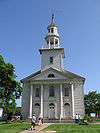 Historic Tallmadge Church, May 2007
 Historic Tallmadge Church, September 1971
 Historic Tallmadge Church, May 2007
Notable people
- Mike Bettes, meteorologist for The Weather Channel
- John Parry, National Football League referee
- Sidney Edgerton, Governor of the Montana Territory
References
- 1 2 "US Gazetteer files 2010". United States Census Bureau. Archived from the original on 2012-01-24. Retrieved 2013-01-06.
- 1 2 "US Board on Geographic Names". United States Geological Survey. 2007-10-25. Retrieved 2008-01-31.
- 1 2 "American FactFinder". United States Census Bureau. Retrieved 2013-01-06.
- ↑ "Population Estimates". United States Census Bureau. Archived from the original on 2013-06-17. Retrieved 2013-06-17.
- 1 2 "American FactFinder". United States Census Bureau. Archived from the original on 2013-09-11. Retrieved 2008-01-31.
- ↑ None (1899). Annals of the Early Settlers Association of Cuyahoga County. 4. Cleveland, Ohio: Early Settlers Association of Cuyahoga County. p. 469. Retrieved 2010-06-18.
The township of Tallmadge being No 2 in tenth range surveyed by Seth Ensign for Rev David Bacon agent for owners as follows A public square of seven and one half acres at the center of the town for a parade ground and site for church and academy and from this square Mr Ensign surveyed into great lots or tracts one and one quarter miles square by running lines through the center of the town to the four cardinal points of the compass then diagonally crossing at the center and terminating at the corners of the township Just one and one fourth miles from the center of the
- ↑ "Tallmadge, Ohio". Ohio History Central. n.d. Retrieved May 4, 2015.
- ↑ History of Tallmadge, Ohio
- 1 2 http://www.tallmadge-ohio.org/history/history.pdf
- ↑ "US Gazetteer files: 2010, 2000, and 1990". United States Census Bureau. 2011-02-12. Retrieved 2011-04-23.
- ↑ "Annual Estimates of the Resident Population for Incorporated Places: April 1, 2010 to July 1, 2015". Retrieved July 2, 2016.
- ↑ Brown, Ellen (Spring 2001). "The Hudson Years". CWRU Magazine. Case Western Reserve University. Retrieved 2010-06-18.
On October 4, the first class of three began in a facility in Tallmadge, Ohio, ten miles south of Hudson, because the first building wouldn’t be completed until 1827.
- ↑ LIFE Magazine Cover hosted at Google
Municipalities and communities of Portage County, Ohio, United States | ||
|---|---|---|
| Cities | 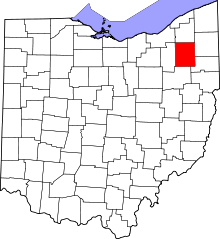 | |
| Villages | ||
| Townships | ||
| CDPs | ||
| Unincorporated communities | ||
| Former settlements | ||
| Footnotes | ‡This populated place also has portions in an adjacent county or counties | |
Municipalities and communities of Summit County, Ohio, United States | ||
|---|---|---|
| Cities |  | |
| Villages | ||
| Townships | ||
| CDPs | ||
| Unincorporated communities | ||
| Footnotes | ‡This populated place also has portions in an adjacent county or counties | |