Boston Heights, Ohio
| Boston Heights, Ohio | |
|---|---|
| Village | |
|
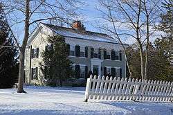
The Luther B. Ranney Farmhouse, a historic site in the village | |
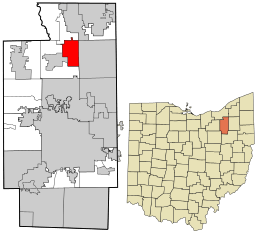 Location in Summit County and the state of Ohio. | |
| Coordinates: 41°15′21″N 81°30′16″W / 41.25583°N 81.50444°WCoordinates: 41°15′21″N 81°30′16″W / 41.25583°N 81.50444°W | |
| Country | United States |
| State | Ohio |
| County | Summit |
| Government | |
| • Mayor | Bill Goncy |
| Area[1] | |
| • Total | 6.90 sq mi (17.87 km2) |
| • Land | 6.90 sq mi (17.87 km2) |
| • Water | 0 sq mi (0 km2) |
| Elevation[2] | 1,070 ft (326 m) |
| Population (2010)[3] | |
| • Total | 1,300 |
| • Estimate (2012[4]) | 1,293 |
| • Density | 188.4/sq mi (72.7/km2) |
| Time zone | Eastern (EST) (UTC-5) |
| • Summer (DST) | EDT (UTC-4) |
| FIPS code | 39-07790[5] |
| GNIS feature ID | 1064468[2] |
| Website | http://www.villageofbostonheights.com/ |
Boston Heights is a village in Summit County, Ohio, United States. The population was 1,300 at the 2010 census. It is part of the [Greater Cleveland |Metropolitan Statistical Area]].
Geography
Boston Heights is located at 41°15′21″N 81°30′16″W / 41.25583°N 81.50444°W (41.255714, -81.504398).[6]
According to the United States Census Bureau, the village has a total area of 6.90 square miles (17.87 km2), all land.[1]
Demographics
| Historical population | |||
|---|---|---|---|
| Census | Pop. | %± | |
| 1880 | 130 | — | |
| 1930 | 309 | — | |
| 1940 | 369 | 19.4% | |
| 1950 | 646 | 75.1% | |
| 1960 | 831 | 28.6% | |
| 1970 | 846 | 1.8% | |
| 1980 | 781 | −7.7% | |
| 1990 | 733 | −6.1% | |
| 2000 | 1,186 | 61.8% | |
| 2010 | 1,300 | 9.6% | |
| Est. 2015 | 1,292 | [7] | −0.6% |
2010 census
As of the census[3] of 2010, there were 1,300 people, 463 households, and 382 families residing in the village. The population density was 188.4 inhabitants per square mile (72.7/km2). There were 493 housing units at an average density of 71.4 per square mile (27.6/km2). The racial makeup of the village was 95.9% White, 2.1% African American, 0.1% Native American, 0.7% Asian, and 1.2% from two or more races. Hispanic or Latino of any race were 0.8% of the population.
There were 463 households of which 36.5% had children under the age of 18 living with them, 72.4% were married couples living together, 6.9% had a female householder with no husband present, 3.2% had a male householder with no wife present, and 17.5% were non-families. 14.5% of all households were made up of individuals and 4.5% had someone living alone who was 65 years of age or older. The average household size was 2.81 and the average family size was 3.11.
The median age in the village was 44.4 years. 26.1% of residents were under the age of 18; 6.1% were between the ages of 18 and 24; 19.2% were from 25 to 44; 36.7% were from 45 to 64; and 12.1% were 65 years of age or older. The gender makeup of the village was 48.8% male and 51.2% female.
2000 census
As of the census[5] of 2000, there were 1,186 people, 392 households, and 323 families residing in the village. The population density was 171.9 people per square mile (66.4/km²). There were 407 housing units at an average density of 59.0 per square mile (22.8/km²). The racial makeup of the village was 96.71% White, 0.59% African American, 1.52% Asian, 0.42% from other races, and 0.76% from two or more races. Hispanic or Latino of any race were 1.10% of the population.
There were 392 households out of which 46.9% had children under the age of 18 living with them, 75.3% were married couples living together, 4.3% had a female householder with no husband present, and 17.6% were non-families. 14.5% of all households were made up of individuals and 6.6% had someone living alone who was 65 years of age or older. The average household size was 3.03 and the average family size was 3.38.
In the village the population was spread out with 32.2% under the age of 18, 5.1% from 18 to 24, 32.0% from 25 to 44, 23.0% from 45 to 64, and 7.6% who were 65 years of age or older. The median age was 37 years. For every 100 females there were 103.1 males. For every 100 females age 18 and over, there were 100.5 males.
The median income for a household in the village was $80,884, and the median income for a family was $87,925. Males had a median income of $63,125 versus $40,000 for females. The per capita income for the village was $36,960. About 0.3% of families and 1.6% of the population were below the poverty line, including none of those under age 18 and 6.3% of those age 65 or over.
References
- 1 2 "US Gazetteer files 2010". United States Census Bureau. Archived from the original on 2012-01-24. Retrieved 2013-01-06.
- 1 2 "US Board on Geographic Names". United States Geological Survey. 2007-10-25. Retrieved 2008-01-31.
- 1 2 "American FactFinder". United States Census Bureau. Retrieved 2013-01-06.
- ↑ "Population Estimates". United States Census Bureau. Archived from the original on 2013-06-17. Retrieved 2013-06-17.
- 1 2 "American FactFinder". United States Census Bureau. Archived from the original on 2013-09-11. Retrieved 2008-01-31.
- ↑ "US Gazetteer files: 2010, 2000, and 1990". United States Census Bureau. 2011-02-12. Retrieved 2011-04-23.
- ↑ "Annual Estimates of the Resident Population for Incorporated Places: April 1, 2010 to July 1, 2015". Retrieved July 2, 2016.
- ↑ "Census of Population and Housing". Census.gov. Archived from the original on May 11, 2015. Retrieved June 4, 2015.
External links
Municipalities and communities of Summit County, Ohio, United States | ||
|---|---|---|
| Cities |  | |
| Villages | ||
| Townships | ||
| CDPs | ||
| Unincorporated communities | ||
| Footnotes | ‡This populated place also has portions in an adjacent county or counties | |