Summitville, Ohio
| Summitville, Ohio | |
|---|---|
| Village | |
|
Summitville Post Office | |
 Location of Summitville, Ohio | |
 Location of Summitville in Columbiana County | |
| Coordinates: 40°40′44″N 80°53′12″W / 40.67889°N 80.88667°WCoordinates: 40°40′44″N 80°53′12″W / 40.67889°N 80.88667°W | |
| Country | United States |
| State | Ohio |
| County | Columbiana |
| Area[1] | |
| • Total | 0.95 sq mi (2.46 km2) |
| • Land | 0.92 sq mi (2.38 km2) |
| • Water | 0.03 sq mi (0.08 km2) |
| Elevation[2] | 1,109 ft (338 m) |
| Population (2010)[3] | |
| • Total | 135 |
| • Estimate (2012[4]) | 134 |
| • Density | 146.7/sq mi (56.6/km2) |
| Time zone | Eastern (EST) (UTC-5) |
| • Summer (DST) | EDT (UTC-4) |
| ZIP code | 43962 |
| Area code(s) | 330, 234 |
| FIPS code | 39-75574[5] |
| GNIS feature ID | 1061662[2] |

Summitville is a village in Columbiana County, Ohio, United States. The population was 135 at the 2010 census.
History
Summitville was laid out in 1853.[6] The village was so named on account of its location at "the highest point of elevation between the waters of the Sandy and Lake Erie".[7]
Geography
Summitville is located at 40°40′44″N 80°53′12″W / 40.67889°N 80.88667°W (40.679020, -80.886687).[8]
According to the United States Census Bureau, the village has a total area of 0.95 square miles (2.46 km2), of which 0.92 square miles (2.38 km2) is land and 0.03 square miles (0.08 km2) is water.[1]
Demographics
| Historical population | |||
|---|---|---|---|
| Census | Pop. | %± | |
| 1950 | 150 | — | |
| 1960 | 144 | −4.0% | |
| 1970 | 143 | −0.7% | |
| 1980 | 146 | 2.1% | |
| 1990 | 125 | −14.4% | |
| 2000 | 108 | −13.6% | |
| 2010 | 135 | 25.0% | |
| Est. 2015 | 132 | [9] | −2.2% |
2010 census
As of the census[3] of 2010, there were 135 people, 51 households, and 39 families residing in the village. The population density was 146.7 inhabitants per square mile (56.6/km2). There were 55 housing units at an average density of 59.8 per square mile (23.1/km2). The racial makeup of the village was 95.6% White, 0.7% African American, and 3.7% from two or more races. Hispanic or Latino of any race were 4.4% of the population.
There were 51 households of which 33.3% had children under the age of 18 living with them, 64.7% were married couples living together, 5.9% had a female householder with no husband present, 5.9% had a male householder with no wife present, and 23.5% were non-families. 17.6% of all households were made up of individuals and 11.7% had someone living alone who was 65 years of age or older. The average household size was 2.65 and the average family size was 3.00.
The median age in the village was 38.2 years. 25.9% of residents were under the age of 18; 6.7% were between the ages of 18 and 24; 24.4% were from 25 to 44; 23.7% were from 45 to 64; and 19.3% were 65 years of age or older. The gender makeup of the village was 50.4% male and 49.6% female.
2000 census
As of the census[5] of 2000, there were 108 people, 45 households, and 31 families residing in the village. The population density was 116.1 people per square mile (44.8/km²). There were 49 housing units at an average density of 52.7 per square mile (20.3/km²). The racial makeup of the village was 97.22% White, and 2.78% from two or more races. Hispanic or Latino of any race were 0.93% of the population.
There were 45 households out of which 28.9% had children under the age of 18 living with them, 57.8% were married couples living together, 13.3% had a female householder with no husband present, and 28.9% were non-families. 26.7% of all households were made up of individuals and 15.6% had someone living alone who was 65 years of age or older. The average household size was 2.40 and the average family size was 2.94.
In the village the population was spread out with 26.9% under the age of 18, 5.6% from 18 to 24, 25.9% from 25 to 44, 28.7% from 45 to 64, and 13.0% who were 65 years of age or older. The median age was 40 years. For every 100 females there were 74.2 males. For every 100 females age 18 and over, there were 68.1 males.
The median income for a household in the village was $26,250, and the median income for a family was $38,750. Males had a median income of $31,250 versus $17,143 for females. The per capita income for the village was $17,236. There were 13.3% of families and 15.7% of the population living below the poverty line, including 36.4% of under eighteens and none of those over 64.
References
- 1 2 "US Gazetteer files 2010". United States Census Bureau. Retrieved 2013-01-06.
- 1 2 "US Board on Geographic Names". United States Geological Survey. 2007-10-25. Retrieved 2008-01-31.
- 1 2 "American FactFinder". United States Census Bureau. Retrieved 2013-01-06.
- ↑ "Population Estimates". United States Census Bureau. Retrieved 2013-06-17.
- 1 2 "American FactFinder". United States Census Bureau. Retrieved 2008-01-31.
- ↑ Mack, Horace (1879). History of Columbiana County, Ohio: With Illustrations and Biographical Sketches of Some of Its Prominent Men and Pioneers. Unigraphic. p. 154.
- ↑ McCord, William B. (1905). History of Columbiana County, Ohio and Representative Citizens. Biographical Publishing Company. p. 312.
- ↑ "US Gazetteer files: 2010, 2000, and 1990". United States Census Bureau. 2011-02-12. Retrieved 2011-04-23.
- ↑ "Annual Estimates of the Resident Population for Incorporated Places: April 1, 2010 to July 1, 2015". Retrieved July 2, 2016.
- ↑ "Census of Population and Housing". Census.gov. Retrieved June 4, 2015.
Municipalities and communities of Columbiana County, Ohio, United States | ||
|---|---|---|
| Cities | 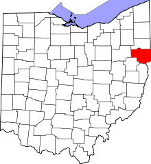 | |
| Villages | ||
| Townships | ||
| CDPs | ||
| Unincorporated communities |
| |
| Ghost town | ||
| Footnotes | ‡This populated place also has portions in an adjacent county or counties | |