Calcutta, Ohio
| Calcutta, Ohio | |
|---|---|
| Census-designated place | |
|
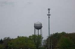
Water tower in Calcutta | |
 Location of Calcutta, Ohio | |
| Coordinates: 40°40′56″N 80°34′13″W / 40.68222°N 80.57028°WCoordinates: 40°40′56″N 80°34′13″W / 40.68222°N 80.57028°W | |
| Country | United States |
| State | Ohio |
| County | Columbiana |
| Township | St. Clair |
| Area | |
| • Total | 11.88 sq mi (30.76 km2) |
| • Land | 11.86 sq mi (30.73 km2) |
| • Water | 0.01 sq mi (0.03 km2) |
| Elevation[1] | 1,115 ft (340 m) |
| Population (2010) | |
| • Total | 3,742 |
| • Density | 315/sq mi (121.8/km2) |
| Time zone | Eastern (EST) (UTC-5) |
| • Summer (DST) | EDT (UTC-4) |
| ZIP code | 43920 |
| Area code(s) | 330, 234 |
| FIPS code | 39-10926[2] |
| GNIS feature ID | 1056753[1] |
Calcutta is a census-designated place (CDP) in Columbiana County, Ohio, United States. The population was 3,742 at the 2010 census.[3] Much of Calcutta is clustered around Ohio State Route 170.
History
Calcutta has historically been known by several different names. It was laid out in 1810 as "West Union".[4] It has also been called "Foulkstown", for William Foulks, who built the first brick house there.[5] Next it was known as "Nineveh", after the Biblical city of Nineveh. Finally, it was renamed "Calcutta", after the Indian city of Calcutta.[4] A post office called Calcutta was established in 1838, and remained in operation until 1913.[6]
Geography
Calcutta is located near the center of St. Clair Township at 40°40′56″N 80°34′13″W / 40.68222°N 80.57028°W (40.682271, -80.570204)[7] in southeastern Columbiana County. The Calcutta CDP extends southwest as far as the U.S. Route 30 expressway, and east and north as far Little Beaver Creek, touching the Pennsylvania state line where the creek crosses the border briefly. The CDP is bordered by Longs Run, a tributary of Little Beaver Creek, on the northwest. To the southwest of Calcutta, across US 30, is the CDP of Glenmoor. The city of East Liverpool is 4 miles (6 km) to the south via St. Clair Avenue.
According to the United States Census Bureau, the Calcutta CDP has a total area of 11.88 square miles (30.76 km2), of which 11.86 square miles (30.73 km2) is land and 0.012 square miles (0.03 km2), or 0.11%, is water.[3]
Demographics
As of the census[2] of 2000, there were 3,491 people, 1,417 households, and 1,025 families residing in the CDP. The population density was 297.1 people per square mile (114.7/km²). There were 1,473 housing units at an average density of 125.4/sq mi (48.4/km²). The racial makeup of the CDP was 98.51% White, 0.17% African American, 0.06% Native American, 0.72% Asian, 0.09% from other races, and 0.46% from two or more races. Hispanic or Latino of any race were 0.66% of the population.
There were 1,417 households out of which 27.7% had children under the age of 18 living with them, 62.2% were married couples living together, 7.7% had a female householder with no husband present, and 27.6% were non-families. 25.2% of all households were made up of individuals and 14.9% had someone living alone who was 65 years of age or older. The average household size was 2.38 and the average family size was 2.84.
In the CDP the population was spread out with 20.6% under the age of 18, 5.7% from 18 to 24, 23.7% from 25 to 44, 27.4% from 45 to 64, and 22.6% who were 65 years of age or older. The median age was 45 years. For every 100 females there were 86.9 males. For every 100 females age 18 and over, there were 84.6 males.
The median income for a household in the CDP was $36,194, and the median income for a family was $45,750. Males had a median income of $41,077 versus $21,352 for females. The per capita income for the CDP was $19,536. About 3.0% of families and 8.3% of the population were below the poverty line, including 8.1% of those under age 18 and 9.7% of those age 65 or over.
References
- 1 2 "US Board on Geographic Names". United States Geological Survey. 2007-10-25. Retrieved 2008-01-31.
- 1 2 "American FactFinder". United States Census Bureau. Archived from the original on 2013-09-11. Retrieved 2008-01-31.
- 1 2 "Geographic Identifiers: 2010 Demographic Profile Data (G001): Calcutta CDP, Ohio". U.S. Census Bureau, American Factfinder. Retrieved January 23, 2015.
- 1 2 Mack, Horace (1879). History of Columbiana County, Ohio: With Illustrations and Biographical Sketches of Some of Its Prominent Men and Pioneers. Unigraphic. p. 234.
- ↑ McCord, William B. (1905). History of Columbiana County, Ohio and Representative Citizens. Biographical Publishing Company. p. 309.
- ↑ "Columbiana County". Jim Forte Postal History. Archived from the original on 4 March 2016. Retrieved 10 January 2016.
- ↑ "US Gazetteer files: 2010, 2000, and 1990". United States Census Bureau. 2011-02-12. Retrieved 2011-04-23.
Municipalities and communities of Columbiana County, Ohio, United States | ||
|---|---|---|
| Cities | 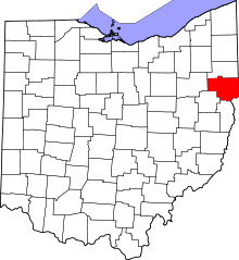 | |
| Villages | ||
| Townships | ||
| CDPs | ||
| Unincorporated communities |
| |
| Ghost town | ||
| Footnotes | ‡This populated place also has portions in an adjacent county or counties | |