Starkweather, North Dakota
| Starkweather, North Dakota | |
|---|---|
| City | |
 | |
 Location of Starkweather, North Dakota | |
| Coordinates: 48°27′8″N 98°52′41″W / 48.45222°N 98.87806°WCoordinates: 48°27′8″N 98°52′41″W / 48.45222°N 98.87806°W | |
| Country | United States |
| State | North Dakota |
| County | Ramsey |
| Area[1] | |
| • Total | 0.14 sq mi (0.36 km2) |
| • Land | 0.14 sq mi (0.36 km2) |
| • Water | 0 sq mi (0 km2) |
| Elevation | 1,496 ft (456 m) |
| Population (2010)[2] | |
| • Total | 117 |
| • Estimate (2014)[3] | 117 |
| • Density | 835.7/sq mi (322.7/km2) |
| Time zone | Central (CST) (UTC-6) |
| • Summer (DST) | CDT (UTC-5) |
| ZIP code | 58377 |
| Area code(s) | 701 |
| FIPS code | 38-75580 |
| GNIS feature ID | 1032289[4] |
Starkweather is a city in Ramsey County, North Dakota, United States. The population was 117 at the 2010 census.[5] Starkweather was founded in 1902.
Geography
Starkweather is located at 48°27′8″N 98°52′41″W / 48.45222°N 98.87806°W (48.452338, -98.878153).[6]
According to the United States Census Bureau, the city has a total area of 0.14 square miles (0.36 km2), all of it land.[1]
Demographics
| Historical population | |||
|---|---|---|---|
| Census | Pop. | %± | |
| 1910 | 246 | — | |
| 1920 | 302 | 22.8% | |
| 1930 | 312 | 3.3% | |
| 1940 | 295 | −5.4% | |
| 1950 | 229 | −22.4% | |
| 1960 | 223 | −2.6% | |
| 1970 | 193 | −13.5% | |
| 1980 | 210 | 8.8% | |
| 1990 | 197 | −6.2% | |
| 2000 | 157 | −20.3% | |
| 2010 | 117 | −25.5% | |
| Est. 2015 | 117 | [7] | 0.0% |
| U.S. Decennial Census[8] 2014 Estimate[3] | |||
2010 census
As of the census[2] of 2010, there were 117 people, 49 households, and 34 families residing in the city. The population density was 835.7 inhabitants per square mile (322.7/km2). There were 74 housing units at an average density of 528.6 per square mile (204.1/km2). The racial makeup of the city was 86.3% White, 9.4% Native American, and 4.3% from two or more races. Hispanic or Latino of any race were 3.4% of the population.
There were 49 households of which 26.5% had children under the age of 18 living with them, 49.0% were married couples living together, 10.2% had a female householder with no husband present, 10.2% had a male householder with no wife present, and 30.6% were non-families. 26.5% of all households were made up of individuals and 8.1% had someone living alone who was 65 years of age or older. The average household size was 2.39 and the average family size was 2.79.
The median age in the city was 40.9 years. 23.1% of residents were under the age of 18; 9.4% were between the ages of 18 and 24; 19.7% were from 25 to 44; 32.4% were from 45 to 64; and 15.4% were 65 years of age or older. The gender makeup of the city was 48.7% male and 51.3% female.
2000 census
As of the census of 2000, there were 157 people, 60 households, and 46 families residing in the city. The population density was 1,120.1 people per square mile (433.0/km²). There were 89 housing units at an average density of 634.9 per square mile (245.5/km²). The racial makeup of the city was 98.73% White, 0.64% Native American, 0.64% from other races. Hispanic or Latino of any race were 0.64% of the population.
There were 60 households out of which 28.3% had children under the age of 18 living with them, 70.0% were married couples living together, 5.0% had a female householder with no husband present, and 23.3% were non-families. 23.3% of all households were made up of individuals and 6.7% had someone living alone who was 65 years of age or older. The average household size was 2.62 and the average family size was 3.09.
In the city the population was spread out with 23.6% under the age of 18, 7.6% from 18 to 24, 27.4% from 25 to 44, 24.2% from 45 to 64, and 17.2% who were 65 years of age or older. The median age was 41 years. For every 100 females there were 98.7 males. For every 100 females age 18 and over, there were 114.3 males.
The median income for a household in the city was $28,750, and the median income for a family was $35,208. Males had a median income of $25,833 versus $16,563 for females. The per capita income for the city was $12,278. About 8.1% of families and 8.3% of the population were below the poverty line, including 3.1% of those under the age of eighteen and none of those sixty five or over.
Notable people
- Gordon Berg, farmer and member of the North Dakota House of Representatives[9]
References
- 1 2 "US Gazetteer files 2010". United States Census Bureau. Retrieved 2012-06-14.
- 1 2 "American FactFinder". United States Census Bureau. Retrieved 2012-06-14.
- 1 2 "Population Estimates". United States Census Bureau. Retrieved June 27, 2015.
- ↑ "US Board on Geographic Names". United States Geological Survey. 2007-10-25. Retrieved 2008-01-31.
- ↑ "2010 Census Redistricting Data (Public Law 94-171) Summary File". American FactFinder. United States Census Bureau. Retrieved 2 May 2011.
- ↑ "US Gazetteer files: 2010, 2000, and 1990". United States Census Bureau. 2011-02-12. Retrieved 2011-04-23.
- ↑ "Annual Estimates of the Resident Population for Incorporated Places: April 1, 2010 to July 1, 2015". Retrieved July 2, 2016.
- ↑ United States Census Bureau. "Census of Population and Housing". Retrieved February 15, 2014.
- ↑ 'Gordon Berg-obituary,Bismarck Tribune (North Dakota), May 29, 2013
Municipalities and communities of Ramsey County, North Dakota, United States | ||
|---|---|---|
| Cities | 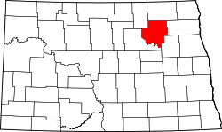 | |
| Townships |
| |
| Unincorporated communities | ||