Crary, North Dakota
| Crary, North Dakota | |
|---|---|
| City | |
|
Sign at Crary | |
 Location of Crary, North Dakota | |
| Coordinates: 48°4′N 98°38′W / 48.067°N 98.633°WCoordinates: 48°4′N 98°38′W / 48.067°N 98.633°W | |
| Country | United States |
| State | North Dakota |
| County | Ramsey |
| Founded | 1884 |
| Area[1] | |
| • Total | 0.94 sq mi (2.43 km2) |
| • Land | 0.89 sq mi (2.31 km2) |
| • Water | 0.05 sq mi (0.13 km2) |
| Elevation | 1,486 ft (453 m) |
| Population (2010)[2] | |
| • Total | 142 |
| • Estimate (2014)[3] | 142 |
| • Density | 159.6/sq mi (61.6/km2) |
| Time zone | Central (CST) (UTC-6) |
| • Summer (DST) | CDT (UTC-5) |
| ZIP code | 58327 |
| Area code(s) | 701 |
| FIPS code | 38-16580 |
| GNIS feature ID | 1028528[4] |

Crary is a city in Ramsey County, North Dakota, United States. The population was 142 at the 2010 census.[5] Crary was founded in 1884 and is named after William Crary whom owned much of the land encompassing the present day community.
Geography
Crary is located at 48°4′N 98°38′W / 48.067°N 98.633°W (48.0696, -98.6394).[6]
According to the United States Census Bureau, the city has a total area of 0.94 square miles (2.43 km2), of which, 0.89 square miles (2.31 km2) is land and 0.05 square miles (0.13 km2) is water.[1]
Demographics
| Historical population | |||
|---|---|---|---|
| Census | Pop. | %± | |
| 1910 | 279 | — | |
| 1920 | 307 | 10.0% | |
| 1930 | 278 | −9.4% | |
| 1940 | 267 | −4.0% | |
| 1950 | 235 | −12.0% | |
| 1960 | 195 | −17.0% | |
| 1970 | 150 | −23.1% | |
| 1980 | 139 | −7.3% | |
| 1990 | 145 | 4.3% | |
| 2000 | 149 | 2.8% | |
| 2010 | 142 | −4.7% | |
| Est. 2015 | 142 | [7] | 0.0% |
| U.S. Decennial Census[8] 2014 Estimate[3] | |||
2010 census
As of the census[2] of 2010, there were 142 people, 45 households, and 38 families residing in the city. The population density was 159.6 inhabitants per square mile (61.6/km2). There were 51 housing units at an average density of 57.3 per square mile (22.1/km2). The racial makeup of the city was 95.1% White, 4.2% Native American, and 0.7% from two or more races. Hispanic or Latino of any race were 2.1% of the population.
There were 45 households of which 48.9% had children under the age of 18 living with them, 57.8% were married couples living together, 8.9% had a female householder with no husband present, 17.8% had a male householder with no wife present, and 15.6% were non-families. 11.1% of all households were made up of individuals. The average household size was 3.16 and the average family size was 3.32.
The median age in the city was 32.5 years. 31.7% of residents were under the age of 18; 8.5% were between the ages of 18 and 24; 28% were from 25 to 44; 26.1% were from 45 to 64; and 5.6% were 65 years of age or older. The gender makeup of the city was 60.6% male and 39.4% female.
2000 census
As of the census of 2000, there were 149 people, 47 households, and 42 families residing in the city. The population density was 169.6 people per square mile (65.4/km²). There were 54 housing units at an average density of 61.5 per square mile (23.7/km²). The racial makeup of the city was 96.64% White, 2.68% Native American, and 0.67% from two or more races.
There were 47 households out of which 44.7% had children under the age of 18 living with them, 74.5% were married couples living together, 2.1% had a female householder with no husband present, and 10.6% were non-families. 6.4% of all households were made up of individuals and none had someone living alone who was 65 years of age or older. The average household size was 3.17 and the average family size was 3.21.
In the city the population was spread out with 33.6% under the age of 18, 8.7% from 18 to 24, 30.9% from 25 to 44, 18.8% from 45 to 64, and 8.1% who were 65 years of age or older. The median age was 32 years. For every 100 females there were 119.1 males. For every 100 females age 18 and over, there were 120.0 males.
The median income for a household in the city was $39,375, and the median income for a family was $43,125. Males had a median income of $21,250 versus $20,156 for females. The per capita income for the city was $13,084. There were 6.1% of families and 9.6% of the population living below the poverty line, including 18.9% of under eighteens and none of those over 64.
References
- 1 2 "US Gazetteer files 2010". United States Census Bureau. Archived from the original on 2012-01-24. Retrieved 2012-06-14.
- 1 2 "American FactFinder". United States Census Bureau. Retrieved 2012-06-14.
- 1 2 "Population Estimates". United States Census Bureau. Retrieved May 29, 2015.
- ↑ "US Board on Geographic Names". United States Geological Survey. 2007-10-25. Retrieved 2008-01-31.
- ↑ "2010 Census Redistricting Data (Public Law 94-171) Summary File". American FactFinder. United States Census Bureau. Archived from the original on 21 July 2011. Retrieved 2 May 2011.
- ↑ "US Gazetteer files: 2010, 2000, and 1990". United States Census Bureau. 2011-02-12. Retrieved 2011-04-23.
- ↑ "Annual Estimates of the Resident Population for Incorporated Places: April 1, 2010 to July 1, 2015". Retrieved July 2, 2016.
- ↑ United States Census Bureau. "Census of Population and Housing". Archived from the original on May 11, 2015. Retrieved February 15, 2014.
Municipalities and communities of Ramsey County, North Dakota, United States | ||
|---|---|---|
| Cities | 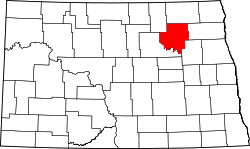 | |
| Townships |
| |
| Unincorporated communities | ||