Spallumcheen
| Spallumcheen | |
|---|---|
| District municipality | |
| The Corporation of the Township of Spallumcheen[1] | |
 Spallumcheen Location of Spallumcheen in British Columbia | |
| Coordinates: 50°26′N 119°13′W / 50.433°N 119.217°W | |
| Country |
|
| Province |
|
| Regional district | North Okanagan |
| Incorporated | 1892 |
| Area | |
| • Total | 255.77 km2 (98.75 sq mi) |
| Population (2011) | |
| • Total | 5,055 |
| • Density | 20/km2 (51/sq mi) |
| Time zone | PST (UTC-8) |
| Website |
www |
Spallumcheen is a district municipality in the Canadian province of British Columbia. Located in the Okanagan region between Vernon and Enderby, the township had a population of 5,055 and land area of 255.77 square kilometres (98.75 sq mi) in the Canada 2011 Census.[3] The district, whose official name is the Township of Spallumcheen and which is the oldest rural municipality in the British Columbia Interior (incorporated in 1892),[4] consists primarily of agricultural land surrounding the separately incorporated City of Armstrong. Both Spallumcheen and Armstrong are member municipalities of the Regional District of North Okanagan.
Etymology
The name is derived from a Shuswap language word, either "spil-a-mi-shine" meaning "flat mouth", or "spal-lum-shin" meaning "meadow flat". Another word, spalmtsin, which has an Okanagan language cognate spelemtsin, means "flat area along edge". Other variations include Spellmacheen and Spallamcheen, which were the original names used for the Shuswap River, which exits the Shuswap Highland in this area and heads north to Mara and Shuswap Lakes. The same word is the source of the mame of the Spillimacheen River and the settlement of the same name in the Columbia Valley.[5][6][7][8]
See also
References
- ↑ "British Columbia Regional Districts, Municipalities, Corporate Name, Date of Incorporation and Postal Address" (XLS). British Columbia Ministry of Communities, Sport and Cultural Development. Retrieved November 2, 2014.
- ↑ "British Columbia – Municipal Census Populations (1921–2011)". BC Stats. Retrieved May 9, 2013.
- ↑ "Census subdivision of Spallumcheen, DM – British Columbia". Statistics Canada. Retrieved March 12, 2013.
- ↑ "British Columbia Regional Districts, Municipalities, Corporate Name, Date of Incorporation and Postal Address" (XLS). British Columbia Ministry of Communities, Sport and Cultural Development. Retrieved December 8, 2012.
- ↑ Geological Survey of Canada Report 1877-78, by G.M. Dawson
- ↑ Claudet's Report of his trip to Cherry Creek in 1867, refers to the river as "Spellmacheen". (12th Report of the Geographic Board of Canada, 1948, citing G.M. Dawson's 1877-78 Geological Survey Report, p.27B
- ↑ Dawson, "Shuswap", 43; Ok, 6:136-138, 10:66).
- ↑ Akrigg, Helen B. and Akrigg, G.P.V; British Columbia Place Names; Sono Nis Press, Victoria 1986 /or University of British Columbia Press 1997
External links
| Subdivisions | 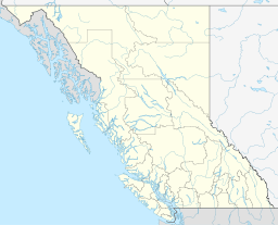 | |
|---|---|---|
| Communities | ||
| Metro areas and agglomerations | ||
| District municipalities |
| |
| ||
Municipalities and communities of Okanagan, British Columbia, Canada | ||
|---|---|---|
| Cities | 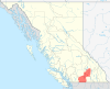 | |
| Towns | ||
| Districts | ||
| Villages | ||
| Designated places |
| |
| Unincorporated communities | ||
| Indian reservations | ||
| Ghost towns | ||
| Footnotes | ‡This populated place also has portions in an adjacent region | |