West Vancouver
| West Vancouver | |||
|---|---|---|---|
| District municipality | |||
| The Corporation of the District of West Vancouver[1] | |||
| |||
| Nickname(s): West Van | |||
 Location of West Vancouver in Metro Vancouver | |||
| Coordinates: 49°22′0″N 123°10′0″W / 49.36667°N 123.16667°WCoordinates: 49°22′0″N 123°10′0″W / 49.36667°N 123.16667°W | |||
| Country |
| ||
| Province |
| ||
| Region | Lower Mainland | ||
| Regional district | Metro Vancouver | ||
| Incorporated | March 15, 1912 | ||
| Government | |||
| • Governing body | West Vancouver District Council | ||
| • Mayor | Michael Smith | ||
| • MLA |
Ralph Sultan (Capilano-Lib) Jordan Sturdy (Garibaldi-Lib) | ||
| • MP | Pam Goldsmith-Jones (Liberal) | ||
| Area | |||
| • Total | 87.26 km2 (33.69 sq mi) | ||
| Highest elevation | 1,224 m (4,016 ft) | ||
| Lowest elevation | 0 m (0 ft) | ||
| Population (2011) | |||
| • Total | 44,000[2] | ||
| • Density | 489.3/km2 (1,267/sq mi) | ||
| Time zone | PST (UTC-8) | ||
| • Summer (DST) | PDT (UTC-7) | ||
| Area code(s) | 604, 778 | ||
| Website | West Vancouver | ||


West Vancouver is a district municipality in the province of British Columbia, Canada. A member municipality of Metro Vancouver, the governing body of the Greater Vancouver Regional District, the municipality is northwest of the city of Vancouver on the northern side of English Bay and the southeast shore of Howe Sound, and is adjoined by the District of North Vancouver to its east. Together with the District of North Vancouver and City of North Vancouver, it is part of a local regional grouping referred to as the North Shore municipalities, or simply "The North Shore".
West Vancouver has a population of 42,694 (2011 census).[3] Cypress Provincial Park, mostly located within the municipal boundaries, was one of the venues for the 2010 Winter Olympics. West Vancouver is also home of Canada's first shopping mall, Park Royal Shopping Centre,[4] and also of the Horseshoe Bay Ferry Terminal, one of the main connecting points between the British Columbia mainland and Vancouver Island.
History

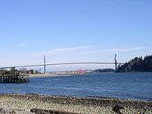
The Municipality of West Vancouver was incorporated on March 15, 1912, after separating from the District of North Vancouver. The first municipal election was held on April 6, 1912. In November 1938, the Lions Gate Bridge was opened to traffic, allowing extensive growth of the semi-populated community, previously only accessible by ferry. Some homes in West Vancouver date back to the 1920s and 30s, though most of the currently existing dwellings were built in the 1970s and 80s, and mostly in British Pacific Properties' developments.
Timeline
- 1792 Captain George Vancouver names Point Atkinson
- 1872 James Blake preempted the first 65 hectares of land
- 1875 First lighthouse at Point Atkinson
- 1898 Mr. Francis Caulfeild was put ashore at Skunk Cove
- 1903 Navvy Jack Thomas, a Welsh deserter from the Royal Navy, was the first Caucasian resident of West Vancouver, offered first ferry service to Vancouver in a rowboat. Their house still stands today at Ambleside and there is a Navvy Jack Point.[5] Thomas' nickname Navvy Jack today remains used in British Columbia English to mean washed pea gravel used in construction and landscaping trades, as he was the original supplier of the material to Vancouver and mined it from coves in West Vancouver.
- 1905 John Lawson, a local leader settled at foot of 17th street
- 1908 First pier, Hollyburn Pier
- 1909 West Vancouver Transportation Company was formed, provides ferry service across harbour to Vancouver
- 1909 "Real estate boom" lots sold for as little as $450 and as much as $4,500
- 1910 Water systems started at Caulfeild and Ambleside
- 1911 First primary school, Presbyterian Church at Dundarave
- 1912 West Vancouver separated from the District Municipality of North Vancouver and incorporated on March 15, 1912.
- 1912 Population was approximately 1,500 people
- 1912 First Municipal election
- 1912 Council appointed John Teare as the first police constable on May 17. F.H. Kettle was appointed the second constable on May 28
- 1914 First known settlement, the Coast Salish village at Sandy Cove
- 1914 Pacific Great Eastern Railway in service from North Vancouver to Caulfeild and Horseshoe Bay
- 1914 Colonel Albert Whyte pressed for a spelling change from White Cliff City to Whytecliff
- 1915 Dundarave Pier built
- 1915 Marine Dr. was officially opened by Premier Richard McBride
- 1916 West Vancouver Municipal Transport bus service started operation
- 1922 British Columbia Electric Railway starts electrical service
- 1924 House numbering scheme started
- 1926 Marine Drive extended to Horseshoe Bay
- 1926 Town Planning Act banned any new industry forming an exclusively residential community with minimum lot sizes
- 1927 Inglewood High School built
- 1928 Direct telephone service to Vancouver operational
- 1930 Septic tanks are mandatory
- 1930 Only 48 of West Vancouver's 100 kilometres of roads paved
- 1931 Dan Sewell opened his marina and the Whytecliff Lodge
- 1932 1,600 acres (6.5 km2) of land bought by A.R. Guinness-Br. Pacific Properties bought for $50 a hectare, they have been developed as the British Properties
- 1934 First police car
- 1936 Hollyburn Post Office built at 17th street and Marine Drive
- 1938 Lions Gate Bridge finished, opened May 29. The bridge cost a total of $6 million to build. It was financed by the Guinness family, in conjunction with the development and marketing of the British Properties.
- 1947 Ferry service stopped due to lack of demand after bridge constructed
- 1950 West Vancouver Memorial Library opened on November 11 (Remembrance Day). The library lends more books per capita than any other library in Canada
- 1950 Park Royal Shopping Centre, Canada's first shopping centre opened
- 1954 Public Safety Building opened. It housed the West Vancouver Police and Fire Departments
- 1959 Rezoning allowed 78 apartment buildings in Ambleside
- 1961 The Crescent Apartments, West Vancouver's first high rise apartment opened
- 1962 Park Royal Shopping Centre enclosed
- 1963 Tolls on Lions Gate Bridge lifted on April 1
- 1967 Fire hall was built and opened on November 22, 1967 at 16th and Fulton Ave. The Police Department remained in the Public
- 1973 Clyde McRae completes a world record walk across Canada on Ambleside Beach.
- 2013 Park Royal Shopping Center sees first major expansion since 1978
Safety building
Industry
West Vancouver has no manufacturing industry by law.

Parks and recreation

West Vancouver is mainly a residential district as many residents are retired, work at home, or take the short commute to downtown Vancouver. A 25-block strip of Marine Drive serves as a commercial district, featuring shops, small offices, garages and gas stations, restaurants, banks, and other common amenities. This area is commonly known as 'Ambleside', with a one-block section separated from that area known as 'Dundarave'. West Vancouver is also home to Park Royal Shopping Centre, Canada's first mall. Opened in the 1950s, it now consumes 2 km of both sides of Marine Drive near North Vancouver, and is home to several department stores and large retailers, as well as many small retailers. Park Royal is also the largest mall on the North Shore, and is a bus terminal for Blue Bus and North Vancouver TransLink buses.

Ambleside Park and the 15 block long West Vancouver Seawall are popular spots for families and outdoor enthusiasts. Whytecliff Park is regarded as one of the best scuba diving spots in Western Canada. The District also has many other small parks, as well as Lighthouse Park at Point Atkinson, which contains some old-growth forest and has with views of Vancouver from downtown to Point Grey and is the boundary-point between English Bay and the Strait of Georgia.
West Vancouver has several public recreation facilities including an 18-hole par 3 golf course, a pool, an ice rink, basketball and tennis courts, skateboard parks and numerous public parks. The new West Vancouver Community Centre (or WVCC) has been rebuilt and opened Spring 2009. West Vancouver is also home to Cypress Provincial Park with mountain biking trails and a large ski and snowboard facility, which served as one of the venues for the 2010 Winter Olympics.
The West Vancouver Memorial Library, located in Ambleside, has a circulation rate of 21.32 per capita, the highest circulation rate per capita in Canada.[6]
Demographics
Population
According to a Statistics Canada 2011 census, West Vancouver has a population of 42,694.[3] It has the second highest percentage of persons aged 65 or older in BC with 22% of persons fitting into the category, compared with 13% for the rest of the province. The top five professions in West Vancouver are professional science and technical services; retail trade; health care; finance and insurance; and educational services. A large portion of the population is involved in senior management in comparison with the rest of the province.[7]
Religions
- No religion 29.3%
- Anglican 17.5%
- United Church 17.5%
- Roman Catholic 13.7%
- Muslim 5.9%
- Source: 2001 Census Profile, BC Stats
Languages
As of 2006, the languages spoken in West Vancouver were:
By mother tongue:
By most commonly used household language:
Mother Languages as reported by each person: Source: [8]
| Canada 2011 Census | Population | % of Total Population | % of Non-official language Population |
|---|---|---|---|
| English | 28,280 | 67.1 | N/A |
| Persian | 3,400 | 8.1 | 25.7 |
| Chinese-Total Chinese-n.o.s. Chinese-Mandarin | 2,750 1,415 1,335 | 6.6 3.4 3.2 | 20.8 10.7 10.1 |
| German | 1,015 | 2.4 | 7.7 |
| Korean | 915 | 2.2 | 6.9 |
| French | 545 | 1.3 | N/A |
Visible minorities and Aboriginals
| Canada 2006 Census | Population | % of Total Population | |
|---|---|---|---|
| Visible minority group Source:[9] | South Asian | 950 | 2.3% |
| Chinese | 3,355 | 8.1% | |
| Black | 125 | 0.3% | |
| Filipino | 305 | 0.7% | |
| Latin American | 255 | 0.6% | |
| Arab | 70 | 0.2% | |
| Southeast Asian | 185 | 0.4% | |
| West Asian | 2,410 | 5.8% | |
| Korean | 1,045 | 2.5% | |
| Japanese | 625 | 1.5% | |
| Other visible minority | 30 | 0.1% | |
| Mixed visible minority | 140 | 0.3% | |
| Total visible minority population | 9,510 | 22.8% | |
| Aboriginal group Source:[10] | First Nations | 65 | 0.2% |
| Métis | 75 | 0.2% | |
| Inuit | 0 | 0% | |
| Total Aboriginal population | 155 | 0.4% | |
| White | 31,960 | 76.8% | |
| Total population | 41,625 | 100% | |
Transportation

West Vancouver is served by the Blue Bus, Canada's longest running municipal transportation system and Canada's first 100% wheelchair accessible transit system. Blue Bus is one of two bus companies in the Greater Vancouver region operating under contract for TransLink, and transfer is free between the Blue Buses and other TransLink buses.
The only freeway route within municipal limits is British Columbia Highway 1 (part of the Trans-Canada Highway), which begins in the community of Horseshoe Bay and continues east into the District of North Vancouver. Highway 99 also runs through West Vancouver, sharing the freeway alignment with Highway 1 between Horseshoe Bay and Taylor Way, and connects the municipality with Downtown Vancouver (via the Lions Gate Bridge) and Whistler (via the Sea-to-Sky Corridor).
Additionally, BC Ferries operates routes departing from Horseshoe Bay to Nanaimo, Bowen Island, and the Sunshine Coast.
Scenery
West Vancouver is known for its parks such as Cypress Provincial Park, which offers scenic views of Howe Sound and the Metro Vancouver area. Whytecliff Park and Lighthouse Park, near the community of Horseshoe Bay, at the continental terminus of the Trans-Canada Highway. All of West Vancouver is situated on the side of the Coast Mountains. Because of this position, most homes in West Vancouver have views of Vancouver Island, the Lower Mainland, and/or Howe Sound.
Affluence

West Vancouver is home to some very large and expensive properties and houses. Occasionally, houses have been priced and sold at around CAD$30,000,000. As of 2011, West Vancouver's average house sells for over CAD$2,000,000;[11] 95% of the houses or close to 16,000 homes are worth over CAD$1 million. West Vancouver is Canada's wealthiest municipality, with the district of North Vancouver just next door the second richest. In West Vancouver, average total incomes were $86,253 for males and $48,070 for females, almost double the provincial average. Over 80% of the population has a total family income of at least $100,000.[7]
Politics
As of 2011, the mayor is Michael Smith having been elected by acclamation on November 19th, 2011.
West Vancouver ridings typically include Squamish and Whistler, and sometimes the Sunshine Coast.
Provincially, Joan McIntyre and Ralph Sultan of the BC Liberal Party were elected to the West Vancouver-Sea To Sky Country and West Vancouver-Capilano ridings, respectively, in the 2005 Provincial election (West Vancouver-Sea To Sky Country includes Squamish, Whistler and Pemberton).
Federally, West Vancouver-based ridings historically have voted Conservative since 1974, electing John Reynolds of the Reform Party of Canada (later the Canadian Alliance) from 1997 to 2004. Reynolds declined to run for re-election in 2006, however, and Liberal Blair Wilson defeated Conservative John Weston to replace Reynolds as Member of Parliament from the West Vancouver—Sunshine Coast—Sea to Sky Country electoral district. Wilson left the Liberals in 2007 and joined the Green Party in 2008, becoming the first Green Member of Parliament. The re-election in 2008 saw a rematch between Weston and Wilson. This time Weston emerged as the victor, carrying nearly triple the vote of his incumbent opponent to handily return the riding to the Conservatives. Weston won again in 2011. In the 2015 federal election, Weston was unseated by Liberal candidate Pam Goldsmith-Jones, who was previously the mayor of West Vancouver from 2005 to 2011.
Education
Public schools are operated by School District 45 West Vancouver.
Schools in West Vancouver and Bowen Island | ||
|---|---|---|
| Secondary schools | ||
| Primary or elementary schools | ||
| Private schools |
| |
Surrounding municipalities

See also
References
- Some highlights of West Vancouver (author unknown), West Vancouver Memorial Library archives
- http://westvancouverpolice.ca/ History of the West Vancouver Police Department
- "West Vancouver", The Encyclopedia of British Columbia (online edition), C 2000 Harbour Publishing
Notes
- ↑ "British Columbia Regional Districts, Municipalities, Corporate Name, Date of Incorporation and Postal Address" (XLS). British Columbia Ministry of Communities, Sport and Cultural Development. Retrieved November 2, 2014.
- ↑ Statistics Canada. "2006 Community Profiles - Census Subdivision". Retrieved 2008-10-11.
- 1 2 Statistics Canada. "Census Profile - West Vancouver". Retrieved 2013-02-18.
- ↑ "West Vancouver", Kerry McPhedran, The Vancouver Book
- ↑ "Navvy Jack Point". BC Geographical Names.
- ↑ North Vancouver District Library, Capilano Branch Library, Space Needs Assessment and Feasibility Study (2004)
- 1 2 2001 Census Profile of British Columbia's Regions, West Vancouver DM BC Stats (subscription service)
- ↑ , Focus on Geography Series, 2011 Census-Census subdivision of North Vancouver, CY - British Columbia
- ↑ Vancouver&SearchType=Begins&SearchPR=01&B1=All&Custom=, Community Profiles from the 2006 Census, Statistics Canada - Census Subdivision
- ↑ , Aboriginal Peoples - Data table
- ↑ Benchmark Detached Home Price, Real Estate Board of Greater Vancouver
External links
| Wikimedia Commons has media related to West Vancouver. |
| Wikivoyage has a travel guide for West Vancouver. |
- Official District Web Site
- West Vancouver Recreation
- West Vancouver Museum
- West Vancouver Police Department
- West Vancouver Blue Buses
- West Vancouver Memorial Library
Municipalities of Metro Vancouver | |
|---|---|
| Population over 500,000 | |
| Population over 100,000 | |
| Population over 50,000 | |
| Population over 10,000 | |
| Population under 10,000 | |
| Unincorporated areas | |
| |
| Subdivisions | 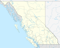 | |
|---|---|---|
| Communities | ||
| Metro areas and agglomerations | ||
| District municipalities |
| |
| ||