British Columbia
British Columbia
| |||
|---|---|---|---|
| |||
|
Motto: Latin: Splendor sine occasu (English: Splendour without diminishment) | |||
| Confederation | July 20, 1871 (7th) | ||
| Capital | Victoria | ||
| Largest city | |||
| Largest metro | Metro Vancouver | ||
| Government | |||
| • Type | Constitutional monarchy | ||
| • Lieutenant Governor | Judith Guichon | ||
| • Premier | |||
| Legislature | Legislative Assembly of British Columbia | ||
| Federal representation | (in Canadian Parliament) | ||
| House seats | 42 of 338 (12.4%) | ||
| Senate seats | 6 of 105 (5.7%) | ||
| Area | |||
| • Total | 944,735 km2 (364,764 sq mi) | ||
| • Land | 925,186 km2 (357,216 sq mi) | ||
| • Water | 19,548.9 km2 (7,547.9 sq mi) 2.1% | ||
| Area rank | Ranked 5th | ||
| 9.5% of Canada | |||
| Population (2011) | |||
| • Total | 4,400,057 [1] | ||
| • Estimate (2016 Q3) | 4,751,612 [2] | ||
| • Rank | Ranked 3rd | ||
| • Density | 4.8/km2 (12/sq mi) | ||
| Demonym(s) |
British Columbian[3] | ||
| Official languages | English | ||
| GDP | |||
| • Rank | 4th | ||
| • Total (2011) | C$217.749 billion[4] | ||
| • Per capita | C$47,579 (8th) | ||
| Time zone |
Pacific (most of province) Mountain (far eastern) UTC−8 & −7 | ||
| Postal abbr. | BC | ||
| Postal code prefix | V | ||
| ISO 3166 code | CA-BC | ||
| Flower | Pacific dogwood | ||
| Tree | Western red cedar | ||
| Bird | Steller's jay | ||
| Website |
www | ||
| Rankings include all provinces and territories | |||

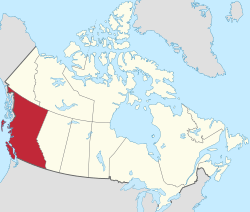
British Columbia (BC) is the westernmost province of Canada, with a population of more than 4 million people located between the Pacific Ocean and the Rocky Mountains. British Columbia is also a component of the Pacific Northwest and the Cascadia bioregion, along with the U.S. states of Idaho, Oregon, Washington and Alaska.[5][6]
The first British settlement in the area was Fort Victoria, established in 1843, which gave rise to the city of Victoria, at first the capital of the separate Colony of Vancouver Island. Subsequently, on the mainland, the Colony of British Columbia (1858–66) was founded by Richard Clement Moody[7] and the Royal Engineers, Columbia Detachment, in response to the Fraser Canyon Gold Rush. Moody was Chief Commissioner of Lands and Works for the Colony and the first Lieutenant-Governor of British Columbia: he was hand-picked by the Colonial Office in London to transform British Columbia into the British Empire's "bulwark in the farthest west",[8] and "to found a second England on the shores of the Pacific".[9] Moody selected the site for and founded the original capital of British Columbia, New Westminster, established the Cariboo Road and Stanley Park,[10] and designed the first version of the Coat of arms of British Columbia.[11][12] Port Moody is named after him.
In 1866, Vancouver Island became part of the colony of British Columbia, and Victoria became the united colony's capital. In 1871, British Columbia became the sixth province of Canada. Its Latin motto is Splendor sine occasu ("Splendour without Diminishment").
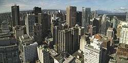
The capital of British Columbia remains Victoria, the fifteenth-largest metropolitan region in Canada, named for the Queen who created the original colonies. The largest city is Vancouver, the third-largest metropolitan area in Canada, the largest in Western Canada, and the third-largest in the Pacific Northwest. In October 2013, British Columbia had an estimated population of 4,606,371 (about 2.5 million of whom were in Greater Vancouver).[13] The province is currently governed by the BC Liberal Party, led by Premier Christy Clark, who became leader as a result of a leadership convention vote on February 26, 2011, and who led her party to an election victory on May 14, 2013.
British Columbia evolved from British possessions that were established in what is now British Columbia by 1871. First Nations, the original inhabitants of the land, have a history of at least 10,000 years in the area. Today there are few treaties and the question of Aboriginal Title, long ignored, has become a legal and political question of frequent debate as a result of recent court actions. Notably, the Tsilhqot'in Nation has established Aboriginal title to a portion of their territory, as a result of the recent Supreme Court of Canada decision (William [Tsilhqot'in Nation] v. British Columbia).
BC's economy is diverse, with service producing industries accounting for the largest portion of the province's GDP.[14] It is the endpoint of transcontinental railways, and the site of major Pacific ports that enable international trade. Though less than 5% of its vast 944,735 km2 (364,764 sq mi) land is arable, the province is agriculturally rich, (particularly in the Fraser and Okanagan valleys), because of milder weather near the coast and in certain sheltered southern valleys. Its climate encourages outdoor recreation and tourism, though its economic mainstay has long been resource extraction, principally logging, farming, and mining. Vancouver, the province's largest city and metropolitan area, also serves as the headquarters of many western-based natural resource companies. It also benefits from a strong housing market and a per capita income well above the national average. While the coast of British Columbia and certain valleys in the south-central part of the province have mild weather, the majority of its land mass experiences a cold-winter-temperate climate similar to that of the rest of Canada. The Northern Interior region has a subarctic climate with very cold winters. The climate of Vancouver is by far the mildest winter climate of the major Canadian cities, with nighttime January temperatures averaging above the freezing point.[15]
Etymology
The province's name was chosen by Queen Victoria, when the Colony of British Columbia, i.e., "the Mainland", became a British colony in 1858.[16] It refers to the Columbia District, the British name for the territory drained by the Columbia River, in southeastern British Columbia, which was the namesake of the pre-Oregon Treaty Columbia Department of the Hudson's Bay Company. Queen Victoria chose British Columbia to distinguish what was the British sector of the Columbia District from that of the United States ("American Columbia" or "Southern Columbia"), which became the Oregon Territory on August 8, 1848, as a result of the treaty.[17]
Geography

British Columbia is bordered by the Pacific Ocean on the west side, by the American state of Alaska to the northwest and parts of the west, on the north by Yukon and the Northwest Territories, on the east by the province of Alberta, and on the south by the states of Washington, Idaho, and Montana. The current southern border of British Columbia was established by the 1846 Oregon Treaty, although its history is tied with lands as far south as California. British Columbia's land area is 944,735 square kilometres (364,800 sq mi). British Columbia's rugged coastline stretches for more than 27,000 kilometres (17,000 mi), and includes deep, mountainous fjords and about 6,000 islands, most of which are uninhabited. It is the only province in Canada that borders the Pacific Ocean.
British Columbia's capital is Victoria, located at the southeastern tip of Vancouver Island. Only a narrow strip of the Island, from Campbell River to Victoria, is significantly populated. Much of the western part of Vancouver Island and the rest of the coast is covered by thick, tall and sometimes impenetrable temperate rainforest. The province's most populous city is Vancouver, which is located at the confluence of the Fraser River and Georgia Strait, in the southwest corner of the mainland (an area often called the Lower Mainland). By land area, Abbotsford is the largest city. Vanderhoof is near the geographic centre of the province.[18]
The Coast Mountains and the Inside Passage's many inlets provide some of British Columbia's renowned and spectacular scenery, which forms the backdrop and context for a growing outdoor adventure and ecotourism industry. Seventy-five percent of the province is mountainous (more than 1,000 metres (3,300 ft) above sea level); 60% is forested; and only about 5% is arable.
The province's mainland away from the coastal regions is somewhat moderated by the Pacific Ocean. Terrain ranges from dry inland forests and semi-arid in numerous valleys, to the range and canyon districts of the Central and Southern Interior, to boreal forest and subarctic prairie in the Northern Interior.
The Okanagan area, extending from near Vernon to Osoyoos, at the United States border, is one of several wine- and cider-producing regions in Canada. Other wine regions in British Columbia include the Cowichan Valley on Vancouver Island and the Fraser Valley.
The Southern Interior cities of Kamloops and Penticton have some of the warmest and longest summer climates in Canada, although their temperatures can be exceeded north of the Fraser Canyon, close to the confluence of the Fraser and Thompson rivers, where the terrain is rugged and covered with desert-type flora. Semi-desert grassland is found in large areas of the Interior Plateau, with land uses ranging from ranching at lower altitudes to forestry at higher ones.
The northern, mostly mountainous two-thirds of the province are largely unpopulated and undeveloped, except for the area east of the Rockies, where the Peace River District, in the northeast of the province, contains BC's portion of the Canadian Prairies, centred at Dawson Creek.
Climate


With origins from the Kuroshio Current (also known as the Japan Current) which merges into the North Pacific Ocean drift current giving coastal southern British Columbia its mild, rainy oceanic climate, some far southern parts of which are warm-summer Mediterranean. Due to the blocking presence of successive mountain ranges, the climate of the interior of the province is semi-arid with certain locations receiving less than 250 mm (10") in annual precipitation. The annual mean temperature in the most populated areas of the province is up to 12 °C (54 °F), the mildest anywhere in Canada.
The valleys of the Southern Interior have short winters with only brief bouts of cold or infrequent heavy snow, while those in the Cariboo, in the Central Interior, are colder because of increased altitude and latitude, but without the intensity or duration experienced at similar latitudes elsewhere in Canada. For example, the average daily low in Prince George (roughly located in the middle of the province) in January is −12 °C (10 °F).[19] Heavy snowfall occurs in all elevated mountainous terrain providing bases for skiers in both south and central BC
Winters are generally severe in the Northern Interior, but even there milder air can penetrate far inland. The coldest temperature in British Columbia was recorded in Smith River, where it dropped to −58.9 °C (−74 °F),[20] one of the coldest readings recorded anywhere in North America. Atlin in the province's far northwest, along with the adjoining Southern Lakes region of Yukon, get midwinter thaws caused by the Chinook effect, which is also common (and much warmer) in more southerly parts of the Interior.
During winter, on the coast, rainfall, sometimes relentless heavy rain, dominates because of consistent barrages of cyclonic low-pressure systems from the North Pacific. Average snowfall on the coast during an average winter is between 25–50 cm (9.8–19.7 in), but on occasion (and not every winter) heavy snowfalls with more than 20 cm (7.9 in) and well below freezing temperatures arrive when modified arctic air reaches coastal areas, typically for short periods, but can still can take temperatures below −10 °C (14 °F) even at sea level and arctic outflow winds can make wind chill temperatures at or even below −17.8 °C (0.0 °F) for a couple of mornings. While winters are very wet, coastal areas are generally milder and dry during summer under the influence of stable anti-cyclonic high pressure. Southern Interior valleys are hot in summer; for example in Osoyoos the July maximum temperature averages 31.7 °C (89 °F) the hottest month of any place in Canada, this hot weather sometimes spreads towards the coast or to the far north of the province. Temperatures often exceed 40 °C (104 °F) in the lower elevations of valleys in the Interior during mid-summer, with the record high of 44.4 °C (111.9 °F) being held in Lytton on July 16, 1941.[21]

The extended summer dryness often creates conditions that spark forest fires, from dry-lightning or man-made causes. Many areas of the province are often covered by a blanket of heavy cloud and low fog during the winter months, in contrast to abundant summer sunshine. Annual sunshine hours vary from 2200 near Cranbrook and Victoria to less than 1300 in Prince Rupert, located on the North Coast, just south of the Alaska Panhandle.
The exception to British Columbia's wet and cloudy winters is El Niño. During this phase, the jet stream is much further south across North America, therefore winters are milder and drier than normal. Winters are much wetter and cooler under the opposite phase, La Niña.
| Municipality | January | April | July | October |
|---|---|---|---|---|
| Prince Rupert | 5.6 °C (42.1 °F)/ −0.8 °C (30.6 °F) | 10.2 °C (50.4 °F)/ 2.5 °C (36.5 °F) | 16.2 °C (61.2 °F)/ 10.5 °C (50.9 °F) | 11.1 °C (52.0 °F)/ 4.9 °C (40.8 °F) |
| Tofino | 8.3 °C (46.9 °F)/ 2.3 °C (36.1 °F) | 11.9 °C (53.4 °F)/ 4.0 °C (39.2 °F) | 18.9 °C (66.0 °F)/ 10.5 °C (50.9 °F) | 13.6 °C (56.5 °F)/ 6.3 °C (43.3 °F) |
| Nanaimo | 6.9 °C (44.4 °F)/ 0.1 °C (32.2 °F) | 14.1 °C (57.4 °F)/ 3.9 °C (39.0 °F) | 23.9 °C (75.0 °F)/ 12.3 °C (54.1 °F) | 14.6 °C (58.3 °F)/ 5.2 °C (41.4 °F) |
| Victoria | 7.6 °C (45.7 °F)/ 1.5 °C (34.7 °F) | 13.6 °C (56.5 °F)/ 4.3 °C (39.7 °F) | 22.4 °C (72.3 °F)/ 11.3 °C (52.3 °F) | 14.2 °C (57.6 °F)/ 5.7 °C (42.3 °F) |
| Vancouver | 6.9 °C (44.4 °F)/ 1.4 °C (34.5 °F) | 13.2 °C (55.8 °F)/ 5.6 °C (42.1 °F) | 22.2 °C (72.0 °F)/ 13.7 °C (56.7 °F) | 13.5 °C (56.3 °F)/ 7.0 °C (44.6 °F) |
| Chilliwack | 6.1 °C (43.0 °F)/ 0.4 °C (32.7 °F) | 15.8 °C (60.4 °F)/ 5.2 °C (41.4 °F) | 25.0 °C (77.0 °F)/ 12.5 °C (54.5 °F) | 15.3 °C (59.5 °F)/ 6.4 °C (43.5 °F) |
| Penticton | 1.8 °C (35.2 °F)/ −3.0 °C (26.6 °F) | 15.7 °C (60.3 °F)/ 2.5 °C (36.5 °F) | 28.7 °C (83.7 °F)/ 13.3 °C (55.9 °F) | 14.3 °C (57.7 °F)/ 3.2 °C (37.8 °F) |
| Kamloops | 0.4 °C (32.7 °F)/ −5.9 °C (21.4 °F) | 16.6 °C (61.9 °F)/ 3.2 °C (37.8 °F) | 28.9 °C (84.0 °F)/ 14.2 °C (57.6 °F) | 13.7 °C (56.7 °F)/ 3.3 °C (37.9 °F) |
| Osoyoos | 2.0 °C (35.6 °F)/ −3.8 °C (25.2 °F) | 18.1 °C (64.6 °F)/ 3.6 °C (38.5 °F) | 31.5 °C (88.7 °F)/ 14.3 °C (57.7 °F) | 16.4 °C (61.5 °F)/ 3.5 °C (38.3 °F) |
| Cranbrook | −1.9 °C (28.6 °F)/ −10.2 °C (13.6 °F) | 12.9 °C (55.2 °F)/ 0.3 °C (32.5 °F) | 26.2 °C (79.2 °F)/ 11.2 °C (52.2 °F) | 11.7 °C (53.1 °F)/ −0.3 °C (31.5 °F) |
| Prince George | −4.0 °C (24.8 °F)/ −11.7 °C (10.9 °F) | 11.2 °C (52.2 °F)/ −1.1 °C (30.0 °F) | 22.4 °C (72.3 °F)/ 9.1 °C (48.4 °F) | 9.4 °C (48.9 °F)/ −0.5 °C (31.1 °F) |
| Fort Nelson | −16.1 °C (3.0 °F)/ −24.6 °C (−12.3 °F) | 9.6 °C (49.3 °F)/ −3.6 °C (25.5 °F) | 23.2 °C (73.8 °F)/ 10.9 °C (51.6 °F) | 5.2 °C (41.4 °F)/ −4.2 °C (24.4 °F) |
Parks and protected areas

There are 14 designations of parks and protected areas in the province that reflects the different administration and creation of these areas in a modern context. There are 141 ecological Reserves, 35 provincial marine parks, 7 Provincial Heritage Sites, 6 National Historic Sites of Canada, 4 National Parks and 3 National Park Reserves. 12.5% (114,000 km2 (44,000 sq mi)) of British Columbia is currently considered protected under one of the 14 different designations that includes over 800 distinct areas.
British Columbia contains seven of Canada's national parks:
- Glacier National Park
- Gulf Islands National Park Reserve
- Gwaii Haanas National Park Reserve and Haida Heritage Site
- Kootenay National Park
- Mount Revelstoke National Park
- Pacific Rim National Park Reserve
- Yoho National Park
British Columbia also contains a large network of provincial parks, run by BC Parks, under the aegis of the Ministry of Environment. British Columbia's provincial parks system is the second largest parks system in Canada (the largest is Canada's National Parks system).
Another tier of parks in British Columbia are regional parks, which are maintained and run by regional districts.
In addition to these areas, over 47,000 km2 (18,000 sq mi) of arable land are protected by the Agricultural Land Reserve.
Fauna

Much of the province is wild or semi-wild, so that populations of many mammalian species that have become rare in much of the United States still flourish in British Columbia. Watching animals of various sorts, including a very wide range of birds, has also long been popular. Bears (grizzly, black, and the Kermode bear or spirit bear—found only in British Columbia) live here, as do deer, elk, moose, caribou, big-horn sheep, mountain goats, marmots, beavers, muskrats, coyotes, wolves, mustelids (such as wolverines, badgers and fishers), cougars, eagles, ospreys, herons, Canada geese, swans, loons, hawks, owls, ravens, harlequin ducks, and many other sorts of ducks. Smaller birds (robins, jays, grosbeaks, chickadees, and so on) also abound. Murrelets are known from Frederick Island, a small islands off the coast of Queen Charlotte's Islands.[23]
Healthy populations of many sorts of fish are found in the waters (including salmonids such as several species of salmon, trout, char, and so on). Besides salmon and trout, sport-fishers in BC also catch halibut, steelhead, bass, and sturgeon. On the coastlines, harbour seals and river otters are common. Cetacean species native to the coast include the orca, grey whale, harbour porpoise, Dall's Porpoise, Pacific white-sided dolphin and minke whale.

British Columbian introduced species include: common dandelion, ring-necked pheasant, Pacific oyster, brown trout, black slug, European starling, cowbird, knapweed, bullfrog, purple loosestrife, Scotch broom, Himalayan blackberry, European earwig, tent caterpillar, sowbug, grey squirrel, Asian longhorn beetle, English ivy, fallow deer, thistle, gorse, Norway rat, crested mynah, and Asian or European gypsy moth.
Some endangered species in British Columbia are: Vancouver Island marmot, spotted owl, American white pelican, and badgers.
| Type of organism | Red-listed species in BC | Total number of species in BC |
|---|---|---|
| Freshwater fish | 24 | 80 |
| Amphibians | 5 | 19 |
| Reptiles | 6 | 16 |
| Birds | 34 | 465 |
| Terrestrial mammals | Requires new data | Requires new data |
| Marine mammals | 3 | 29 |
| Plants | 257 | 2333 |
| Butterflies | 19 | 187 |
| Dragonflies | 9 | 87 |
As of 2001[24]
Forests
White spruce or Engelmann spruce and their hybrids occur in 12 of the 14 biogeoclimatic zones of British Columbia (Coates et al. 1994).[25] Some common types of trees that grow wild in BC's forests are varieties of pine, fir, cedar, birch, hemlock, maple, and spruce.
Traditional plant foods
Plant foods traditionally contributed only a part of the total food intake of coastal First Nations peoples of British Columbia, though they contributed to most of the material good produced. Among the plant foods used, berries, some roots (for example the Camas Lily – part of the Camassia family), cambium noodles (inner bark of hemlock), and seaweeds were (and to an extent still are) important. Animal products were traditionally far more important than plant foods in terms of quantity consumed; however, the huge nutritional diversity provided by native plants of BC largely contributes to the health of First Nations peoples of British Columbia. (Before colonization, British Columbia had the densest aboriginal population of any region in what is now called Canada.)[26]
Ecozones

Environment Canada subdivides British Columbia into six ecozones:
- Pacific Marine
- Pacific Maritime
- Boreal Cordillera
- Montane Cordillera
- Taiga Plains
- Boreal Plains Ecozones.
History
First Nations (Aboriginal) history
The area that is now known as British Columbia is home to First Nations groups that have a deep history with a significant percentage of indigenous languages. There are more than 200 First Nations in BC. Prior to contact (with non-Aboriginal people) human history is known from archaeological investigations, oral history of First Nations groups, and from early records from explorers encountering societies early in the period.
The arrival of Paleoindians from Beringia took place between 20,000 and 12,000 years ago.[27] Hunter gatherer families were the main social structure from 10,000 to 5,000 years ago.[28] The nomadic population lived in non-permanent structures foraging for nuts, berries and edible roots while hunting and trapping larger and small game for food and furs.[28] Around 5,000 years ago individual groups started to focus on resources available to them locally. Thus with the passage of time there is a pattern of increasing regional generalization with a more sedentary lifestyle.[28] Theses indigenous populations evolved over the next 5,000 years across a large area into many different groups with shared traditions and customs.
To the northwest of the province are the peoples of the Na-Dene languages, which include the Athapaskan-speaking peoples and the Tlingit, who lived on the islands of southern Alaska and northern British Columbia. The Na-Dene language group is believed to be linked to the Yeniseian languages of Siberia.[29] The Dene of the western Arctic may represent a distinct wave of migration from Asia to North America.[29] The Interior of British Columbia was home to the Salishan language groups such as the Shuswap (Secwepemc), Okanagan and Athabaskan language groups, primarily the Dakelh (Carrier) and the Tsilhqot'in.[30] The inlets and valleys of the British Columbia Coast sheltered large, distinctive populations, such as the Haida, Kwakwaka'wakw and Nuu-chah-nulth, sustained by the region's abundant salmon and shellfish.[30] These peoples developed complex cultures dependent on the western red cedar that included wooden houses, seagoing whaling and war canoes and elaborately carved potlatch items and totem poles.[30]
Contact with Europeans brought a series of devastating epidemics of diseases from Europe that the people had no immunity to.[31] The result was a dramatic population collapse, culminating in the 1862 Smallpox outbreak in Victoria that spread throughout the coast. European settlement did not bode well for the remaining native population of British Columbia. Colonial officials deemed that colonists could make better use of the land than the First Nations people, and thus the land territory be owned by the colonists.[32] To ensure colonists would be able to settle properly and make use of the land, natives were relocated onto reserves, which were often too small to support their way of life.[33] By the 1930s, over 1500 reserves were located within British Columbia.[34]
Fur trade and colonial era
The British, during the colonial period, spread across the world claiming territories and building the British Empire. Lands now known as British Columbia were added to the empire during the 19th century. Originally established under the auspices of the Hudson's Bay Company, colonies were established (Vancouver Island, the mainland) that were amalgamated, then entered Confederation as British Columbia in 1871 as part of the Dominion of Canada.
During the 1770s, smallpox killed at least 30% of the Pacific Northwest First Nations.[35] This devastating epidemic was the first in a series; the Great Smallpox Epidemic of 1862 killed 50% of the native population.[36]


The arrival of Europeans began around the mid-18th century, as fur traders entered the area to harvest sea otters. While it is thought that Sir Francis Drake may have explored the British Columbian coast in 1579, it was Juan Pérez who completed the first documented voyage, which took place in 1774. Juan Francisco de la Bodega y Quadra explored the coast in 1775. In doing so, Pérez and Quadra reasserted the Spanish claim for the Pacific coast, first made by Vasco Núñez de Balboa in 1513.
The explorations of James Cook in 1778 and George Vancouver in 1792–93 established British jurisdiction over the coastal area north and west of the Columbia River. In 1793, Sir Alexander Mackenzie was the first European to journey across North America overland to the Pacific Ocean, inscribing a stone marking his accomplishment on the shoreline of Dean Channel near Bella Coola. His expedition theoretically established British sovereignty inland, and a succession of other fur company explorers charted the maze of rivers and mountain ranges between the Canadian Prairies and the Pacific. Mackenzie and other explorers—notably John Finlay, Simon Fraser, Samuel Black, and David Thompson—were primarily concerned with extending the fur trade, rather than political considerations. In 1794, by the third of a series of agreements known as the Nootka Conventions, Spain conceded its claims of exclusivity in the Pacific. This opened the way for formal claims and colonization by other powers, including Britain, but because of the Napoleonic Wars there was little British action on its claims in the region until later.
The establishment of trading posts under the auspices of the North West Company and the Hudson's Bay Company (HBC), effectively established a permanent British presence in the region. The Columbia District was broadly defined as being south of 54°40 north latitude, (the southern limit of Russian America), north of Mexican-controlled California, and west of the Rocky Mountains. It was, by the Anglo-American Convention of 1818, under the "joint occupancy and use" of citizens of the United States and subjects of Britain (which is to say, the fur companies). This co-occupancy was ended with the Oregon Treaty of 1846.
The major supply route was the York Factory Express between Hudson Bay and Fort Vancouver. Some of the early outposts grew into settlements, communities, and cities. Among the places in British Columbia that began as fur trading posts are Fort St. John (established 1794); Hudson's Hope (1805); Fort Nelson (1805); Fort St. James (1806); Prince George (1807); Kamloops (1812); Fort Langley (1827); Fort Victoria (1843); Yale (1848); and Nanaimo (1853). Fur company posts that became cities in what is now the United States include Vancouver, Washington (Fort Vancouver), formerly the "capital" of Hudson's Bay operations in the Columbia District, Colville, Washington and Walla Walla, Washington (old Fort Nez Percés).
With the amalgamation of the two fur trading companies in 1821, the region now comprising British Columbia existed in three fur trading departments. The bulk of the central and northern interior was organized into the New Caledonia district, administered from Fort St. James. The interior south of the Thompson River watershed and north of the Columbia was organized into the Columbia District, administered from Fort Vancouver on the lower Columbia River. The northeast corner of the province east of the Rockies, known as the Peace River Block, was attached to the much larger Athabasca District, headquartered in Fort Chipewyan, in present-day Alberta.
Until 1849, these districts were a wholly unorganized area of British North America under the de facto jurisdiction of HBC administrators. Unlike Rupert's Land to the north and east, however, the territory was not a concession to the company. Rather, it was simply granted a monopoly to trade with the First Nations inhabitants. All that was changed with the westward extension of American exploration and the concomitant overlapping claims of territorial sovereignty, especially in the southern Columbia basin (within present day Washington and Oregon). In 1846, the Oregon Treaty divided the territory along the 49th parallel to the Strait of Georgia, with the area south of this boundary (excluding Vancouver Island and the Gulf Islands) transferred to sole American sovereignty. The Colony of Vancouver Island was created in 1849, with Victoria designated as the capital. New Caledonia, as the whole of the mainland rather than just its north-central Interior came to be called, continued to be an unorganized territory of British North America, "administered" by individual HBC trading post managers.
Colony of British Columbia (1858–66)
With the Fraser Canyon Gold Rush in 1858, an influx of Americans into New Caledonia prompted the colonial office to formally designate the mainland as the Colony of British Columbia. When news of the Fraser Canyon Gold Rush reached London, Richard Clement Moody was hand-picked by the Colonial Office, under Sir Edward Bulwer-Lytton, to establish British order and to transform the newly established Colony of British Columbia into the British Empire's "bulwark in the farthest west" [8] and “found a second England on the shores of the Pacific”.[9] Lytton desired to send to the colony 'representatives of the best of British culture, not just a police force’: he sought men who possessed ‘courtesy, high breeding and urbane knowledge of the world’[37] and he decided to send Moody, whom the Government considered to be the 'English gentleman and British Officer’[38] at the head of the Royal Engineers, Columbia Detachment.
Moody and his family arrived in British Columbia in December 1858, commanding the Royal Engineers, Columbia Detachment. He was sworn in as the first Lieutenant-Governor of British Columbia and appointed Chief Commissioner of Lands and Works for British Columbia. On the advice of Lytton, Moody hired Robert Burnaby as his personal secretary.
In British Columbia, Moody ‘wanted to build a city of beauty in the wilderness’ and planned his city as an iconic visual metaphor for British dominance, ‘styled and located with the objective of reinforcing the authority of the crown and of the robe’.[39] Subsequent to the enactment of the Pre-emption Act of 1860, Moody settled the Lower Mainland. He selected the site and founded the new capital, New Westminster. He selected the site due to its the strategic excellence of its position and the quality of its port.[40] He also struck by the majestic beauty of the site, writing in his letter to Blackwood,
"The entrance to the Frazer is very striking--Extending miles to the right & left are low marsh lands (apparently of very rich qualities) & yet fr the Background of Superb Mountains-- Swiss in outline, dark in woods, grandly towering into the clouds there is a sublimity that deeply impresses you. Everything is large and magnificent, worthy of the entrance to the Queen of England’s dominions on the Pacific mainland. [...] My imagination converted the silent marshes into Cuyp-like pictures of horses and cattle lazily fattening in rich meadows in a glowing sunset. [...] The water of the deep clear Frazer was of a glassy stillness, not a ripple before us, except when a fish rose to the surface or broods of wild ducks fluttered away".[41][42]
Moody designed the Coat of Arms of British Columbia.[11][12]
However, Lord Lytton 'forgot the practicalities of paying for clearing and developing the site and the town’ and the efforts of Moody's Engineers were continuous hampered by insufficient funds, which, together with the continuous opposition of Douglas, 'made it impossible for [Moody’s] design to be fulfilled’.[43]
Moody and the Royal Engineers also built an extensive road network, including what would become Kingsway, connecting New Westminster to False Creek, the North Road between Port Moody and New Westminster, and the Cariboo Road and Stanley Park. He named Burnaby Lake after his private secretary Robert Burnaby and named Port Coquitlam’s 400-foot "Mary Hill" after his wife. As part of the surveying effort, several tracts were designated "government reserves", which included Stanley Park as a military reserve (a strategic location in case of an American invasion). The Pre-emption act did not specify conditions for distributing the land, so large parcels were snapped up by speculators, including 3,750 acres (1,517 hectares) by Moody himself. For this he was criticized by local newspapermen for land grabbing.Port Moody is named after him. It was established at the end of a trail that connected New Westminster with Burrard Inlet to defend New Westminster from potential attack from the US.
By 1862, the Cariboo Gold Rush, attracting an additional 5000 miners, was underway, and Douglas hastened construction of the Great North Road (commonly known now as the Cariboo Wagon Road) up the Fraser Canyon to the prospecting region around Barkerville. By the time of this gold rush, the character of the colony was changing, as a more stable population of British colonists settled in the region, establishing businesses, opening sawmills, and engaging in fishing and agriculture. With this increased stability, objections to the colony's absentee governor and the lack of responsible government began to be vocalised, led by the influential editor of the New Westminster British Columbian and future Premier, John Robson. A series of petitions requesting an assembly were ignored by Douglas and the colonial office until Douglas was eased out of office in 1864. Finally the colony would have both an assembly and a resident governor.
Later gold rushes
A series of gold rushes in various parts of the province followed, the largest being the Cariboo Gold Rush in 1862, forcing the colonial administration into deeper debt as it struggled to meet the extensive infrastructure needs of far-flung boom communities like Barkerville and Lillooet, which sprang up overnight. The Vancouver Island colony was facing financial crises of its own, and pressure to merge the two eventually succeeded in 1866, when the colony of British Columbia was amalgamated with the Colony of Vancouver Island to form the Colony of British Columbia (1866–71), which was, in turn, succeeded by the present day province of British Columbia following the Canadian Confederation of 1871.
Rapid growth and development

The Confederation League, including such figures as Amor De Cosmos, John Robson, and Robert Beaven, led the chorus pressing for the colony to join Canada, which had been created out of three British North American colonies in 1867 (the Province of Canada, Nova Scotia and New Brunswick). Several factors motivated this agitation, including the fear of annexation to the United States, the overwhelming debt created by rapid population growth, the need for government-funded services to support this population, and the economic depression caused by the end of the gold rush.
.jpg)
With the agreement by the Canadian government to extend the Canadian Pacific Railway to British Columbia and to assume the colony's debt, British Columbia became the sixth province to join Confederation on July 20, 1871. The borders of the province were not completely settled. The Treaty of Washington sent the Pig War San Juan Islands Border dispute to arbitration in 1871 and in 1903, the province's territory shrank again after the Alaska boundary dispute settled the vague boundary of the Alaska Panhandle.
Population in British Columbia continued to expand as the province's mining, forestry, agriculture, and fishing sectors were developed. Mining activity was particularly notable throughout the Mainland, particularly in the Boundary Country, in the Slocan, in the West Kootenay around Trail, the East Kootenay (the southeast corner of the province), the Fraser Canyon, the Cariboo, the Omineca and the Cassiar, so much so a common epithet for the Mainland, even after provincehood, was "the Gold Colony". Agriculture attracted settlers to the fertile Fraser Valley, and cattle ranchers and later fruit growers came to the drier grasslands of the Thompson River area, the Cariboo, the Chilcotin, and the Okanagan. Forestry drew workers to the lush temperate rainforests of the coast, which was also the locus of a growing fishery.
The completion of the railway in 1885 was a huge boost to the province's economy, facilitating the transportation of the region's considerable resources to the east. The milltown of Granville, known as Gastown, near the mouth of the Burrard Inlet was selected as the terminus of the railway, prompting the incorporation of the City as Vancouver in 1886. The completion of the Port of Vancouver spurred rapid growth, and in less than fifty years the city surpassed Winnipeg, Manitoba, as the largest in Western Canada. The early decades of the province were ones in which issues of land use—specifically, its settlement and development—were paramount. This included expropriation from First Nations people of their land, control over its resources, as well as the ability to trade in some resources (such as the fishery).
Establishing a labour force to develop the province was problematic from the start, and British Columbia was the locus of immigration from Europe, China, and Japan. The influx of a non-Caucasian population stimulated resentment from the dominant ethnic groups, resulting in agitation (much of it successful) to restrict the ability of Asian people to immigrate to British Columbia through the imposition of a head tax. This resentment culminated in mob attacks against Chinese and Japanese immigrants in Vancouver in 1887 and 1907. By 1923, almost all Chinese immigration had been blocked except for merchants, professionals, students and investors.
Meanwhile, the province continued to grow. In 1914, the last spike of a second transcontinental rail line, the Grand Trunk Pacific, linking north-central British Columbia from the Yellowhead Pass through Prince George to Prince Rupert was driven at Fort Fraser. This opened up the North Coast and the Bulkley Valley region to new economic opportunities. What had previously been an almost exclusively fur trade and subsistence economy soon became a locus for forestry, farming, and mining.
In World War I, the province responded strongly to the call to assist the British Empire against its German foes in French and Belgian battlefields. About 55,570 of the 400,000 British Columbian residents, the highest per-capita rate in Canada, responded to the military needs. Horseriders from the province's Interior region and First Nations soldiers made contributions to Vimy Ridge and other battles. About 6,225 men from the province died in combat.[44]
1920s through 1940s
When the men returned from World War I, they discovered the recently enfranchised women of the province had helped vote in the prohibition of liquor in an effort to end the social problems associated with the hard-core drinking that Vancouver and the rest of the province was famous for until the war. Because of pressure from veterans, prohibition was quickly relaxed so that the "soldier and the working man" could enjoy a drink, but widespread unemployment among veterans was hardened by many of the available jobs being taken by European immigrants and disgruntled veterans organized a range of "soldier parties" to represent their interests, variously named Soldier-Farmer, Soldier-Labour, and Farmer-Labour Parties. These formed the basis of the fractured labour-political spectrum that would generate a host of fringe leftist and rightist parties, including those who would eventually form the Co-operative Commonwealth and the early Social Credit splinter groups.

The advent of prohibition in the United States created new opportunities, and many found employment or at least profit in cross-border liquor smuggling. Much of Vancouver's prosperity and opulence in the 1920s results from this "pirate economy", although growth in forestry, fishing and mining continued. The end of US prohibition, combined with the onset of the Great Depression, plunged the province into economic destitution. Compounding the already dire local economic situation, tens of thousands of men from colder parts of Canada swarmed into Vancouver, creating huge hobo jungles around False Creek and the Burrard Inlet rail yards, including the old Canadian Pacific Railway mainline right-of-way through the heart of the city's downtown (at Hastings and Carrall). Increasingly desperate times led to intense political organizing efforts, an occupation of the main Post Office at Granville and Hastings which was violently put down by the police and an effective imposition of martial law on the docks for almost three years. A Vancouver contingent for the On-to-Ottawa Trek was organized and seized a train, which was loaded with thousands of men bound for the capital but was met by a Gatling gun straddling the tracks at Mission; the men were arrested and sent to work camps for the duration of the Depression.[45]
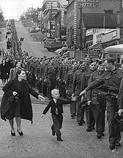
There were some signs of economic life beginning to return to normal towards the end of the 1930s, but it was the onset of World War II which transformed the national economy and ended the hard times of the Depression. Because of the war effort, women entered the workforce as never before.
British Columbia has long taken advantage of its location on the Pacific Ocean to have close relations with East Asia. However, this has often caused friction between cultures which have caused occasional displays of animosity toward Asian immigrants. This was most manifest during the Second World War when many people of Japanese descent were relocated or interned in the Interior of the province.
Coalition and the post-War boom
During World War II the mainstream BC Liberal and BC Conservative Parties of British Columbia united in a formal coalition government under new Liberal leader John Hart, who replaced Duff Pattullo when the latter failed to win a majority in the 1941 election. While the Liberals won the most number of seats, they actually received fewer votes than the socialist Co-operative Commonwealth Federation (CCF). Pattullo was unwilling to form a coalition with the rival Conservatives led by Royal Maitland and was replaced by Hart who formed a coalition cabinet made up of five Liberal and three Conservative ministers.[46] The CCF was invited to join the coalition but refused.[46]
The pretext for continuing the coalition after the end of World War II was to prevent the CCF, which had won a surprise victory in Saskatchewan in 1944, from ever coming to power in British Columbia. The CCF's popular vote was high enough in the 1945 election that they were likely to have won three-way contests and could have formed government. However, the coalition prevented that by uniting the anti-socialist vote.[46] In the post-war environment the government initiated a series of infrastructure projects, notably the completion of Highway 97 north of Prince George to the Peace River Block, a section called the John Hart Highway and also public hospital insurance.
In 1947 the reins of the Coalition were taken over by Byron Ingemar Johnson. The Conservatives had wanted their new leader Herbert Anscomb to be premier, but the Liberals in the Coalition refused. Johnson led the coalition to the highest percentage of the popular vote in British Columbia history (61%) in the 1949 election. This victory was attributable to the popularity of his government's spending programmes, despite rising criticism of corruption and abuse of power. During his tenure, major infrastructures continued to expand, such as the agreement with Alcan Aluminum to build the town of Kitimat with an aluminum smelter and the large Kemano Hydro Project.[47] Johnson achieved popularity for flood relief efforts during the 1948 flooding of the Fraser Valley, which was a major blow to that region and to the province's economy.
Increasing tension between the Liberal and Conservative coalition partners led the Liberal Party executive to vote to instruct Johnson to terminate the arrangement. Johnson ended the coalition and dropped his Conservative cabinet ministers, including Deputy Premier and Finance Minister Herbert Anscomb, precipitating the general election of 1952.[46] A referendum on electoral reform prior to this election had instigated an elimination ballot (similar to a preferential ballot), where voters could select second and third choices. The intent of the ballot, as campaigned for by Liberals and Conservatives, was that their supporters would list the rival party in lieu of the CCF, but this plan backfired when a large group of voters from all major parties, including the CCF, voted for the fringe British Columbia Social Credit Party (Socreds), who wound up with the largest number of seats in the House (19), only one seat ahead of the CCF, despite the CCF having 34.3% of the vote to Social Credit's 30.18%.
The Social Credit Party, led by rebel former Conservative MLA W. A. C. Bennett, formed a minority government backed by the Liberals and Conservatives (with 6 and 4 seats respectively). Bennett began a series of fiscal reforms, preaching a new variety of populism as well as waxing eloquent on progress and development, laying the ground for a second election in 1953 in which the new Bennett regime secured a majority of seats, with 38% of the vote. Secure with that majority, Bennett returned the province to the first-past-the-post system thereafter, which is still in use today.
1952–1960s
With the election of the Social Credit Party, British Columbia embarked on a phase of rapid economic development. Bennett and his party governed the province for the next twenty years, during which time the government initiated an ambitious programme of infrastructure development, fuelled by a sustained economic boom in the forestry, mining, and energy sectors.
During these two decades, the government nationalized British Columbia Electric and the British Columbia Power Company, as well as smaller electric companies, renaming the entity BC Hydro. West Kootenay Power and Light remained independent of BC Hydro, being owned and operated by Cominco, though tied into the regional power grid. By the end of the 1960s, several major dams had been begun or completed in—among others—the Peace, Columbia, and Nechako River watersheds (the Nechako Diversion to Kemano, was to supply power to the Alcan Inc. aluminum smelter at Kitimat, and was not part of the provincial power grid but privately owned). Major transmission deals were concluded, most notably the Columbia River Treaty between Canada and the United States. The province's economy was also boosted by unprecedented growth in the forest sector, as well as oil and gas development in the province's northeast.
The 1950s and 1960s were also marked by development in the province's transportation infrastructure. In 1960, the government established BC Ferries as a crown corporation, to provide a marine extension of the provincial highway system, also supported by federal grants as being part of the Trans-Canada Highway system. That system was improved and expanded through the construction of new highways and bridges, and paving of existing highways and provincial roads.
Vancouver and Victoria became cultural centres as poets, authors, artists, musicians, as well as dancers, actors, and haute cuisine chefs flocked to the beautiful scenery and warmer temperatures, with the cultural and entrepreneurial community notably bolstered by many Draft dodgers from the United States. Similarly, these cities have either attracted or given rise to their own noteworthy academics, commentators, and creative thinkers. Tourism also began to play an important role in the economy. The rise of Japan and other Pacific economies was a great boost to British Columbia's economy, primarily because of massive exports of lumber products and unprocessed coal and trees.
Politically and socially, the 1960s brought a period of significant social ferment. The divide between the political left and right, which had prevailed in the province since the Depression and the rise of the labour movement, sharpened as so-called free enterprise parties coalesced into the de facto coalition represented by Social Credit—in opposition to the social democratic New Democratic Party, the successor to the Co-operative Commonwealth Federation. As the province's economy blossomed, so did labour-management tensions. Tensions emerged, also, from the counterculture movement of the late 1960s, of which Vancouver and Nanaimo were centres. The conflict between hippies and Vancouver mayor Tom Campbell was particularly legendary, culminating in the so-called Gastown Riots of 1971. By the end of the decade, with social tensions and dissatisfaction with the status quo rising, the Bennett government's achievements could not stave off its growing unpopularity.
1970s and 1980s
On August 27, 1969, the Social Credit Party was re-elected in a general election for what would be Bennett's final term in power. At the start of the 1970s, the economy was quite strong because of rising coal prices and an increase in annual allowable cuts in the forestry sector. However, BC Hydro reported its first loss, which was the beginning of the end for Bennett and the Social Credit Party.[48]
The Socreds were forced from power in the August 1972 election, paving the way for a provincial New Democratic Party (NDP) government under Dave Barrett. Under Barrett, the large provincial surplus soon became a deficit, although changes to the accounting system makes it likely that some of the deficit was carried over from the previous Social Credit regime and its "two sets of books", as WAC Bennett had once referred to his system of fiscal management. The brief three-year ("Thousand Days") period of NDP governance brought several lasting changes to the province, most notably the creation of the Agricultural Land Reserve, intended to protect farmland from redevelopment, and the Insurance Corporation of British Columbia, a crown corporation charged with a monopoly on providing single-payer basic automobile insurance.
Perceptions that the government had instituted reforms either too swiftly or that were too far-reaching, coupled with growing labour disruptions led to the ouster of the NDP in the 1975 general election. Social Credit, under W.A.C. Bennett's son, Bill Bennett, was returned to office. Under the younger Bennett's government, 85% of the province's land base was transferred from Government Reserve to management by the Ministry of Forests, reporting of deputy ministers was centralized to the Premier's Office, and NDP-instigated social programs were rolled back, with then-Human Resources Minister infamously demonstrating a golden shovel to highlight his welfare policy, although the new-era Socreds also reinforced and backed certain others instigated by the NDP—notably the creation of the Resort Municipality of Whistler, whose special status including Sunday drinking, then an anomaly in BC
Also during the "MiniWac" regime (a reference to his father's acronym, WAC) certain money-losing Crown-owned assets were "privatized" in a mass giveaway of shares in the British Columbia Resources Investment Corporation, "BCRIC", with the "Brick shares" soon becoming near-worthless. Towards the end of his tenure in power, Bennett oversaw the completion of several megaprojects meant to stimulate the economy and win votes – unlike most right-wing parties, British Columbia's Social Credit actively practised government stimulation of the economy. Most notable of these was the winning of a world's fair for Vancouver, which came in the form of Expo 86, to which was tied the construction of the Coquihalla Highway and Vancouver's SkyTrain system. The Coquihalla Highway project became the subject of a scandal after revelations that the premier's brother bought large tracts of land needed for the project before it was announced to the public, and also because of graft investigations of the huge cost overruns on the project. Both investigations were derailed in the media by a still further scandal, the Doman Scandal, in which the Premier and millionaire backer Herb Doman were investigated for insider-trading and securities fraud. Nonetheless, the Socreds were re-elected in 1979 under Bennett, who led the party until 1986.

As the province entered a sustained recession, Bennett's popularity and media image were in decline. On April 1, 1983, Premier Bennett overstayed his constitutional limits of power by exceeding the legal tenure of a government, and the Lieutenant-Governor, Henry Pybus Bell-Irving, was forced to call Bennett to Government House to resolve the impasse, and an election was called for April 30, while in the meantime government cheques were covered by special emergency warrants as the Executive Council no longer had signing authority because of the constitutional crisis. Campaigning on a platform of moderation, Bennett won an unexpected majority.
After several weeks of silence in the aftermath, a sitting of the House was finally called and in the speech from the Throne the Socreds instituted a programme of fiscal cutbacks dubbed "restraint", which had been a buzzword for moderation during the campaign. The programme included cuts to "motherhood" issues of the left, including the human rights branch, the offices of the Ombudsman and Rentalsman, women's programs, environmental and cultural programs, while still supplying mass capital infusions to corporate British Columbia. This sparked a backlash, with tens of thousands of people in the streets the next day after the budget speech, and through the course of a summer repeated large demonstrations of up to 100,000 people.
This became known as the 1983 Solidarity Crisis, from the name of the Solidarity Coalition, a huge grassroots opposition movement mobilized, consisting of organized labour and community groups, with the British Columbia Federation of Labour forming a separate organization of unions, Operation Solidarity, under the direction of Jack Munro, then-President of the International Woodworkers of America (IWA), the most powerful of the province's resource unions. Tens of thousands participated in protests and many felt that a general strike would be the inevitable result unless the government backed down from its policies they had claimed were only about restraint and not about recrimination against the NDP and the left. Just as a strike at Pacific Press ended, which had crippled the political management of the public agenda by the publishers of the province's major papers, the movement collapsed after an apparent deal was struck by union leader and IWA president, Jack Munro and Premier Bennett.[49]
A tense winter of blockades at various job sites around the province ensued, as among the new laws were those enabling non-union labour to work on large projects and other sensitive labour issues, with companies from Alberta and other provinces brought in to compete with union-scale British Columbia companies. Despite the tension, Bennett's last few years in power were relatively peaceful as economic and political momentum grew on the megaprojects associated with Expo, and Bennett was to end his career by hosting Prince Charles and Lady Diana on their visit to open Expo 86. His retirement being announced, a Social Credit convention was scheduled for the Whistler Resort, which came down to a three-way shooting match between Bud Smith, the Premier's right-hand man but an unelected official, Social Credit party grande dame Grace McCarthy, and the charismatic but eccentric Bill Vander Zalm.
Bill Vander Zalm became the new Socred leader when Smith threw his support to him rather than see McCarthy win, and led the party to victory in the election later that year. Vander Zalm was later involved in a conflict of interest scandal following the sale of Fantasy Gardens, a Christian and Dutch culture theme park built by the Premier, to Tan Yu, a Filipino Chinese gambling kingpin. There were also concerns over Yu's application to the government for a bank licence, and lurid stories from flamboyant realtor Faye Leung of a party in the "Howard Hughes Suite" on the top two floors of the Bayshore Inn, where Tan Yu had been staying, with reports of a bag of money in a brown paper bag passed from Yu to Vander Zalm during the goings-on. These scandals forced Vander Zalm's resignation, and Rita Johnston became premier of the province. Johnston presided over the end of Social Credit power, calling an election which led to the reducing of the party's caucus to only two seats, and the revival of the long-defunct British Columbia Liberal Party as Opposition to the victorious NDP under former Vancouver mayor Mike Harcourt.
In 1988, David Lam was appointed as British Columbia’s twenty-fifth Lieutenant-Governor, and was the Province's first Lieutenant-Governor of Chinese origin.
1990s to present
Johnston lost the 1991 general election to the NDP, under the leadership of Mike Harcourt, a former mayor of Vancouver. The NDP's unprecedented creation of new parkland and protected areas was popular, and helped boost the province's growing tourism sector. However, the economy continued to struggle against the backdrop of a weak resource economy. Housing starts and an expanded service sector saw growth overall through the decade, despite political turmoil. Harcourt ended up resigning over "Bingogate"—a political scandal involving the funnelling of charity bingo receipts into party coffers in certain ridings. Harcourt was not implicated, but he resigned nonetheless in respect of constitutional conventions calling for leaders under suspicion to step aside. Glen Clark, a former president of the BC Federation of Labour, was chosen the new leader of the NDP, which won a second term in 1996. More scandals dogged the party, most notably the Fast Ferry Scandal involving the province trying to develop the shipbuilding industry in British Columbia. An allegation (never substantiated) that the Premier had received a favour in return for granting a gaming licence led to Clark's resignation as Premier. He was succeeded on an interim basis by Dan Miller who was in turn followed by Ujjal Dosanjh following a leadership convention.
In the 2001 general election Gordon Campbell's BC Liberals defeated the NDP, gaining 77 out of 79 total seats in the provincial legislature. Campbell instituted various reforms and removed some of the NDP's policies including scrapping the "fast ferries" project, lowering income taxes, and the controversial sale of BC Rail to CN Rail. Campbell was also the subject of criticism after he was arrested for driving under the influence during a vacation in Hawaii. However, Campbell still managed to lead his party to victory in the 2005 general election, against a substantially strengthened NDP opposition. Campbell won a third term in the British Columbia general election, 2009, marking the first time in 23 years that a premier has been elected to a third term.
The province won a bid to host the 2010 Winter Olympics in Vancouver and Whistler. As promised in his 2002 re-election campaign, Vancouver Mayor Larry Campbell staged a non-binding civic referendum regarding the hosting of the Olympics. In February 2003, Vancouver's residents voted in a referendum accepting the responsibilities of the host city should it win its bid. Sixty-four percent of residents voted in favour of hosting the games.[50]
After the Olympic joy had faded, Campbell's popularity started to fall. His management style, the implementation of the Harmonized Sales Tax (HST) against election promises and the cancelling of the BC Rail corruption trial lead to low approval ratings and loss of caucus support. He would resign in November 2010 and call on the party to elect a new leader.[51]
In early 2011, Christy Clark, former Deputy Premier, would become leader of the Liberal Party. Though she was not currently a sitting MLA, she would go on to win the seat left vacant by Campbell and form a government. For the next two years she would attempt to distance herself from the unpopularity of Campbell and forge an image for the upcoming election. Among her early accomplishments she raised the minimum wage, created the new holiday of Family Day and pushed the development of BC's liquified natural gas. In the 2013 election the liberals lagged behind with a 20-point gap in the polls but on election night were able to come to a surprise victory with a healthy majority, making Clark the first elected female premier in BC history.[52] While Christy Clark lost her seat, she would win a by-election in the riding of Westside-Kelowna. Since this victory her government has brought a balanced budget, implemented changes in liquor laws and continued with the question of the proposed Enbridge Northern Gateway Pipelines.
British Columbia has also been significantly affected by demographic changes within Canada and around the world. Vancouver (and to a lesser extent some other parts of British Columbia) was a major destination for many of the immigrants from Hong Kong who left the former UK colony (either temporarily or permanently) in the years immediately prior to its handover to the People's Republic of China. British Columbia has also been a significant destination for internal Canadian migrants. This has been the case throughout recent decades, because of its image of natural beauty, mild climate and relaxed lifestyle, but is particularly true during periods of economic growth. As a result, British Columbia has moved from approximately 10% of Canada's population in 1971 to approximately 13% in 2006. Trends of urbanization mean that the Greater Vancouver area now includes 51% of the Province's population, followed in second place by Greater Victoria with 8%. These two metropolitan regions have traditionally dominated the demographics of BC
The net number of people coming to BC from other provinces has grown almost four times larger since 2012. BC was the largest net recipient of interprovincial migrants in Canada in the first quarter of 2016 with half of the 5,000 people coming from Alberta.[53]
Demographics
| Year | Population | Five year % change |
Ten year % change |
Rank among provinces |
|---|---|---|---|---|
| 1851 | 55,000 | n/a | n/a | 6 |
| 1861 | 51,524 | n/a | −6.3 | 6 |
| 1871 | 36,247 | n/a | −35.3 | 7 |
| 1881 | 49,459 | n/a | 36.4 | 8 |
| 1891 | 98,173 | n/a | 98.5 | 8 |
| 1901 | 178,657 | n/a | 82.0 | 0 |
| 1911 | 392,480 | n/a | 119.7 | 6 |
| 1921 | 524,582 | n/a | 33.7 | 6 |
| 1931 | 694,263 | n/a | 32.3 | 6 |
| 1941 | 817,861 | n/a | 17.8 | 4 |
| 1951 | 1,165,210 | n/a | 42.5 | 3 |
| 1956 | 1,398,464 | 20.0 | n/a | 3 |
| 1961 | 1,629,082 | 16.5 | 39.8 | 3 |
| 1966 | 1,873,674 | 15.0 | 34.0 | 3 |
| 1971 | 2,184,620 | 16.6 | 34.1 | 3 |
| 1976 | 2,466,610 | 12.9 | 31.6 | 3 |
| 1981 | 2,744,467 | 11.3 | 25.6 | 3 |
| 1986 | 2,883,370 | 5.1 | 16.9 | 3 |
| 1991 | 3,282,061 | 13.8 | 19.6 | 3 |
| 1996 | 3,724,500 | 13.5 | 29.2 | 3 |
| 2001 | 3,907,738 | 4.9 | 19.1 | 3 |
| 2006 | 4,113,487 | 5.3 | 10.4 | 3 |
| 2011 | 4,400,057 | 6.9 | 12.6 | 3 |
| 1991 BC % | 2001 BC % | 2001 Canada % | BC 2001 number | ||
|---|---|---|---|---|---|
| Total population | 100% | 100% | 100% | 3,868,875 | |
| No religious affiliation | 30.0% | 35.1% | 16.5% | 1,388,300 | includes agnostic, atheist, humanist, and no religion, and other responses, such as Darwinism, and so on. |
| Protestant | 41.9% | 31.4% | 29.2% | 1,213,295 | |
| Catholic | 18.3% | 17.2% | 43.6% | 675,320 | includes Roman Catholic, Eastern Catholic. |
| Eastern Orthodox | 0.7% | 0.9% | 1.6% | 35,655 | includes Greek Orthodox, Russian Orthodox |
| Christian n. i. e. | 2.7% | 5.2% | 2.6% | 200,345 | Includes mostly answers of 'Christian', not identified elsewhere |
| Sikh | 2.3% | 3.5% | 0.9% | 135,310 | |
| Buddhist | 1.1% | 2.2% | 1% | 85,540 | |
| Muslim | 0.8% | 1.5% | 2% | 56,220 | |
| Hindu | 0.6% | 0.8% | 1% | 31,500 | |
| Jewish | 0.5% | 0.5% | 1.1% | 21,230 | |
| Eastern religions | 0.3% | 0.1% | 9,970 | includes Baha'i, Eckankar, Jains, Shinto, Taoist, Zoroastrian and Eastern religions, not identified elsewhere | |
| Other religions | 0.4% | 0.2% | 16,205 | includes Aboriginal spirituality, pagan, wicca, unity – new thought – pantheist, Scientology, Rastafarian, new age, gnostic, and so on. |
The largest denominations by number of adherents according to the 2001 census were none (atheist, agnostic, and so on.) with 1,388,300 (35.9%); Protestant with 1,213,295 (31.4%); the Roman Catholic Church with 675,320 (17%); the United Church of Canada with 361,840 (9%); and the Anglican Church of Canada with 298,375 (8%).[58]
Ethnic groups and languages
The following statistics represent both single (for example, "German") and multiple (for example, "Chinese-Canadian") responses to the 2006 Census, and thus do not add up to 100%. All items are self-identified.[59]
| Ethnic origin | Population | Percent |
|---|---|---|
| English | 1,207,245 | 29.6% |
| Scottish | 828,145 | 20.3% |
| Canadian | 720,200 | 17.7% |
| Irish | 618,120 | 15.2% |
| German | 561,570 | 13.8% |
| Chinese | 432,435 | 10.6% |
| French | 361,215 | 8.9% |
| South Asian | 232,370 | 5.7% |
| Ukrainian | 197,265 | 4.8% |
| Dutch (Netherlands) | 196,420 | 4.8% |
| North American Indian | 193,060 | 4.7% |
| Italian | 143,155 | 3.5% |
| Norwegian | 129,420 | 3.2% |
| Polish | 128,360 | 3.2% |
| Russian | 114,105 | 2.8% |
| Welsh | 104,275 | 2.6% |
| Swedish | 104,025 | 2.6% |
| Filipino | 94,255 | 2.3% |
| British | 74,145 | 1.8% |
| American (US) | 66,765 | 1.6% |
| Ethnic origin | Population | Percent |
|---|---|---|
| Métis | 62,570 | 1.5% |
| Danish | 56,125 | 1.4% |
| Spanish | 52,640 | 1.3% |
| Korean | 51,860 | 1.3% |
| Hungarian | 49,870 | 1.2% |
| Austrian | 46,620 | 1.1% |
| Japanese | 41,585 | 1.0% |
| Portuguese | 34,660 | 0.9% |
| Vietnamese | 30,835 | 0.8% |
| Jewish | 30,830 | 0.8% |
| Finnish | 29,875 | 0.7% |
| Iranian | 29,265 | 0.7% |
| Swiss | 28,240 | 0.7% |
| Romanian | 25,670 | 0.6% |
| Icelandic | 22,110 | 0.5% |
| Greek | 21,770 | 0.5% |
| Czech | 21,150 | 0.5% |
| Croatian | 18,815 | 0.5% |
| Punjabi | 18,525 | 0.5% |
| Belgian | 17,510 | 0.4% |
Though just 1.8% refer to their origins as being "British", a majority (57.3%) of the population of British Columbia claim their ethnic origin as being from one of the three main British nations (England, Scotland or Wales). Migration was primarily from Scotland, Wales and Northern England, especially North East England – out of the 54 of Metro Vancouver's 100 most common names that are British in origin, 29 are of Scottish or Northern English origin, 9 are Welsh, and only four are native to England's south.[60][61] Another 15.2% refer to their ethnicity as "Irish", though not distinguishing between Northern Ireland and the Republic of Ireland.
Of the provinces, British Columbia had the highest proportion of visible minorities, representing 24.8% of its population.[62] Asians at 20.2% of the total population, are by far the largest visible minority demographic, with many of the Lower Mainland's large cities having sizeable Chinese, South Asian, Japanese, Filipino, and Korean communities.
Also present in large numbers relative to other regions of Canada (except Toronto), and ever since the province was first settled (unlike Toronto), are many European ethnicities of the first and second generation, notably Germans, Scandinavians, Yugoslavs and Italians. Third-generation Europeans are generally of mixed lineage, and traditionally intermarried with other European-derived ethnic groups more than in any other Canadian province. First-generation Britons remain a strong component of local society despite limitations on immigration from Britain since the ending of special status for British subjects in the 1960s.
Of the 4,113,847 population counted by the 2006 census, 4,074,385 people completed the section about language. Of these 4,022,045 gave singular responses to the question regarding mother tongue. The languages most commonly reported were the following:
| Language | Number of native speakers |
Percentage of singular responses |
|---|---|---|
| English | 2,875,770 | 71.5% |
| Chinese | 342,920 | 8.5% |
| Punjabi | 158,750 | 4.0% |
| German | 86,690 | 2.2% |
| French | 54,745 | 1.4% |
| Tagalog (Filipino) | 50,425 | 1.3% |
| Korean | 46,500 | 1.2% |
| Spanish | 34,075 | 0.9% |
| Persian | 28,150 | 0.7% |
| Italian | 27,020 | 0.7% |
| Dutch | 26,355 | 0.7% |
| Vietnamese | 24,560 | 0.7% |
| Hindi | 23,240 | 0.6% |
| Japanese | 20,040 | 0.5% |
| Russian | 19,320 | 0.5% |
| Polish | 17,565 | 0.4% |
| Portuguese | 14,385 | 0.4% |
| Ukrainian | 12,285 | 0.3% |
| Hungarian | 10,670 | 0.3% |
| Croatian | 8,505 | 0.2% |
| Language | Number of native speakers |
Percentage of singular responses |
|---|---|---|
| Arabic | 8,440 | 0.2% |
| Urdu | 7,025 | 0.2% |
| Danish | 6,720 | 0.2% |
| Greek | 6,620 | 0.2% |
| Gujarati | 6,565 | 0.2% |
| Romanian | 6,335 | 0.2% |
| Serbian | 6,180 | 0.2% |
| Czech | 6,000 | 0.1% |
| Finnish | 4,770 | 0.1% |
| Athabaskan languages | 3,500 | 0.1% |
| Slovak | 3,490 | 0.1% |
| Norwegian | 3,275 | 0.1% |
| Tamil | 3,200 | 0.1% |
| Salish languages | 3,190 | 0.1% |
| Ilocano | 3,100 | 0.1% |
| Malay | 3,100 | 0.1% |
| Bisayan languages | 3,035 | 0.1% |
| Swedish | 2,875 | 0.1% |
| Turkish | 2,255 | 0.1% |
| Tsimshianic languages | 2,125 | 0.1% |
Numerous other languages were also counted, but only languages with more than 2,000 native speakers are shown.
Figures shown are for the number of single language responses and the percentage of total single-language responses.[63]
Cities

Half of all British Columbians live in the Metro Vancouver area, which includes Vancouver, Surrey, New Westminster, West Vancouver, North Vancouver (city), North Vancouver (district municipality), Burnaby, Coquitlam, Port Coquitlam, Maple Ridge, Langley (city), Langley (district municipality), Delta, Pitt Meadows, White Rock, Richmond, Port Moody, Anmore, Belcarra, Lions Bay and Bowen Island, with adjacent unincorporated areas (including the University Endowment Lands) represented in the regional district as the electoral area known as Greater Vancouver Electoral Area A. Seventeen Indian reserves are located in the metropolitan area but are outside the jurisdiction of the regional district and not represented in its government.
The second largest concentration of British Columbia population is located at the southern tip of Vancouver Island, which is made up of the 13 municipalities of Greater Victoria, Victoria, Saanich, Esquimalt, Oak Bay, View Royal, Highlands, Colwood, Langford, Central Saanich/Saanichton, North Saanich, Sidney, Metchosin, Sooke, which are part of the Capital Regional District. The metropolitan area also includes several Indian reserves (the governments of which are not part of the regional district). Almost half of the Vancouver Island population is located in Greater Victoria.
|
|
| Canada 2006 Census | Population | % of total population | |
|---|---|---|---|
| White | 2,869,455 | 70.4% | |
| Visible minority group Source:[66] | Chinese | 407,225 | 10% |
| South Asian | 262,290 | 6.4% | |
| Black | 28,315 | 0.7% | |
| Filipino | 88,075 | 2.2% | |
| Latin American | 28,965 | 0.7% | |
| Southeast Asian | 40,685 | 1% | |
| Arab | 8,635 | 0.2% | |
| West Asian | 29,810 | 0.7% | |
| Korean | 50,490 | 1.2% | |
| Japanese | 35,060 | 0.9% | |
| Other visible minority | 3,880 | 0.1% | |
| Mixed visible minority | 25,420 | 0.6% | |
| Total visible minority population | 1,008,855 | 24.8% | |
| Aboriginal group Source:[67] | First Nations | 129,575 | 3.2% |
| Métis | 59,445 | 1.5% | |
| Inuit | 795 | 0% | |
| Total Aboriginal population | 196,070 | 4.8% | |
| Total population | 4,074,380 | 100% | |
Economy
British Columbia has a history of being a resource dominated economy, centred on the forestry industry but also with fluctuating importance in mining. Employment in the resource sector has fallen steadily as a percentage of employment, and new jobs are mostly in the construction and retail/service sectors. It now has the highest percentage of service industry jobs in the west, comprising 72% of industry (compared to 60% Western Canadian average).[68] The largest section of this employment is in finance, insurance, real estate and corporate management. Many areas outside of metropolitan areas, however, are still heavily reliant on resource extraction. With its film industry known as Hollywood North, the Vancouver region is the third-largest feature film production location in North America, after Los Angeles and New York City.[69]
The economic history of British Columbia is replete with tales of dramatic upswings and downswings, and this boom and bust pattern has influenced the politics, culture and business climate of the province. Economic activity related to mining in particular has widely fluctuated with changes in commodity prices over time, with documented costs to community health.[70]
British Columbia's GDP is the fourth largest in Canada at C$219.99 billion in 2012. GDP per capita was $45,430.[71] British Columbia's debt was $57 billion in June 2013, or 25.9% of GDP.[72]
Government and politics

The Lieutenant-Governor of British Columbia, Judith Guichon, is the Queen of Canada's representative in the Province of British Columbia. During the absence of the Lieutenant-Governor, the Governor General in Council may appoint an administrator to execute the duties of the office. In practice, this is usually the Chief Justice of British Columbia.[73]
British Columbia has an 85-member elected Legislative Assembly, elected by the plurality voting system, though in recent years there has been significant debate about switching to a single transferable vote system. The government of the day appoints ministers for various portfolios, what are officially part of the Executive Council of British Columbia (cabinet), of whom the premier is chair.
The province is governed by the Liberal Party under Premier Christy Clark. The previous election saw then Premier Gordon Campbell win a third straight majority government in May 2009, taking 49 seats to the opposition New Democratic Party's 35. Campbell had previously led the largest landslide election in British Columbia history in 2001, with 77 of 79 seats, but the legislature has been more evenly divided between Liberals and NDP following the 2005 (46 of 79) and 2009 (49 of 85) provincial elections. The New Democratic Party (NDP) and its predecessor the CCF have been the main opposition force to right-wing parties since the 1930s and have ruled majority governments 1972–1975 and 1991–2001. The Green Party of British Columbia plays a larger role in the politics of British Columbia than Green Parties do in most other jurisdictions in Canada. However, after a breakthrough election in 2001 (12.39%), the party's vote share has declined (2005 – 9.17%, 2009 – 8.09%).
The British Columbia Liberal Party is not related to the federal Liberal Party and does not share the same ideology. Instead, the BC Liberal party is a rather diverse coalition, made up of the remnants of the Social Credit Party, many federal Liberals, federal Conservatives, and those who would otherwise support right-of-centre or free enterprise parties. Historically, there have commonly been third parties present in the legislature (including the Liberals themselves from 1952 to 1975); the BC Green Party are the current third party in British Columbia, with one seat in the legislature.
Prior to the rise of the Liberal Party, British Columbia's main political party was the British Columbia Social Credit Party which ruled British Columbia for 20 continuous years. While sharing some ideology with the current Liberal government, they were more right-wing although undertook nationalization of various important monopolies, notably BC Hydro and BC Ferries.

British Columbia is known for having politically active labour unions who have traditionally supported the NDP or its predecessor, the CCF.
British Columbia's political history is typified by scandal and a cast of colourful characters, beginning with various colonial-era land scandals and abuses of power by early officials (such as those that led to McGowan's War in 1858–59). Notable scandals in Social Credit years included the Robert Bonner Affair, the Fantasy Gardens scandal which forced Premier Bill Vander Zalm to resign and ended the Social Credit era, the Bingogate scandal which brought down NDP Premier Mike Harcourt, the alleged scandal named Casinogate which drove NDP Premier Glen Clark to resign. A variety of scandals have plagued the current Liberal government, including Campbell's arrest for drunk driving in Maui and the resignation of various cabinet ministers because of conflict-of-interest allegations. A Christmas Eve raid on the Parliament Buildings in Victoria, including the Premier's Office, has resulted in charges only for ministerial aides, although key cabinet members from the time have since resigned. The case, currently in preliminary hearings in the courts and relating to the sale of BC Rail to CN Rail, may not reach trial because of the mass of evidence and various procedural problems. Campbell eventually resigned in late 2010 due to opposition to his government's plan to introduce a Harmonized Sales Tax (HST) and was replaced by Christy Clark as Premier in a BC Liberal leadership election.
British Columbia is under represented in the Senate of Canada, leading premier Clark to refuse to cooperate with the federal government's new reforms for senate appointments to be made based on the recommendations of a new advisory board that would use non-partisan criteria. Hours after that plan was unveiled in Ottawa on 3 December 2015, Clark issued a statement that it did "not address what’s been wrong with the Senate since the beginning".[74]
The imbalance in representation in that House is apparent when considering population size. The six senators from BC constitute only one for every 775,000 people vs. one for every 75,000 in P.E.I. which has four senators. Nova Scotia and New Brunswick have much smaller populations than BC and yet, each has ten Senators according to a Global News summary.[75] Correcting this imbalance would require a constitutional amendment, but that is unlikely to be supported by the Atlantic Provinces.[75]
Official symbols

The government of British Columbia has designated several official symbols:[76]
- Flag: Flag of British Columbia
- Coat of arms: Coat of arms of British Columbia
- Floral emblem: Pacific dogwood
- Mineral emblem: Jade
- Tree emblem: Western red cedar
- Bird emblem: Steller's jay
- Mammal emblem: "Spirit" or Kermode bear
- Fish emblem: Pacific salmon
- Tartan emblem: British Columbia Tartan
The flag of British Columbia is not protected and is in the Public Domain.[77] However, the Coat of arms of British Columbia is protected by law, where no one may, "without the permission of the minister, assume, display or use the Coat of Arms of British Columbia or a design so closely resembling it as to be likely to deceive."[76]
Civil rights
British Columbia was the second Canadian jurisdiction (after Ontario) to legalize same-sex marriage.[78]
Transportation
Transportation played a huge role in British Columbia history. The Rocky Mountains and the ranges west of them constituted a significant obstacle to overland travel until the completion of the transcontinental railway in 1885. The Peace River Canyon through the Rocky Mountains was the route that the earliest explorers and fur traders used. Fur trade routes were only marginally used for access to British Columbia through the mountains. Travel from the rest of Canada before 1885 meant the difficulty of overland travel via the United States, around Cape Horn or overseas from Asia. Nearly all travel and freight to and from the region occurred via the Pacific Ocean, primarily through the ports of Victoria and New Westminster.
Until the 1930s, rail was the only means of overland travel to and from the rest of Canada; travellers using motor vehicles needed to journey through the United States. With the construction of the Inter-Provincial Highway in 1932 (now known as the Crowsnest Pass Highway), and later the Trans-Canada Highway, road transportation evolved into the preferred mode of overland travel to and from the rest of the country.
Roads and highways
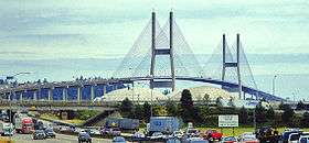
Because of its size and rugged, varying topography, British Columbia requires thousands of kilometres of provincial highways to connect its communities. British Columbia's roads systems were notoriously poorly maintained and dangerous until a concentrated programme of improvement was initiated in the 1950s and 1960s. There are now freeways in Greater Victoria, the Lower Mainland, and Central Interior of the province. Much of the rest of the province, where traffic volumes are generally low, is accessible by well-maintained generally high-mobility two-lane arterial highways with additional passing lanes in mountainous areas and usually only a few stop-controlled intersections outside the main urban areas.
A couple of busy intercity corridors outside Greater Vancouver feature more heavily signalized limited-mobility arterial highways that are mostly four-lane and often divided by portable median traffic barriers. Highway 1 on Vancouver Island and Highway 97 through the Okanagan Valley are medium- to high-volume roadways with variable posted speeds that range from 50 km/h to maximums just slightly lower than the principal grade-separated highways. Numerous traffic lights operate in place of interchanges on both arterials as long-term cost-cutting measures. Signalization along both these highways is heaviest through urban areas and along inter-urban sections where traffic volumes are similar to and sometimes higher than the freeways, but where funding is not available for upgrades to interchanges or construction of high-mobility alternative routes or bypasses. The building and maintenance of provincial highways is the responsibility of the British Columbia Ministry of Transportation and Infrastructure.[79]
There are only five major routes to the rest of Canada. From south to north they are: BC Highway 3 through the Crowsnest Pass, the Vermilion Pass (Highway 93 in both British Columbia and Alberta), the Kicking Horse Pass, the latter being used by the Trans-Canada Highway entering Alberta through Banff National Park, the Yellowhead Highway (16) through Jasper National Park, and Highway 2 through Dawson Creek. There are also several highway crossings to the adjoining American states of Washington, Idaho, and Montana. The longest highway is Highway 97, running 2,081 km (1,293 mi) from the British Columbia-Washington border at Osoyoos north to Watson Lake, Yukon and which includes the British Columbia portion of the Alaska Highway.
Public transit
Prior to 1979, surface public transit was administered by BC Hydro, the provincially owned electricity utility. Subsequently, the province established BC Transit to oversee and operate all municipal transportation systems. In 1998, the Greater Vancouver Transportation Authority (TransLink) (now South Coast British Columbia Transportation Authority), a separate authority for routes within the Greater Vancouver Regional District was established.
Public transit in British Columbia consists mainly of diesel buses, although Vancouver is also serviced by a fleet of trolleybuses. Several experimental buses are being tested such as hybrid buses that have both gasoline and electric engines. Additionally, there are CNG-fueled buses being tested and used in Nanaimo and Kamloops systems.[80] British Columbia also tested a fleet of Hydrogen-fueled buses for the Vancouver-Whistler Winter Olympics in 2010.[81] TransLink operates SkyTrain, an automated metro system serving the cities of Vancouver, Burnaby, New Westminster, North Surrey and Richmond. In 2009, the Canada Line SkyTrain was completed, linking Vancouver International Airport and the city of Richmond to downtown Vancouver bringing the total to three operating metro lines.
Presently, a new line to Coquitlam and Port Moody (the Evergreen Line) is being constructed, expansion of the Expo Line is being developed, and there is planning for an extension of the Millennium Line through Vancouver City to the University of British Columbia. Also of note, Turnstiles are being added to all existing (and future) lines of the system. In the past, SkyTrain used a proof of payment honour system. In the capital city of Victoria BC Transit and the provincial government's infrastructure ministry are working together to create a bus rapid transit from the Westshore communities to downtown Victoria.[82] In Kamloop's there is a rapid transit/ bus GPS trail underway to see how bus rapid transit effects smaller cities, rather than larger (Victoria and Vancouver).
Rail
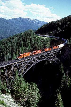
Rail development expanded greatly in the decades after the Canadian Pacific Railway was completed, in 1885, and was the chief mode of long-distance surface transportation until the expansion and improvement of the provincial highways system began in the 1950s. Two major routes through the Yellowhead Pass competed with the Canadian Pacific Railway—the Grand Trunk Pacific, terminating at Prince Rupert, and the Canadian Northern Railway, terminating at Vancouver.
The Pacific Great Eastern line supplemented this service, providing a north–south route between interior resource communities and the coast. The Pacific Great Eastern (later known as British Columbia Railway and now owned by Canadian National Railway) connects Fort St James, Fort Nelson, and Tumbler Ridge with North Vancouver. The E&N Railway, rebranded as Southern Railway of Vancouver Island, serves the commercial and passenger train markets of Vancouver Island by owning the physical rail lines.
Amtrak runs international passenger service between Vancouver and Seattle.
The White Pass and Yukon Route runs between Alaska and the Yukon, via British Columbia.
Water
BC Ferries was established as a provincial crown corporation in 1960 to provide passenger and vehicle ferry service between Vancouver Island and the Lower Mainland as a cheaper and more reliable alternative to the service operated by the Canadian Pacific Railway. It now operates 25 routes among the islands of British Columbia, as well as between the islands and the mainland. Ferry service to Washington is offered by the Washington State Ferries (between Sidney and Anacortes) and Black Ball Transport (between Victoria and Port Angeles, Washington). Ferry service over inland lakes and rivers is provided by the provincial government.
Commercial ocean transport is of vital importance. Major ports are located at Vancouver, Roberts Bank (near Tsawwassen), Prince Rupert, and Victoria.[83][84] Of these, the Port of Vancouver is the most important, being the largest in Canada and the most diversified in North America.
Vancouver, Victoria, and Prince Rupert are also major ports of call for cruise ships. In 2007, a large maritime container port was opened in Prince Rupert with an inland sorting port located in Prince George.
Air
There are over 200 airports located throughout British Columbia, the major ones being the Vancouver International Airport, the Victoria International Airport, the Kelowna International Airport, and the Abbotsford International Airport, the first three of which each served over 1,000,000 passengers in 2005. Vancouver International Airport is the 2nd busiest airport in the country and the second biggest International Gateway on the west coast (after Los Angeles) with an estimated 17.9 million travellers passing through in 2008.
Culture
Outdoor life

Given its varied mountainous terrain and its coasts, lakes, rivers, and forests, British Columbia has long been enjoyed for pursuits like hiking and camping, rock climbing and mountaineering, hunting and fishing.
Water sports, both motorized and non-motorized, are enjoyed in many places. Sea kayaking opportunities abound on the British Columbia coast with its fjords. Whitewater rafting and kayaking are popular on many inland rivers. Sailing and sailboarding are widely enjoyed.
In winter, cross-country and telemark skiing are much enjoyed, and in recent decades high-quality downhill skiing has been developed in the Coast Mountain range and the Rockies, as well as in the southern areas of the Shuswap Highlands and the Columbia Mountains. Snowboarding has mushroomed in popularity since the early 1990s. The 2010 Winter Olympics downhill events were held in Whistler Blackcomb area of the province, while the indoor events were conducted in the Vancouver area.
In Vancouver and Victoria (as well as some other cities), opportunities for joggers and bicyclists have been developed. Cross-country bike touring has been popular since the ten-speed bike became available many years ago. Since the advent of the more robust mountain bike, trails in more rugged and wild places have been developed for them. Some of the province's retired rail beds have been converted and maintained for hiking, biking, and cross-country skiing. Longboarding is also a popular activity because of the hilly geography of the region.
Horseback riding is enjoyed by many British Columbians. Opportunities for trail riding, often into especially scenic areas, have been established for tourists in numerous areas of the province.
British Columbia also has strong participation levels in many other sports, including golf, tennis, soccer, hockey, Canadian football, rugby union, lacrosse, baseball, softball, basketball, curling and figure skating. British Columbia has produced many outstanding athletes, especially in aquatic and winter sports.
Consistent with both increased tourism and increased participation in diverse recreations by British Columbians has been the proliferation of lodges, chalets, bed and breakfasts, motels, hotels, fishing camps, and park-camping facilities in recent decades.
In certain areas, there are businesses, non-profit societies, or municipal governments dedicated to promoting ecotourism in their region. A number of British Columbia farmers offer visitors to combine tourism with farm work, for example, through the WWOOF Canada program.[85]
Education
Public universities include:
- University of British Columbia
- Simon Fraser University
- University of Victoria
- University of Northern British Columbia
- Vancouver Island University
- Kwantlen Polytechnic University
- Thompson Rivers University
- Emily Carr University of Art and Design
- Capilano University
- University of the Fraser Valley
In September 2014 there were 11,000 international students in BC public K-12 schools and about 3,000 international students in other BC K-12 schools.[86] As of 2006 there were 59 school districts. As of the same year, 44 of them offered French immersion programs. Conseil scolaire francophone de la Colombie-Britannique, established in 1995, operates French-language public schools throughout the entire province.[87]
Social issues
Housing affordability is of concern to British Columbians[88]
See also
- Bibliography of British Columbia
- Index of British Columbia-related articles
- List of designated places in British Columbia
- List of historic places in British Columbia
- List of people from British Columbia
- List of regions of Canada
- Outline of British Columbia
Notes
- ↑ "Population and dwelling counts, for Canada, provinces and territories, 2011 and 2006 censuses". Statistics Canada. February 8, 2012. Retrieved February 8, 2012.
- ↑ "Table 051-0005 Estimates of population, Canada, provinces and territories". Statistics Canada. September 28, 2016. Retrieved September 28, 2016.
- ↑ According to the Oxford Guide to Canadian English Usage (ISBN 0-19-541619-8; p. 335), BCer(s) is an informal demonym that is sometimes used for residents of BC
- ↑ "Gross domestic product, expenditure-based, by province and territory (2011)". Statistics Canada. November 19, 2013. Retrieved September 26, 2013.
- ↑ "Pacific Northwest Washington Oregon British Columbia". Celebratebig.com. Retrieved January 24, 2012.
- ↑ "Northwest Hiking Trails: Washington, Oregon, Idaho". Cooltrails.com. Retrieved January 24, 2012.
- ↑ Minutes of the Proceedings of the Institution of Civil Engineers, Volume 90, Issue 1887, 1887, pp. 453-455, OBITUARY. MAJOR-GENERAL RICHARD CLEMENT MOODY, R.E., 1813-1887.
- 1 2 Donald J. Hauka, McGowan's War, Vancouver: 2003, New Star Books, p.146
- 1 2 Jean Barman, The West Beyond the West: A History of British Columbia, (Toronto: University of Toronto), p.71
- ↑ "Col. Richard Clement Moody -- Postscript". Retrieved 4 July 2016.
- 1 2 Margaret Ormsby, Richard Clement Moody, in Dictionary of Canadian Biography Online
- 1 2 "Heraldic Science Héraldique, Arms and Devices of Provinces and Territories, British Columbia". Retrieved 3 November 2016.
- ↑ "Population Estimates, British Columbia and Sub-Provincial". BC Stats. December 2012. Retrieved February 12, 2014.
- ↑ "2014 BRITISH COLUMBIA FINANCIAL AND ECONOMIC REVIEW, 74 th EDITION APRIL 2013 – MARCH 2014" (PDF). BC Ministry of Finance. July 2014. Retrieved March 11, 2016.
- ↑ "Canadian climate normals 1981–2010 Vancouver International Airport". Environment Canada. Retrieved 3 October 2015.
- ↑ Martin, Ged (1978). "The Naming of British Columbia". Albion: A Quarterly Journal Concerned with British Studies. 10 (3): 257–263. JSTOR 4048132.
- ↑ Akrigg, Helen B. and G.P.V. (1977). British Columbia Chronicle, 1847–1871: Gold & Colonists (illustrated ed.). Discovery Press.
- ↑ "Vanderhoof". Tourism BC. Retrieved April 26, 2007.
- ↑ "Canadian Climate Normals 1981-2010 Station Data". weather.gc.ca.
- ↑ Heidorn, Keith C. (2002). "NORTH AMERICA'S RECORD COLD". The Weather Doctor Almanac. Retrieved July 14, 2012.
- ↑ "Daily Data Report for July 1941". Climate.weatheroffice.gc.ca. September 21, 2010. Retrieved February 22, 2011.
- ↑ "Canadian Climate Normals or Averages 1981–2010". Environment Canada. Retrieved December 19, 2014.
- ↑ Attenborough, D.1998. The Life of Birds. BBC publication.ISBN 0563-38792-0
- ↑ BC Ministry of Sustainable Resource Management, Conservation Data Centre
- ↑ Coates, K.D.; Haeussler, S.; Lindeburgh, S.; Pojar, R.; Stock, A.J. (1994). Ecology and silviculture of interior spruce in British Columbia. Canada/British Columbia Partnership Agreement For. Resour. Devel. (Report). FRDA.
- ↑ Turner, Nancy (September 2007). "Importance of biodiversity for First Peoples of British Columbia" (PDF). Biodiversity BC. Retrieved September 21, 2014.
- ↑ Robert James Muckle (2007). The First Nations of British Columbia: An Anthropological Survey. UBC Press. pp. 18–19. ISBN 978-0-7748-4010-1.
- 1 2 3 Dawn Elaine Bastian; Judy K. Mitchell (2004). Handbook of Native American Mythology. ABC-CLIO. p. 6. ISBN 978-1-85109-533-9.
- 1 2 BENGTSON, J.D (2008). "Materials for a Comparative Grammar of the Dene-Caucasian (Sino-Caucasian) Languages – In Aspects of Comparative Linguistics" (PDF). Moscow- RSUH. pp. 45–118. Retrieved April 11, 2010.
- 1 2 3 "First Nations – People of the Northwest Coast". BC Archives. 1999. Archived from the original on March 14, 2010. Retrieved April 11, 2010.
- ↑ Boyd, Robert T. "Demographic History, 1774–1874" in Handbook of North American Indians: 7 the Northwest Coast. Smithsonian Institution. 1990.
- ↑ Gilmartin, Mary. "Colonialism/ Imperialism" in Key Concepts in Political Geography. Sage Publications. 2009.120
- ↑ Gilmartin, Mary. "Colonialism/ Imperialism" in Key Concepts in Political Geography. Sage Publications. 2009. 120–121
- ↑ Gilmartin, Mary. "Colonialism/ Imperialism" in Key Concepts in Political Geography. Sage Publications. 2009. 121
- ↑ Lange, Greg (January 23, 2003). "Smallpox epidemic ravages Native Americans on the northwest coast of North America in the 1770s". Historylink.org. Retrieved February 22, 2011.
- ↑ "Plagues and Peoples on the Northwest Coast". .h-net.msu.edu. Retrieved February 22, 2011.
- ↑ Scott, Laura Elaine (1983). The Imposition of British Culture as Portrayed in the New Westminster Capital Plan of 1859 to 1862. Simon Fraser University. p. 13.
- ↑ Scott, Laura Elaine (1983). The Imposition of British Culture as Portrayed in the New Westminster Capital Plan of 1859 to 1862. Simon Fraser University. p. 19.
- ↑ Scott, Laura Elaine (1983). The Imposition of British Culture as Portrayed in the New Westminster Capital Plan of 1859 to 1862. Simon Fraser University. p. 26.
- ↑ Scott, Laura Elaine (1983). The Imposition of British Culture as Portrayed in the New Westminster Capital Plan of 1859 to 1862. Simon Fraser University. p. 26.
- ↑ Moody, Richard Clement. Letter of Colonel Richard Clement Moody, R.E., to Arthur Blackwood, February 1, 1859, preserved in the British Columbia Historical Quarterly (January – April 1951), ed. Willard E. Ireland, Archives of British Columbia. British Columbia Historical Association. pp. 85–107.
- ↑ Jean Barman, The West Beyond the West: A History of British Columbia, (Toronto: University of Toronto) p.7
- ↑ Scott, Laura Elaine (1983). The Imposition of British Culture as Portrayed in the New Westminster Capital Plan of 1859 to 1862. Simon Fraser University. p. 27.
- ↑ British Columbia History magazine vol.48 no.2 Summer 2015, Book Review – From the West Coast to the Western Front: British Columbians and the Great War by Greg Dickson and Mark Forsythe
- ↑ Schroeder, Andreas (1992). Carved From Wood; Mission, BC, 1861–1992. The Mission Foundation. ISBN 978-1-55056-131-9.
- 1 2 3 4 Michelmann, Hans; Smith, David; De Clercy, Cristine (2006). Continuity And Change in Canadian Politics: Essays in Honour of David E. Smith. University of Toronto Press. p. 184.
- ↑ "Boom in the Big Triangle". Popular Mechanics: 102–107/246. June 1952.
- ↑ Elections BC (1998). "Electoral History of British Columbia 1871–1986" (PDF). Archived from the original (PDF) on October 20, 2006. Retrieved April 26, 2007.
- ↑ Palmer, Bryan (1987). Solidarity: The Rise and Fall of an Opposition in British Columbia. Vancouver: New Star Books.
- ↑ Wallechinsky, D.; Loucky J. (2010). The Complete Book of the Winter Olympics: 2010 Edition. p. 12.
- ↑ Staff (November 3, 2010). "BC Premier Campbell stepping down". CBC News. Retrieved May 22, 2014.
- ↑ "Christy Clark leads BC Liberals to surprise majority". CBC. May 15, 2013.
- ↑ http://vancouversun.com/news/local-news/canadians-flock-to-b-c-in-search-of-jobs
- ↑ "Statistics Canada — Population".
- ↑ "Canada's population". Statistics Canada. Archived from the original on November 4, 2008. Retrieved September 28, 2006.
- ↑ "Major religious denominations". Statistics Canada. Retrieved September 21, 2014.
- ↑ "Profile of British Columbia". Statistics Canada. Retrieved September 21, 2014.
- ↑ "Religions in Canada". Statistics Canada. Retrieved February 22, 2011.
- ↑ "2006 Canadian Census". Statistics Canada. Retrieved September 21, 2014.
- ↑ "100 most common surnames in a changing Metro Vancouver". Vancouver Sun. Canada.com. November 3, 2007.
- ↑ "Search for a Surname". gbnames. Retrieved September 21, 2014.
- ↑ "Canada's Ethnocultural Mosaic, 2006 Census: Provinces and territories". Statistics Canada. Retrieved September 21, 2014.
- ↑ "Detailed Mother Tongue (148), Single and Multiple Language Responses (3) and Sex (3) for the Population of Canada, Provinces, Territories, Census Metropolitan Areas and Census Agglomerations, 2006 Census – 20% Sample Data". Statistics Canada. 2007.
- ↑ "Population and Dwelling Counts, for Canada, Provinces and Territories, Census Metropolitan Areas and Census Agglomerations". Statistics Canada. 2002. Retrieved April 26, 2007.
- ↑ Indian reserve populations are not included in these figures
- ↑ "Community Profiles from the 2006 Census, Statistics Canada – Census Subdivision". Statistics Canada. December 6, 2010. Retrieved April 13, 2013.
- ↑ "Aboriginal Peoples – Data table". Statistics Canada. October 6, 2010. Retrieved April 13, 2013.
- ↑ "Economic output in the West" (PDF). State of the West 2010. Canada West Foundation. pp. 103–109. Retrieved September 21, 2014.
- ↑ "Film and TV". Vancouver Economic Development. 2005. Archived from the original on January 1, 2007. Retrieved April 26, 2007.
- ↑ "Hard on Health of Mining Communities". University of British Columbia. September 2006. Retrieved April 26, 2007.
- ↑ "Gross domestic product, expenditure-based, by province and territory". Statistics Canada. November 10, 2009. Retrieved May 22, 2014.
- ↑ Bergen, Rachel (June 26, 2013). "BC's debt clock at $57 billion and growing". CTV News. Retrieved May 22, 2014.
- ↑ "Search for a Surname". gbnames. Retrieved September 21, 2014.n/const/c1867_e.html#provincial Executive Power in the Provinces] under the Constitutional Act, 1867.
- ↑ Galloway, Gloria (3 December 2015). "Liberals to set up advisory board for Senate nominees, but BC won't take part". Globe and Mail. Toronto, Ontario, Canada. Retrieved 4 December 2015.
- 1 2 Baldrey, Keith (3 December 2015). "Why Christy Clark is rejecting Justin Trudeau's reform of the Senate". Global News. Shaw Media Inc. Retrieved 4 December 2015.
- 1 2 "Provincial Symbols and Honours Act". Her Majesty the Queen in Right of British Columbia. 1996. Retrieved August 8, 2014.
- ↑ "Official Symbols of British Columbia". Government of British Columbia. Retrieved August 8, 2014.
- ↑ "Same-Sex rights: Canada timeline". CBC News. March 1, 2007. Retrieved January 24, 2010.
- ↑ BC ministry of transportation and infrastructure (2013). "BC highways". Retrieved October 24, 2013.
- ↑ http://bctransit.com/*/about/fleet
- ↑ http://www.chfca.ca/say-h2i/cars-and-buses/bc-transit-fuel-cell-bus-fleet
- ↑ http://bctransit.com/victoria/transit-future/victoria-transit-priority-corridors
- ↑ "International Shipping in British Columbia". Chamber of Shipping of BC. Retrieved September 21, 2014.
- ↑ "BC Ports handbook" (PDF). Chamber of Shipping of BC.
- ↑ "WWOOF — Willing Workers on Organic Farms, Canada".
- ↑ Sherlock, Tracy. "BC school shutdown has China 'concerned'." Vancouver Sun. September 12, 2014. Retrieved on December 25, 2014.
- ↑ Jacquet, Marianne. "The Discourse on Diversity in British Columbia Public Schools: From Difference to In/Difference" (Chapter 3). In: Gérin-Lajoie, Diane. Educators' Discourses on Student Diversity in Canada: Context, Policy, and Practice. Canadian Scholars’ Press, 2008. ISBN 1551303469, 9781551303468. Start: p. 51. CITED: p. 54.
- ↑ https://www.theguardian.com/world/2016/aug/02/vancouver-real-estate-foreign-house-buyers-tax
References
Further reading
- Akrigg, G. P. V; Akrigg, Helen B (1997). British Columbia place names. Univ. of British Columbia Press. ISBN 0-7748-0636-2.
- Barman, Jean (2007). The West beyond the West: a history of British Columbia. Univ. of Toronto Press. ISBN 0-8020-9309-4.
- Dawson, Michael (2005). Selling British Columbia: Tourism and Consumer Culture, 1890–1970. Univ. of British Columbia Press. ISBN 978-0-7748-1055-5.
- Foster, Leslie T (2007). People, politics, and child welfare in British Columbia. Univ. of British Columbia Press. ISBN 978-0-7748-1372-3.
- Harris, R Cole (1997). The resettlement of British Columbia : essays on colonialism and geographical change. Univ. of British Columbia Press. ISBN 0-7748-0588-9.
- McKee, Christopher (2000). Treaty talks in British Columbia: negotiating a mutually beneficial future. Univ. of British Columbia Press. ISBN 0-7748-0824-1.
- McGillivray, Brett (2000). Geography of British Columbia: people and landscapes in transition. Univ. of British Columbia Press. ISBN 0-7748-0784-9.
- Muckle, Robert James (1998). The First Nations of British Columbia: an anthropological survey. Univ. of British Columbia Press. ISBN 0-7748-0663-X.
- Thirkell, Fred; Bob Scullion (2002). British Columbia 100 years ago: portraits of a province. Heritage House Pub. ISBN 1-894384-49-0.
- Ver Berkmoes, Ryan; John Lee (2007). Guide to "British Columbia". Lonely Planet. ISBN 978-1-74104-584-0.
External links
| Wikimedia Commons has media related to British Columbia. |
| Wikivoyage has a travel guide for British Columbia. |
| Wikisource has the text of the 1911 Encyclopædia Britannica article British Columbia. |
- Government of British Columbia website
- Tourism British Columbia official website
- BC Facts
- Newsroom
- BCStats & Infoline Weekly Digest
- British Columbia at DMOZ
- Provincial Archives including online photo database
- Vancouver Public Library; Historical Photographs of BC & the Yukon
- BC Multicultural Photographs from the Vancouver Public Library – searchable photo database
- BC Government online map archive

| |||||||||||||||||||||||||||||||||||||||||||||||||||||||||||||||||||||||||||||||||||||||||||||||||||||||||||||||||||||||||||||||||||||||||||||||||||||||||||
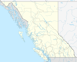
Coordinates: 54°N 125°W / 54°N 125°W