Southern Rhaetian Alps
| Southern Rhaetian Alps | |
|---|---|
| Italian: Alpi Retiche meridionali | |
 The Ortler, the highest mountain of the range | |
| Highest point | |
| Peak | Ortler |
| Elevation | 3,905 m (12,812 ft) |
| Coordinates | 46°30′32″N 10°32′42″E / 46.50889°N 10.54500°ECoordinates: 46°30′32″N 10°32′42″E / 46.50889°N 10.54500°E |
| Geography | |
 Southern Rhaetian Alps (section nr.28) within Eastern Alps | |
| Country | Italy |
| Region | Trentino-Alto Adige and Lombardy |
| Parent range | Alps |
| Borders on |
List
|
| Geology | |
| Orogeny | Alpine orogeny |
The Southern Rhaetian Alps (Südliche Rätische Alpen in German, Alpi Retiche meridionali in Italian) are a mountain range in the southern part of the Alps.
Geography
Administratively the range belongs to the Italian regions of Trentino-Alto Adige and Lombardy.
SOIUSA classification
According to SOIUSA (International Standardized Mountain Subdivision of the Alps) the mountain range is an Alpine section, classified in the following way:[1]
- main part = Eastern Alps
- major sector = Southern Limestone Alps
- section =Southern Rhaetian Alps
- code = II/C-28
Subdivision
The range is subdivided into four subsections:[1]
- Alpi dell'Ortles - SOIUSA code: II/C-28.I,
- Alpi della Val di Non - SOIUSA code: II/C-28.II,
- Alpi dell'Adamello e della Presanella - SOIUSA code: II/C-28.III;
- Dolomiti di Brenta - SOIUSA code: II/C-28.IV.
Notable summits

Cima Brenta Alta, Brenta group
Some notable summits of the Southern Rhaetian Alps are:
| Name | elevation (m) | subsection |
|---|---|---|
| Ortler | 3,902 | Alpi dell'Ortles |
| Königspitze | 3,851 | Alpi dell'Ortles |
| Monte Cevedale | 3,769 | Alpi dell'Ortles |
| Presanella | 3,558 | Alpi dell'Adamello e della Presanella |
| Mount Adamello | 3,539 | Alpi dell'Adamello e della Presanella |
| Monte Sobretta | 3,296 | Alpi dell'Ortles |
| Monte Gavia | 3,223 | Alpi dell'Ortles |
| Paganella | 2,125 | Dolomiti di Brenta |
Notable passes
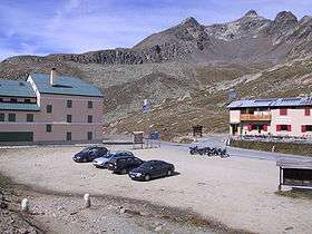
Gavia Pass
Some notable passes of the Southern Rhaetian Alps are:
References
Maps
- Italian official cartography (Istituto Geografico Militare - IGM); on-line version: www.pcn.minambiente.it
| Western Alps |
| ||||||||||
|---|---|---|---|---|---|---|---|---|---|---|---|
| Eastern Alps |
| ||||||||||
This article is issued from Wikipedia - version of the 12/26/2014. The text is available under the Creative Commons Attribution/Share Alike but additional terms may apply for the media files.