Sonora Junction, California
| Sonora Junction | |
|---|---|
| Unincorporated community | |
 Sonora Junction  Sonora Junction Location in California | |
| Coordinates: 38°20′55″N 119°27′07″W / 38.34861°N 119.45194°WCoordinates: 38°20′55″N 119°27′07″W / 38.34861°N 119.45194°W | |
| Country | United States |
| State | California |
| County | Mono County |
| Elevation[1] | 6,919 ft (2,109 m) |
Sonora Junction is an unincorporated community in Mono County, eastern California.[1]
Geography
It is located in the eastern Sierra Nevada at an elevation of 6919 feet (2109 m).[1] It is 3 miles (4.8 km) west of Fales Hot Springs,[2]
According to the Mono County's government website, the population of Sonora Junction and area as of 2000 was 217.[3]
History
The Junction House, a stage station, was built by A. Mack at Sonora Junction in the 1860s.[2] A road branched from the main road at the junction, heading up to Sonora Pass. They are the present day U.S. Highway 395, and State Route 108 to the pass[2]
References
- 1 2 3 U.S. Geological Survey Geographic Names Information System: Sonora Junction, California
- 1 2 3 Durham, David L. (1998). California's Geographic Names: A Gazetteer of Historic and Modern Names of the State. Clovis, Calif.: Word Dancer Press. p. 1203. ISBN 1-884995-14-4.
- ↑ Mono County populations
Municipalities and communities of Mono County, California, United States | ||
|---|---|---|
| Town | 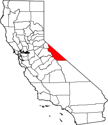 | |
| CDPs | ||
| Unincorporated communities | ||
| Indian reservations | ||
| Former settlements | ||
This article is issued from Wikipedia - version of the 7/5/2016. The text is available under the Creative Commons Attribution/Share Alike but additional terms may apply for the media files.