Benton Hot Springs, California
| Benton Hot Springs | |
|---|---|
| Unincorporated community | |
|
Benton Hot Springs | |
 Benton Hot Springs  Benton Hot Springs Location in California | |
| Coordinates: 37°48′01″N 118°31′44″W / 37.80028°N 118.52889°WCoordinates: 37°48′01″N 118°31′44″W / 37.80028°N 118.52889°W | |
| Country | United States |
| State | California |
| County | Mono County |
| Elevation[1] | 5,630 ft (1,716 m) |

Benton Hot Springs (also, Benton,[1] Old Benton,[1] and Hot Springs[2]) is an unincorporated community in Mono County, California.[1] It is located 3 miles (4.8 km) west-southwest of Benton and 31 miles (50 km) north-northwest of Bishop, at an elevation of 5630 feet (1716 m).[1]
The Benton post office opened at the place in 1886.[2] The name honors Senator Thomas Hart Benton, United States senator from Missouri.[2] The town saw its heyday from 1862 to 1889 as a supply center for nearby mines.[2] After the close of the 19th century, the town declined and the name Benton was transferred to Benton Station.[2]
Of the springs at the site, one was described in a 1915 book as issuing water at 135 °F (57 °C).[3]
Nearby
Other springs are located nearby: Paert's Hot Springs and Taylor Springs, a little more than 1 mile (1.6 km) northeast of Benton Hot Springs.[2]
References
- 1 2 3 4 5 U.S. Geological Survey Geographic Names Information System: Benton Hot Springs, California
- 1 2 3 4 5 6 Durham, David L. (1998). California's Geographic Names: A Gazetteer of Historic and Modern Names of the State. Clovis, Calif.: Word Dancer Press. p. 1146. ISBN 1-884995-14-4.
- ↑ Waring, Gerald A. (1915). Springs of California. Washington, D.C.: United States Geological Survey Water-Supply Paper 338, Government Printing Office. p. 136.
Municipalities and communities of Mono County, California, United States | ||
|---|---|---|
| Town | 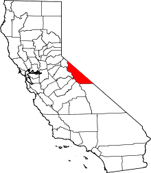 | |
| CDPs | ||
| Unincorporated communities | ||
| Indian reservations | ||
| Former settlements | ||