Somis, California
| Somis | |
|---|---|
| Unincorporated community | |
|
| |
 Somis Location within the state of California | |
| Coordinates: 34°15′26″N 118°59′43″W / 34.25722°N 118.99528°WCoordinates: 34°15′26″N 118°59′43″W / 34.25722°N 118.99528°W | |
| Country | United States |
| State | California |
| County | Ventura |
| Established | 1892 |
| Time zone | Pacific (PST) (UTC-8) |
| • Summer (DST) | PDT (UTC-7) |
| ZIP codes | 93066 |
| Area code(s) | 805 |
| GNIS feature IDs | 1661469;[5] 1670906[6] |

Somis is an unincorporated community of Ventura County, California that was established in 1892 by Thomas Bard and D.T. Perkins on a portion of the Mexican land grant, Rancho Las Posas.[7] Somis is in the Las Posas Valley[8](p194) on the south bank of Fox Barranca,[9] just west of Arroyo Las Posas.[10] The name of this townsite may have been derived from “water of the scrub oak,” a Chumash placename referring to the presence of water.[11] There was a Ranchería named Somes noted in records from 1795 and 1796.[12]
History
Like many of the farms on the adjacent Oxnard Plain, the crops of corn, wheat and barley grown here were shipped through the wharf that had been constructed in Hueneme in 1871.[7] Agricultural products were able to be shipped by rail when the line from Los Angeles to San Francisco was routed through the valley and a stop was established adjacent to the community. The current spelling of the name was established when the railroad came through.[12]
Geography
The school provides a sense of community for the town and the surrounding rural agricultural area that lies within the Somis Union School District boundary.[13] Several structures have been designated County of Ventura Landmarks.[14][15] The Camarillo station is the nearest stop for Amtrak and Metrolink trains and is served by Amtrak's Pacific Surfliner from San Luis Obispo to San Diego and Metrolink's Ventura County Line from Los Angeles Union Station to east Ventura.
.jpg)
Somis Road (State Route 34), as the main thoroughfare, is lined with a few shops, businesses and a county fire station[16] and intersects State Route 118 (Los Angeles Avenue) just north of town after crossing Fox Barranca. The railroad, which is parallel with Los Angeles Avenue between Somis and Moorpark, turns and becomes parallel with Somis Road at the south end of town where they located the railroad stop for shipping agricultural products. The tracks continue south to the Camarillo Station and the intersection with US 101. The original name of Somis Road has been changed though to Lewis Road a little over 1 mile (1.6 km) south of town at the northern boundary of the City of Camarillo which is also generally the southerly boundary of Rancho Las Posas.
Shown as Central Avenue on the original plat filed by Bard, Somis Road runs in a north-south direction through the middle of the townsite. The parallel roads on either side are named West Street and East Street. Three streets are oriented in an east-west direction.[17] The most northerly, named North Street, was extended northwesterly with plats filed in 1948 and 1953 that subdivided additional town lots.[18][19] No further subdivision of town lots has occurred after this post-World War II expansion of the townsite to 96 acres (39 ha).[8](p194)[20]
Climate
This region experiences warm (but not hot) and dry summers, with no average monthly temperatures above 71.6 °F (22.0 °C). According to the Köppen Climate Classification system, Somis has a warm-summer Mediterranean climate, abbreviated "Csb" on climate maps.[21]
Demographics
As of 2000, the total population was 2,946[22] It is primarily an agricultural area, but is home to a hardware store, a market with a Mexican cafe, a post office, an elementary school, several shops, a small animal hospital, one main residential tract and numerous estates and ranches. It has no formal local government, but it is serviced by the Ventura County Sheriff's Department and the Ventura County Fire Department.
The Somis ZIP Code, 93066, includes a large area of surrounding agricultural lands bounded on the south by the edge of housing tracts in Camarillo and on the north by the ridge line of South Mountain,[23] 6 miles (9.7 km) north of Los Angeles Ave. The Zip code encompasses an area some 11 miles (18 km) in width in the east-west direction. Forbes Magazine ranked Somis the 108th most-expensive ZIP code in the United States in 2015. [24]
References
- ↑ Omestad, Thomas (August 31, 1986) "A Store of History in Somis : Hardware Stock Includes Common Nails, Common Sense" Los Angeles Times
- ↑ Sampson, Talia (August 25, 2008) "Hardware store stays in the family: Landmark in Somis has passed from father to son" Ventura County Star
- ↑ Omestad, Thomas (August 31, 1986) "A Store of History in Somis : Hardware Stock Includes Common Nails, Common Sense" Los Angeles Times
- ↑ Sampson, Talia (August 25, 2008) "Hardware store stays in the family: Landmark in Somis has passed from father to son" Ventura County Star
- ↑ "Somis". Geographic Names Information System. United States Geological Survey.
- ↑ "Somis (historical)". Geographic Names Information System. United States Geological Survey.
- 1 2 McCLELLAN, DOUG (October 11, 1992). "Centennial of Somis Is Small Affair : Communities: A walking tour and back-yard party mark today's celebration. The 400 residents call their town an oasis.". Los Angeles Times. Retrieved October 22, 2013.
- 1 2 "SUBSEQUENT ENVIRONMENTAL IMPACT REPORT FOR FOCUSED GENERAL PLAN UPDATE and Related Amendments to the Non-Coastal Zoning Ordinance and Zone Change ZN05-0008" County of Ventura (June 22, 2005)
- ↑ "Fox Barranca". Geographic Names Information System. United States Geological Survey.
- ↑ "Arroyo Las Posas". Geographic Names Information System. United States Geological Survey.
- ↑ Applegate, Richard B. (1974). "Chumash Placenames" Journal of California Anthropology. The, 1(2). Retrieved October 22, 2013.
- 1 2 Gudde, Erwin G. (1969). California place names : the origin and etymology of current geographical names (3rd ed., rev. and enl. ed.). Berkeley: University of California Press. p. 316.
- ↑ "Somis Elementary School". Geographic Names Information System. United States Geological Survey.
- ↑ Cultural Heritage Board. "Ventura County Landmark Map" County of Ventura Planning Division Accessed 2 November 2013
- ↑ Payne, Paul (July 16, 1991) "3 Somis Site to Be Labeled Landmarks" Los Angeles Times
- ↑ "Ventura County Fire Protection District Station 57 Somis". Geographic Names Information System. United States Geological Survey.
- ↑ "Map of the Town of Somis in Rancho Los Posas." 3 MR 33. Ventura County Recorder Retrieved October 22, 2013 from CountyView GIS
- ↑ "BARD-HOLBERT SUBDIVISION NO. 1." 15 MR 67. Ventura County Recorder Retrieved November 2, 2013 from CountyView GIS.
- ↑ "BARD-HOLBERT SUBDIVISION NO. 2." 21 MR 74. Ventura County Recorder Retrieved November 2, 2013 from CountyView GIS.
- ↑ McDonald, Jeff (April 29, 1996). "Quiet Somis Seeking Bigger Voice in County Decisions". Los Angeles Times. Retrieved 21 February 2016.
- ↑ Climate Summary for Somis, California
- ↑ "CA zipcode 93066". DownloadZipcode.com. Archived from the original on February 10, 2005.
- ↑ "South Mountain". Geographic Names Information System. United States Geological Survey.
- ↑ (http://www.forbes.com/sites/betsyschiffman/2015/11/10/full-list-most-expensive-zip-codes-in-2015/6/)
Municipalities and communities of Ventura County, California, United States | ||
|---|---|---|
| Cities | 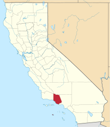 | |
| CDPs | ||
| Unincorporated communities | ||
| Footnotes | ‡This populated place also has portions in an adjacent county or counties | |