Snead, Alabama
| Snead, Alabama | |
|---|---|
| Town | |
 Location in Blount County and the state of Alabama | |
| Coordinates: 34°6′57″N 86°23′29″W / 34.11583°N 86.39139°W | |
| Country | United States |
| State | Alabama |
| County | Blount |
| Area | |
| • Total | 5.3 sq mi (13.7 km2) |
| • Land | 5.3 sq mi (13.6 km2) |
| • Water | 0.02 sq mi (0.05 km2) |
| Elevation | 791 ft (241 m) |
| Population (2010) | |
| • Total | 835 |
| • Density | 154.6/sq mi (61.3/km2) |
| Time zone | Central (CST) (UTC-6) |
| • Summer (DST) | CDT (UTC-5) |
| FIPS code | 01-71280 |
| GNIS feature ID | 0127070 |
Snead is a town in Blount County, Alabama, United States. At the 2010 census the population was 835.[1]
Geography
Snead is located in northeastern Blount County at 34°6'57.492" North, 86°23'29.443" West (34.115970, -86.391512).[2] The town is centered on the crossroads of U.S. Route 278 and Alabama State Route 75. US-278 leads east 26 miles (42 km) to Gadsden and west 27 miles (43 km) to Cullman. Highway 75 leads northeast 15 miles (24 km) to Albertville and 14 miles (23 km) southwest to Oneonta, the Blount County seat.
The town is bordered to the northeast by the Locust Fork of the Black Warrior River.
According to the U.S. Census Bureau, the town has a total area of 5.3 square miles (13.7 km2), of which 5.3 square miles (13.6 km2) is land and 0.019 square miles (0.05 km2), or 0.36%, is water.[1]
Demographics
| Historical population | |||
|---|---|---|---|
| Census | Pop. | %± | |
| 1970 | 347 | — | |
| 1980 | 667 | 92.2% | |
| 1990 | 632 | −5.2% | |
| 2000 | 748 | 18.4% | |
| 2010 | 835 | 11.6% | |
| Est. 2015 | 843 | [3] | 1.0% |
| U.S. Decennial Census[4] 2013 Estimate[5] | |||
As of the census[6] of 2010, there were 835 people, 374 households, and 233 families residing in the town. The population density was 154.6 people per square mile (58.8/km²). There were 415 housing units at an average density of 76.85 per square mile (29.2/km²). The racial makeup of the town was 96.8% White, 0.1% Asian, 0.1% African American (U.S. Census), 0.5% Native American (U.S. Census), 0.8% from some other race, and 1.7% from two or more races. 1.8% of the population were Hispanic or Latino of any race.
There were 374 households out of which 25.1% had children under the age of 18 living with them, 51.9% were married couples living together, 8.0% had a female householder with no husband present, and 37.7% were non-families. 35.8% of all households were made up of individuals and 19.8% had someone living alone who was 65 years of age or older. The average household size was 2.23 and the average family size was 2.9.
In the town the age distribution of the population shows 22.6% under the age of 18, 5.9% from 18 to 24, 23.0% from 25 to 44, 25.9% from 45 to 64, and 22.6% who were 65 years of age or older. The median age was 43.8 years. For every 100 females there were 85.1 males. For every 100 females age 18 and over, there were 82.4 males.
The median income for a household in the town was $36,029, and the median income for a family was $41,563. Males had a median income of $23,558 versus $13,799 for females. The per capita income for the town was $15,891. About 9.8% of families and 15.0% of the population were below the poverty line, including 15.8% of those under age 18 and 20.2% of those age 65 or over.
References
- 1 2 "Geographic Identifiers: 2010 Demographic Profile Data (G001): Snead town, Alabama". U.S. Census Bureau, American Factfinder. Retrieved September 18, 2013.
- ↑ "US Gazetteer files: 2010, 2000, and 1990". United States Census Bureau. 2011-02-12. Retrieved 2011-04-23.
- ↑ "Annual Estimates of the Resident Population for Incorporated Places: April 1, 2010 to July 1, 2015". Retrieved July 2, 2016.
- ↑ "U.S. Decennial Census". Census.gov. Retrieved June 6, 2013.
- ↑ "Annual Estimates of the Resident Population: April 1, 2010 to July 1, 2013". Retrieved June 3, 2014.
- ↑ "American FactFinder". United States Census Bureau. Retrieved 2008-01-31.
Coordinates: 34°06′57″N 86°23′29″W / 34.11597°N 86.391512°W
Municipalities and communities of Blount County, Alabama, United States | ||
|---|---|---|
| Cities | 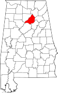 | |
| Towns | ||
| CDP | ||
| Unincorporated communities | ||
| Footnotes | ‡This populated place also has portions in an adjacent county or counties | |