Allgood, Alabama
| Allgood, Alabama | |
|---|---|
| Town | |
 Location in Blount County and the state of Alabama | |
| Coordinates: 33°54′15″N 86°30′59″W / 33.90417°N 86.51639°W | |
| Country | United States |
| State | Alabama |
| County | Blount |
| Area | |
| • Total | 1.0 sq mi (2.7 km2) |
| • Land | 1.0 sq mi (2.7 km2) |
| • Water | 0 sq mi (0 km2) |
| Elevation | 787 ft (240 m) |
| Population (2010) | |
| • Total | 622 |
| • Density | 599/sq mi (231.2/km2) |
| Time zone | Central (CST) (UTC-6) |
| • Summer (DST) | CDT (UTC-5) |
| ZIP code | 35013 |
| Area code(s) | 205 |
| FIPS code | 01-01396 |
| GNIS feature ID | 0113021 |
Allgood, formerly known as Chepultepec, is a town in Blount County, Alabama, United States. At the 2010 census the population was 622.[1]
Geography
Allgood is located in south-central Blount County at 33°54′15″N 86°30′59″W / 33.90417°N 86.51639°W (33.904216, -86.516428).[2] It is in the Murphree Valley, with Straight Mountain to the southeast and Red Mountain and Sand Mountain to the northwest. Alabama State Route 75 passes through the town, leading northeast 3 miles (5 km) to Oneonta, the county seat, and southwest 38 miles (61 km) to Birmingham.
According to the U.S. Census Bureau, the town has a total area of 1.0 square mile (2.6 km2), all land.
Demographics
| Historical population | |||
|---|---|---|---|
| Census | Pop. | %± | |
| 1960 | 147 | — | |
| 1970 | 272 | 85.0% | |
| 1980 | 387 | 42.3% | |
| 1990 | 464 | 19.9% | |
| 2000 | 629 | 35.6% | |
| 2010 | 622 | −1.1% | |
| Est. 2015 | 628 | [3] | 1.0% |
| U.S. Decennial Census[4] 2013 Estimate[5] | |||
2000 Census data
As of the census[6] of 2000, there were 629 people, 189 households, and 140 families residing in the town. The population density was 606.6 people per square mile (233.5/km²). There were 198 housing units at an average density of 190.9 per square mile (73.5/km²). The racial makeup of the town was 83.94% White, 0.32% Black or African American, 0.48% Native American, 12.08% from other races, and 3.18% from two or more races. 43.40% of the population were Hispanic or Latino of any race.
There were 189 households out of which 40.7% had children under the age of 18 living with them, 62.4% were married couples living together, 8.5% had a female householder with no husband present, and 25.9% were non-families. 18.5% of all households were made up of individuals and 7.4% had someone living alone who was 65 years of age or older. The average household size was 3.33 and the average family size was 3.80.
In the town the population dispersal was 30.7% under the age of 18, 14.8% from 18 to 24, 34.3% from 25 to 44, 15.4% from 45 to 64, and 4.8% who were 65 years of age or older. The median age was 28 years. For every 100 females there were 109.0 males. For every 100 females age 18 and over, there were 116.9 males. The median income for a household in the town was $29,583, and the median income for a family was $30,750. Males had a median income of $31,058 versus $25,486 for females. The per capita income for the town was $11,729. About 23.4% of families and 27.3% of the population were below the poverty line, including 33.9% of those under age 18 and 8.7% of those age 65 or over.
Water system controversy
The town received international press coverage when it posted a notice that residents who failed to "HAVE AN ALABAMA DRIVER'S LICENSE OR ALABAMA PICTURE ID CARD ON FILE AT THIS OFFICE" may lose water service. The notice is reported to be a reaction to an anti-illegal immigration bill, Alabama HB 56.[7]
Notable people
- Miles C. Allgood, U.S. Representative from Alabama's 5th congressional district from 1923 to 1935
- Albert A. Murphree, president of Florida State University from 1897 to 1909 and president of the University of Florida from 1909 to 1927
References
- ↑ "Geographic Identifiers: 2010 Demographic Profile Data (G001): Allgood town, Alabama". U.S. Census Bureau, American Factfinder. Retrieved September 17, 2013.
- ↑ "US Gazetteer files: 2010, 2000, and 1990". United States Census Bureau. 2011-02-12. Retrieved 2011-04-23.
- ↑ "Annual Estimates of the Resident Population for Incorporated Places: April 1, 2010 to July 1, 2015". Retrieved July 2, 2016.
- ↑ "U.S. Decennial Census". Census.gov. Archived from the original on May 11, 2015. Retrieved June 6, 2013.
- ↑ "Annual Estimates of the Resident Population: April 1, 2010 to July 1, 2013". Retrieved June 3, 2014.
- ↑ "American FactFinder". United States Census Bureau. Archived from the original on 2013-09-11. Retrieved 2008-01-31.
- ↑ Pilkington, Ed (October 7, 2011), "Alabama immigration threat: prove your legal status or lose water supply", Guardian, London, retrieved 11 October 2011
Coordinates: 33°54′15″N 86°30′59″W / 33.904216°N 86.516428°W
Municipalities and communities of Blount County, Alabama, United States | ||
|---|---|---|
| Cities | 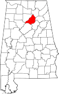 | |
| Towns | ||
| CDP | ||
| Unincorporated communities | ||
| Footnotes | ‡This populated place also has portions in an adjacent county or counties | |