Slade Green railway station
| Slade Green | |
|---|---|
_-_geograph.org.uk_-_717708.jpg) | |
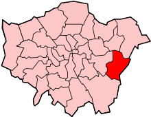
 Slade Green Location of Slade Green in Greater London | |
| Location | Slade Green |
| Local authority | London Borough of Bexley |
| Managed by | Southeastern |
| Station code | SGR |
| DfT category | E |
| Number of platforms | 2 |
| Accessible | Yes [1] |
| Fare zone | 6 |
| National Rail annual entry and exit | |
| 2009–10 |
|
| 2010–11 |
|
| 2011–12 |
|
| 2012–13 |
|
| 2013–14 |
|
| Key dates | |
| 1 July 1900 | Opened as Slades Green |
| 21 September 1953[3] | Renamed Slade Green |
| Other information | |
| Lists of stations | |
| External links | |
| WGS84 | 51°28′04″N 0°11′25″E / 51.4678°N 0.1904°ECoordinates: 51°28′04″N 0°11′25″E / 51.4678°N 0.1904°E |
|
| |
Slade Green railway station is in the London Borough of Bexley, southeast London, on the North Kent Line. The station was built in 1900 to serve the developing community. As of 2012 the station and all trains serving it is operated by Southeastern.
Services
The typical off-peak service from the station is:
Westbound;
- 6tph (trains per hour) to London Cannon Street via Greenwich
Eastbound;
- 2tph to London Cannon Street via Sidcup
- 2tph to London Cannon Street via Bexleyheath
- 2tph to Dartford
Evening and Sunday services generally terminate at London Charing Cross instead of London Cannon Street.
| Preceding station | |
Following station | ||
|---|---|---|---|---|
| Erith | Southeastern Greenwich Line |
Dartford or Terminus | ||
| Southeastern Dartford Loop Line |
Crayford | |||
| Southeastern Bexleyheath Lines |
Barnehurst | |||
Connections
London Buses routes 89, 99 and 428 serve the station.
External links
- Train times and station information for Slade Green railway station from National Rail
| Wikimedia Commons has media related to Slade Green railway station. |
Future Development
Studies by Crossrail Ltd. identified Gravesend as the preferred termination point. However, the same studies found Slade Green station to be the outermost station with sufficient capacity to support Crossrail. Rail Freight studies seeking to extend traffic in the opposite direction, with a planned multi modal distribution centre between Slade Green and Dartford, meant that extending Crossrail beyond Slade Green would require additional tracks and possibly a viaduct. From 2009, the commuter route through Slade Green has been safeguarded for future Crossrail extensions.[4]
References
- ↑ "London and South East" (PDF). National Rail Enquiries. National Rail. September 2006. Archived from the original (pdf) on 6 March 2009.
- 1 2 3 4 5 "Station usage estimates". Rail statistics. Office of Rail Regulation. Please note: Some methodology may vary year on year.
- ↑ Chronology of London Railways by H.V.Borley
- ↑ "Update on Crossrail and the impact on Abbey Wood". Bexley Council. Environment and Regeneration Overview and Scrutiny Committee, February 2011. Retrieved 10 September 2016.
| Companies and organisations | |||||||||||
|---|---|---|---|---|---|---|---|---|---|---|---|
| Airports |
| ||||||||||
| Major stations | |||||||||||
| Roads |
| ||||||||||
| Ticketing | |||||||||||
| Other | |||||||||||
| Former BR sectors | |||||||||||
| |||||||||||
| Districts |
|  |
|---|---|---|
| Attractions |
| |
| Parks and open spaces |
| |
| Constituencies | ||
| Rail stations | ||
| Other topics | ||