Old Bexley and Sidcup (UK Parliament constituency)
| Old Bexley and Sidcup | |
|---|---|
|
Borough constituency for the House of Commons | |
|
Boundary of Old Bexley and Sidcup in Greater London. | |
| County | Greater London |
| Electorate | 65,161 (December 2010)[1] |
| Current constituency | |
| Created | 1983 |
| Member of parliament | James Brokenshire (Conservative) |
| Number of members | One |
| Created from | Bexleyheath and Sidcup |
| Overlaps | |
| European Parliament constituency | London |


Old Bexley and Sidcup is a constituency[n 1] represented in the House of Commons of the UK Parliament since 2010 by James Brokenshire, a Conservative.[n 2]
History
Sir Edward Heath, (prime minister of the United Kingdom 1970-1974), held this seat and its predecessors from 1950 until 2001 when he retired; at the age of 85 he was by then the nation's oldest member of parliament.
The two general elections from 2001 were won by Derek Conway, elected as a Conservative Party candidate. However, on 29 January 2008 the Conservative Party withdrew the whip from Derek Conway following alleged misuse of funds, and he became an Independent MP. He retired in 2010 and the seat was won by the Conservative James Brokenshire, who had transferred to this seat and approved by his local party when his former seat of Hornchurch was abolished in boundary changes.
Since its creation with the exception of the 1997 New Labour Landslide the constituency large majorities suggest a Conservative safe seat.
Boundaries
1983-1997: The London Borough of Bexley wards of Blackfen, Blendon and Penhill, Cray, Lamorbey, St Mary's, Sidcup East, and Sidcup West.
1997-2010: The London Borough of Bexley wards of Blackfen, Blendon and Penhill, Cray, Danson, East Wickham, Falconwood, Lamorbey, St Mary's, Sidcup East, and Sidcup West.
2010-present: The London Borough of Bexley wards of Blackfen and Lamorbey, Blendon and Penhill, Cray Meadows, East Wickham, Falconwood and Welling, Longlands, St Mary’s, and Sidcup.
As its name suggest, the seat covers the Bexley and Sidcup areas; it formerly included Danson Park which owing to more development in the south was moved to the Bexleyheath and Crayford constituency.
Constituency profile
Old Bexley and Sidcup has average incomes above the national average,[2] a high proportion of semi-detached and detached homes[3] and low unemployment[4] with a lower than average dependency on social housing.[2]
South London had major factory, ship repairs and dock labour in areas such as Deptford, Brixton, Greenwich, New Cross, Woolwich, Lewisham and Croydon which contributed to family labour union ties forming in the early 20th century to the Labour Party but here this is weak as a result of very late urbanization, triggered by garden-character[5] Commuter Belt status starting with construction of the Dartford Loop or "Sidcup" Line opened in 1866, before which there was significant heath and woodland.[6]
In 1848 Bexley (the largest parish) had 3955 inhabitants.[7] In 1797 the central parish of Bexley was described as including or being next to parts of the several seats of Lamienby, Blendon, and Danson, and the several small hamlets of Hurst, Halfway-street, Bridgen, Blendon, Upton, and Welling, or indeed, more properly, Wellend, (which name was given to it from the safe arrival of the traveller at it, after having escaped the danger of robbers through the hazardous road of Shooter's Hill).[6]
Members of Parliament
| Election | Member[8] | Party | |
|---|---|---|---|
| 1983 | Sir Edward Heath | Conservative | |
| 2001 | Derek Conway | ||
| 2008 | Independent | ||
| 2010 | James Brokenshire | Conservative | |
Election results
Elections in 2010s
| Party | Candidate | Votes | % | ± | |
|---|---|---|---|---|---|
| Conservative | James Brokenshire | 24,682 | 52.8 | −1.3 | |
| Labour | Ibby Mehmet | 8,879 | 19.0 | −0.3 | |
| UKIP | Catherine Reilly | 8,528 | 18.2 | +14.9 | |
| Liberal Democrat | Jennifer Keen | 1,644 | 3.5 | −11.9 | |
| Green | Derek Moran | 1,336 | 2.9 | +2.0 | |
| National Health Action | Bob Gill | 1,216 | 2.6 | N/A | |
| Christian | Laurence Williams | 245 | 0.5 | N/A | |
| BNP | Nicola Finch | 218 | 0.5 | −4.2 | |
| Majority | 15,803 | 33.8 | −1.1 | ||
| Turnout | 46,748 | 70.8 | +1.5 | ||
| Conservative hold | Swing | −0.5 | |||
| Party | Candidate | Votes | % | ± | |
|---|---|---|---|---|---|
| Conservative | James Brokenshire | 24,625 | 54.1 | +4.1 | |
| Labour | Rick Everitt | 8,768 | 19.3 | −8.7 | |
| Liberal Democrat | Duncan Borrowman | 6,996 | 15.4 | +1.5 | |
| BNP | John Brooks | 2,132 | 4.7 | +1.8 | |
| UKIP | David Coburn MEP | 1,532 | 3.4 | −1.2 | |
| English Democrat | Elaine Cheeseman | 520 | 1.1 | N/A | |
| Independents to save Queen Mary’s Hospital | John Hemming-Clark | 393 | 0.9 | N/A | |
| Green | Jonathan Rooks | 371 | 0.8 | N/A | |
| Monster Raving Loony | Napoleon Dynamite | 155 | 0.3 | N/A | |
| Majority | 15,857 | 34.9 | +12.6 | ||
| Turnout | 45,492 | 69.3 | +4.0 | ||
| Conservative hold | Swing | 6.3 | |||
Elections in 2000s
| Party | Candidate | Votes | % | ± | |
|---|---|---|---|---|---|
| Conservative | Derek Conway | 22,191 | 49.8 | +4.4 | |
| Labour | Gavin Moore | 12,271 | 27.5 | −10.0 | |
| Liberal Democrat | Nick O'Hare | 6,564 | 14.7 | +1.0 | |
| UKIP | Michael Barnbrook | 2,015 | 4.5 | +1.1 | |
| BNP | Claire Sayers | 1,227 | 2.8 | N/A | |
| Independent | Gregory Peters | 304 | 0.7 | N/A | |
| Majority | 9,920 | 22.3 | +14.4 | ||
| Turnout | 44,572 | 65.3 | +3.2 | ||
| Conservative hold | Swing | +7.2 | |||
| Party | Candidate | Votes | % | ± | |
|---|---|---|---|---|---|
| Conservative | Derek Conway | 19,130 | 45.4 | +3.4 | |
| Labour | James Rowan Chatterton Dickson | 15,785 | 37.5 | +2.4 | |
| Liberal Democrat | Belinda Ford | 5,792 | 13.7 | −2.4 | |
| UKIP | Janice Cronin | 1,426 | 3.4 | −1.4 | |
| Majority | 3,345 | 7.9 | +1.0 | ||
| Turnout | 42,133 | 62.1 | −13.4 | ||
| Conservative hold | Swing | +0.5 | |||
Elections in 1990s
| Party | Candidate | Votes | % | ± | |
|---|---|---|---|---|---|
| Conservative | Edward Heath | 21,608 | 42.1 | −18.3 | |
| Labour | Richard Justham | 18,039 | 35.1 | +13.5 | |
| Liberal Democrat | Iain King | 8,284 | 16.1 | +0.2 | |
| Referendum | Brian Reading | 2,457 | 4.8 | N/A | |
| UKIP | C. Bullen | 489 | 1.0 | N/A | |
| BNP | Valerie Tyndall | 415 | 0.8 | N/A | |
| Natural Law | Robert Stephens | 99 | 0.2 | −0.2 | |
| Majority | 3,569 | 7.0 | −31.8 | ||
| Turnout | 51,391 | 75.5 | −6.5 | ||
| Conservative hold | Swing | −15.9 | |||
| Party | Candidate | Votes | % | ± | |
|---|---|---|---|---|---|
| Conservative | Edward Heath | 24,450 | 60.3 | −1.8 | |
| Labour | Ms Donna Brierly | 8,751 | 21.6 | +4.3 | |
| Liberal Democrat | David J. Nicolle | 6,438 | 15.9 | −4.7 | |
| Independent | Barry Rose | 733 | 1.8 | N/A | |
| Natural Law | Robert Stephens | 148 | 0.4 | N/A | |
| Majority | 15,699 | 38.7 | −2.8 | ||
| Turnout | 40,520 | 81.9 | +4.9 | ||
| Conservative hold | Swing | −1.4 | |||
Elections in 1980s
| Party | Candidate | Votes | % | ± | |
|---|---|---|---|---|---|
| Conservative | Edward Heath | 24,350 | 62.1 | +1.9 | |
| Liberal | Thomas Henry Pearce | 8,076 | 20.6 | −5.4 | |
| Labour | Howard Geoffrey Alvan Stoate | 6,762 | 17.3 | +3.5 | |
| Majority | 16,274 | 41.5 | +7.4 | ||
| Turnout | 39,188 | 77.1 | +2.9 | ||
| Conservative hold | Swing | +3.7 | |||
| Party | Candidate | Votes | % | ± | |
|---|---|---|---|---|---|
| Conservative | Edward Heath | 22,442 | 60.2 | N/A | |
| Liberal | P. Vickers | 9,704 | 26.0 | N/A | |
| Labour | Chris Kiff | 5,116 | 13.7 | N/A | |
| Majority | 12,738 | 34.2 | N/A | ||
| Turnout | 37,262 | 74.2 | N/A | ||
| Conservative win (new seat) | |||||
See also
Notes and references
- Notes
- ↑ A borough constituency (for the purposes of election expenses and type of returning officer)
- ↑ As with all constituencies, the constituency elects one Member of Parliament (MP) by the first past the post system of election at least every five years.
- References
- ↑ "Electorate Figures - Boundary Commission for England". 2011 Electorate Figures. Boundary Commission for England. 4 March 2011. Retrieved 13 March 2011.
- 1 2 2001 Census
- ↑ 2011 census interactive maps
- ↑ Unemployment claimants by constituency The Guardian
- ↑ Open Street Map
- 1 2 Edward Hasted (1797). "Parishes: Bexley". The History and Topographical Survey of the County of Kent: Volume 2. Institute of Historical Research. Retrieved 22 January 2013.
- ↑ Samuel Lewis (publisher) (1848). "Beverstone - Bickleigh". A Topographical Dictionary of England. Institute of Historical Research. Retrieved 22 January 2013.
- ↑ Leigh Rayment's Historical List of MPs – Constituencies beginning with "O"
- ↑ "Election Data 2015". Electoral Calculus. Archived from the original on 17 October 2015. Retrieved 17 October 2015.
- ↑ http://democracy.bexley.gov.uk/mgElectionAreaResults.aspx?XXR=0&ID=94&RPID=9646321
- ↑ http://www.bbc.co.uk/news/politics/constituencies/E14000869
- ↑ "Election Data 2010". Electoral Calculus. Archived from the original on 17 October 2015. Retrieved 17 October 2015.
- ↑ "Election Data 2005". Electoral Calculus. Archived from the original on 15 October 2011. Retrieved 18 October 2015.
- ↑ "Election Data 2001". Electoral Calculus. Archived from the original on 15 October 2011. Retrieved 18 October 2015.
- ↑ "Election Data 1997". Electoral Calculus. Archived from the original on 15 October 2011. Retrieved 18 October 2015.
- ↑ http://www.webarchive.org.uk/wayback/archive/20150908004337/http://www.politicsresources.net/area/uk/constit/010.htm
- ↑ "Election Data 1992". Electoral Calculus. Archived from the original on 15 October 2011. Retrieved 18 October 2015.
- ↑ "Election Data 1987". Electoral Calculus. Archived from the original on 15 October 2011. Retrieved 18 October 2015.
- ↑ "Election Data 1983". Electoral Calculus. Archived from the original on 15 October 2011. Retrieved 18 October 2015.
| Parliament of the United Kingdom | ||
|---|---|---|
| Preceded by Castle Point |
Constituency represented by the Father of the House 1992–2001 |
Succeeded by Linlithgow |
9 July 1916 - 17 July 2005 | ||
| Premiership | 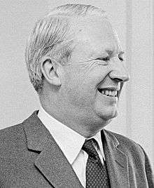 | |
| General elections | ||
| Party elections | ||
| Constituencies | ||
| Related articles | ||
Coordinates: 51°26′20″N 0°07′12″E / 51.439°N 0.120°E