Northumberland Heath
| Northumberland Heath | |
 Northumberland Heath |
|
| Population | 10,598 (2011 Census. Ward)[1] |
|---|---|
| OS grid reference | TQ505771 |
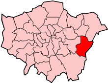
| London borough | Bexley |
| Ceremonial county | Greater London |
| Region | London |
| Country | England |
| Sovereign state | United Kingdom |
| Post town | ERITH |
| Postcode district | DA8 |
| Dialling code | 01322 |
| Police | Metropolitan |
| Fire | London |
| Ambulance | London |
| EU Parliament | London |
| UK Parliament | Bexleyheath and Crayford |
| Erith and Thamesmead | |
| London Assembly | Bexley and Bromley |
Coordinates: 51°28′22″N 0°10′04″E / 51.4727°N 0.1679°E

Northumberland Heath is a neighbourhood and electoral ward within the London Borough of Bexley, south east London, England. Northumberland Heath is often referred to locally as "North' Heath" and is often considered to be part of upper Erith.
History
The area was once known as Spike Island after the workhouse that was situated there.[2] The area is mainly residential although there is a large industrial bakery in Belmont Road. Much of the housing stock is Victorian with some 1940's council developments and a Cottage estate built for local Vickers armaments workers in 1916. Nearest Railway stations are Erith and Barnehurst. There is a large Catholic church in Bexley Road (Our Lady of the Angels) with a friary attached, and a Church of England (St Paul's) in Mill Road. A conservation area on Brook Street safeguards some terraces that represent early examples of municipal housing.
Politics
Most of Northumberland Heath is within Northumberland Heath ward (local Councillors are Philip Read, Peter Reader and Alex Sawyer - all Conservative), whilst other parts are within Colyers ward.
Education
- For education in Northumberland Heath see the main London Borough of Bexley article
Transport and locale
Nearest places
Places of worship
Northumberland Heath Baptist Church
Rail
The nearest stations are at Slade Green and Erith on the Woolwich line and Barnehurst on the Bexleyheath line. Trains run between London Charing Cross, or London Cannon Street and Dartford railway station. On the Bexleyheath line there is also a 6-day train service to London Victoria.
Buses
The 89 bus contracted by TfL runs between Lewisham Station and Slade Green Station; The 89 has a frequency of 10 minutes Monday to Saturday daytime and, in the evenings and on Sundays, a frequency of 20 minutes. In the early mornings a night bus service operates called the N89 which runs between Trafalgar Square and Erith; The N89 operates to a frequency of every 30 minutes.
The 229 bus contracted by TfL runs between Queen Mary's hospital Sidcup and Thamesmead Town Centre; The 229 has a frequency of 10 minutes Monday to Saturday daytime, and in the evenings and on Sundays a frequency of 15 minutes.
The smaller B12 bus contracted by TfL runs between Erith and Joydens Wood via Bexleyheath Station and the shopping centres of Bexleyheath and Bexley village. The B12 has a daytime frequency of 20 minutes Monday to Saturday daytime, and in the evenings a frequency of 30 minutes. This bus started running on Sundays since 29 April 2013. The first bus from Joydens Wood will depart at 6.50am and the last bus at 11.50pm. Meanwhile, the first departure from Bexley Road in Erith will be at 7.12am and the last bus at 12.10am the following Monday morning. The bus has a frequency of 30 minutes all day through until Monday morning.
References
- ↑ "Bexley Ward population 2011". Neighbourhood Statistics. Office for National Statistics. Retrieved 14 October 2016.
- ↑ Bexley Local Studies Note 64 'Origins of Street & Place Names in Bexley' accessed 27 Jun 2007
External links
- Bexley Local Studies Note 17 'Northumberland Heath' - a brief history
- Two maps of the area c.1800
- Erith & Crayford District Scouts
| Districts |
|  |
|---|---|---|
| Attractions |
| |
| Parks and open spaces |
| |
| Constituencies | ||
| Rail stations | ||
| Other topics | ||