Shepton Beauchamp
| Shepton Beauchamp | |
 Village School |
|
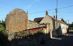 Fives court wall |
|
 Shepton Beauchamp |
|
| Population | 728 (2011)[1] |
|---|---|
| OS grid reference | ST403173 |
| District | South Somerset |
| Shire county | Somerset |
| Region | South West |
| Country | England |
| Sovereign state | United Kingdom |
| Post town | ILMINSTER |
| Postcode district | TA19 0 |
| Dialling code | 01460 |
| Police | Avon and Somerset |
| Fire | Devon and Somerset |
| Ambulance | South Western |
| EU Parliament | South West England |
| UK Parliament | Yeovil |
Coordinates: 50°57′09″N 2°51′01″W / 50.9525°N 2.8504°W
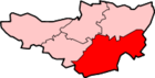
Shepton Beauchamp is a village and civil parish, 1 mile (2 km) from Barrington and 4 miles (6 km) north east of Ilminster between the Blackdown Hills and the Somerset Levels in the South Somerset district of Somerset, England.
History
The first part of the name of the village has Saxon origins meaning sheep settlement. The second part was added to honour the Beauchamp family (pronounced ‘Beecham’), who held the manor from the mid 12th century.[2] The parish of Shepton Beauchamp was part of the South Petherton Hundred.[3]
It passed to the Seymours in 1361, and Sir John Seymour lived here when High Sheriff of Somerset 1515–16, possibly with his young daughter Jane Seymour, later third Queen of Henry VIII.[2]
In 1755 about half the land was in unenclosed strips, but enclosure by private agreement began in 1807 and was largely complete by 1850.[4]
In 1791 the parish was described as having 85 houses and "lying in a rich, flat and inclosed country". The first census in 1801 recorded the population as 439, and the area of the parish was 836 acres (3.38 km2).[5]
Governance
The parish council has responsibility for local issues, including setting an annual precept (local rate) to cover the council’s operating costs and producing annual accounts for public scrutiny. The parish council evaluates local planning applications and works with the local police, district council officers, and neighbourhood watch groups on matters of crime, security, and traffic. The parish council's role also includes initiating projects for the maintenance and repair of parish facilities, as well as consulting with the district council on the maintenance, repair, and improvement of highways, drainage, footpaths, public transport, and street cleaning. Conservation matters (including trees and listed buildings) and environmental issues are also the responsibility of the council.
The village falls within the Non-metropolitan district of South Somerset, which was formed on 1 April 1974 under the Local Government Act 1972, having previously been part of Chard Rural District.[6] The district council is responsible for local planning and building control, local roads, council housing, environmental health, markets and fairs, refuse collection and recycling, cemeteries and crematoria, leisure services, parks, and tourism.
Somerset County Council is responsible for running the largest and most expensive local services such as education, social services, libraries, main roads, public transport, policing and fire services, trading standards, waste disposal and strategic planning.
It is also part of the Yeovil county constituency represented in the House of Commons of the Parliament of the United Kingdom. It elects one Member of Parliament (MP) by the first past the post system of election, and part of the South West England constituency of the European Parliament which elects seven MEPs using the d'Hondt method of party-list proportional representation.
Church
The Church of St Michael, is built of local hamstone, and has 13th-century origins, although it has been extensively changed since then, with major renovation in 1865 by George Edmund Street. It has a tall three-stage tower with set-back buttresses ascending to the shafts of former pinnacles, set off with an embattled parapet and gargoyles. There are two-light traceried bell-chamber windows with stone grilles, continuing as blank openings on the ringing chamber below. There are clocks with Roman numerals to the west and south faces and a higher polygonal stair-turret to the north corner. It has been designated by English Heritage as a Grade I listed building.[7]
The former rectory, now called Beauchamp Manor, was built in 1874 for the rector V.S.S. Coles to house his curates and visitors.[8][9]
School
The village school caters for children aged 4 to 11 years.[10] It was built in 1856.[11]
References
- ↑ "Statistics for Wards, LSOAs and Parishes — SUMMARY Profiles" (Excel). Somerset Intelligence. Retrieved 4 January 2014.
- 1 2 "Village introduction". Shepton Beauchamp. Retrieved 2008-01-26.
- ↑ "Somerset Hundreds". GENUKI. Retrieved 20 October 2011.
- ↑ Havinden, Michael (1982). The Somerset Landscape. The making of the English landscape. London: Hodder and Stoughton. p. 133. ISBN 0-340-20116-9.
- ↑ "Shepton Beauchamp". Somerset County Archives. Retrieved 2008-01-26.
- ↑ "Chard RD". A vision of Britain Through Time. University of Portsmouth. Retrieved 4 January 2014.
- ↑ "Church of St Michael". Images of England. Retrieved 2008-01-26.
- ↑ Dunning, Robert (1980). Somerset and Avon. Edinburgh: John Bartholomew & Son. p. 125. ISBN 0-7028-8380-8.
- ↑ "The Old Rectory and Beauchamp Manor". Images of England. Retrieved 2008-01-26.
- ↑ "Shepton Beauchamp Church of England First School". Shepton Beauchamp Church of England First School. Retrieved 2010-10-10.
- ↑ "Shepton Beauchamp C of E (VC) Primary School". Images of England. Retrieved 2008-01-26.
External links
| Wikimedia Commons has media related to Shepton Beauchamp. |