Sandy Creek, North Carolina
| Sandy Creek, North Carolina | |
|---|---|
| Town | |
 Sandy Creek Location within the state of North Carolina | |
| Coordinates: 34°17′14″N 78°9′12″W / 34.28722°N 78.15333°WCoordinates: 34°17′14″N 78°9′12″W / 34.28722°N 78.15333°W | |
| Country | United States |
| State | North Carolina |
| County | Brunswick |
| Area | |
| • Total | 1.3 sq mi (3.3 km2) |
| • Land | 1.3 sq mi (3.3 km2) |
| • Water | 0.0 sq mi (0.0 km2) |
| Elevation | 39 ft (12 m) |
| Population (2010) | |
| • Total | 260 |
| • Density | 206/sq mi (79.4/km2) |
| Time zone | Eastern (EST) (UTC-5) |
| • Summer (DST) | EDT (UTC-4) |
| FIPS code | 37-59090[1] |
| GNIS feature ID | 1001109[2] |
Sandy Creek is a town in Brunswick County, North Carolina, United States. The population was 260 at the 2010 census.[3] It is part of the Myrtle Beach metropolitan area.
Geography
Sandy Creek is located in northern Brunswick County at 34°17′14″N 78°9′12″W / 34.28722°N 78.15333°W (34.287202, -78.153266).[4] U.S. Routes 74 and 76 (the Andrew Jackson Highway) run along the northern edge of the town and lead 13 miles (21 km) east to Wilmington and 33 miles (53 km) west to Whiteville.
According to the United States Census Bureau, Sandy Creek has a total area of 1.3 square miles (3.3 km2), all of it land.[3]
Demographics
| Historical population | |||
|---|---|---|---|
| Census | Pop. | %± | |
| 1990 | 243 | — | |
| 2000 | 246 | 1.2% | |
| 2010 | 260 | 5.7% | |
| Est. 2015 | 267 | [5] | 2.7% |
As of the census[1] of 2000, there were 246 people, 91 households, and 64 families residing in the town. The population density was 411.2 people per square mile (158.3/km²). There were 105 housing units at an average density of 175.5 per square mile (67.6/km²). The racial makeup of the town was 91.87% White, 5.69% African American, 0.81% from other races, and 1.63% from two or more races. Hispanic or Latino of any race were 2.03% of the population.
There were 91 households out of which 40.7% had children under the age of 18 living with them, 57.1% were married couples living together, 9.9% had a female householder with no husband present, and 28.6% were non-families. 24.2% of all households were made up of individuals and 8.8% had someone living alone who was 65 years of age or older. The average household size was 2.70 and the average family size was 3.23.
In the town the population was spread out with 28.0% under the age of 18, 8.5% from 18 to 24, 31.7% from 25 to 44, 25.2% from 45 to 64, and 6.5% who were 65 years of age or older. The median age was 34 years. For every 100 females there were 105.0 males. For every 100 females age 18 and over, there were 103.4 males.
The median income for a household in the town was $33,333, and the median income for a family was $40,625. Males had a median income of $27,500 versus $22,813 for females. The per capita income for the town was $14,296. About 9.0% of families and 8.5% of the population were below the poverty line, including 13.9% of those under the age of eighteen and none of those sixty five or over.
References
- 1 2 "American FactFinder". United States Census Bureau. Retrieved 2008-01-31.
- ↑ "US Board on Geographic Names". United States Geological Survey. 2007-10-25. Retrieved 2008-01-31.
- 1 2 "Geographic Identifiers: 2010 Demographic Profile Data (G001): Sandy Creek town, North Carolina". U.S. Census Bureau, American Factfinder. Retrieved February 12, 2014.
- ↑ "US Gazetteer files: 2010, 2000, and 1990". United States Census Bureau. 2011-02-12. Retrieved 2011-04-23.
- ↑ "Annual Estimates of the Resident Population for Incorporated Places: April 1, 2010 to July 1, 2015". Retrieved July 2, 2016.
- ↑ "Census of Population and Housing". Census.gov. Retrieved June 4, 2015.
Municipalities and communities of Brunswick County, North Carolina, United States | ||
|---|---|---|
| Cities | 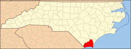 | |
| Towns | ||
| Townships |
| |
| Village | ||
| Unincorporated communities | ||