Carolina Shores, North Carolina
| Carolina Shores, North Carolina | ||
|---|---|---|
| Town | ||
| ||
 Carolina Shores Location within the state of North Carolina | ||
| Coordinates: 33°53′57″N 78°34′41″W / 33.89917°N 78.57806°WCoordinates: 33°53′57″N 78°34′41″W / 33.89917°N 78.57806°W | ||
| Country | United States | |
| State | North Carolina | |
| County | Brunswick | |
| Government | ||
| • Mayor | Walter Goodenough | |
| Area | ||
| • Total | 2.56 sq mi (6.63 km2) | |
| • Land | 2.56 sq mi (6.62 km2) | |
| • Water | 0.004 sq mi (0.01 km2) | |
| Elevation | 46 ft (14 m) | |
| Population (2010) | ||
| • Total | 3,048 | |
| • Density | 1,192/sq mi (460.3/km2) | |
| Time zone | Eastern (EST) (UTC-5) | |
| • Summer (DST) | EDT (UTC-4) | |
| ZIP code | 28467 | |
| Area code(s) | 910 | |
| FIPS code | 37-10550[1] | |
| GNIS feature ID | 1802948[2] | |
| Website |
www | |

Carolina Shores is a town in Brunswick County, North Carolina, United States. The population was 3,048 at the 2010 census,[3] up from 1,482 at the 2000 census. It is part of the Myrtle Beach metropolitan area.
The town was incorporated in 1998 after a split from the town of Calabash, which came as the result of years of disagreement over "sewer, garbage collection and sign restrictions".[4] The town limits of Carolina Shores currently interlock with those of Calabash. Sharing the name of the local country club, "Carolina Shores" could be considered a misnomer since the town does not have a "shore" with any large body of water.
Geography
Carolina Shores is located in southwestern Brunswick County at 33°53′57″N 78°34′41″W / 33.89917°N 78.57806°W (33.899163, -78.578070).[5] Its southwest border is the South Carolina state line; the town of Calabash borders Carolina Shores to the south. U.S. Route 17 (Ocean Highway) forms the northwest border of the town; the highway leads 47 miles (76 km) northeast to Wilmington and 24 miles (39 km) southwest to Myrtle Beach, South Carolina.
According to the United States Census Bureau, Carolina Shores has a total area of 2.5 square miles (6.6 km2), of which 0.004 square miles (0.01 km2), or 0.17%, is water.[3]
Demographics
| Historical population | |||
|---|---|---|---|
| Census | Pop. | %± | |
| 2000 | 1,482 | — | |
| 2010 | 3,048 | 105.7% | |
| Est. 2015 | 3,767 | [6] | 23.6% |
As of the census[1] of 2000, there were 1,482 people, 766 households, and 593 families residing in the town. The population density was 1,073.8 people per square mile (414.6/km²). There were 838 housing units at an average density of 607.2 per square mile (234.5/km²). The racial makeup of the town was 99.33% White, 0.40% African American, 0.27% from other races. Hispanic or Latino of any race were 0.54% of the population.
There were 766 households out of which 4.0% had children under the age of 18 living with them, 74.5% were married couples living together, 2.0% had a female householder with no husband present, and 22.5% were non-families. 20.5% of all households were made up of individuals and 14.9% had someone living alone who was 65 years of age or older. The average household size was 1.93 and the average family size was 2.17.
In the town the population was spread out with 3.9% under the age of 18, 1.6% from 18 to 24, 6.0% from 25 to 44, 29.4% from 45 to 64, and 59.1% who were 65 years of age or older. The median age was 68 years. For every 100 females there were 90.7 males. For every 100 females age 18 and over, there were 88.1 males.
The median income for a household in the town was $43,933, and the median income for a family was $48,527. Males had a median income of $34,167 versus $24,250 for females. The per capita income for the town was $27,093. About 2.8% of families and 4.9% of the population were below the poverty line, including 18.8% of those under age 18 and 1.2% of those age 65 or over.
References
- 1 2 "American FactFinder". United States Census Bureau. Archived from the original on 2013-09-11. Retrieved 2008-01-31.
- ↑ "US Board on Geographic Names". United States Geological Survey. 2007-10-25. Retrieved 2008-01-31.
- 1 2 "Geographic Identifiers: 2010 Demographic Profile Data (G001): Carolina Shores town, North Carolina". U.S. Census Bureau, American Factfinder. Retrieved February 10, 2014.
- ↑ Star News: Carolina Shores celebrates 10 year split from Calabash (September 17, 2008)
- ↑ "US Gazetteer files: 2010, 2000, and 1990". United States Census Bureau. 2011-02-12. Retrieved 2011-04-23.
- ↑ "Annual Estimates of the Resident Population for Incorporated Places: April 1, 2010 to July 1, 2015". Retrieved July 2, 2016.
- ↑ "Census of Population and Housing". Census.gov. Archived from the original on May 11, 2015. Retrieved June 4, 2015.
External links
Municipalities and communities of Brunswick County, North Carolina, United States | ||
|---|---|---|
| Cities | 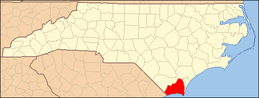 | |
| Towns | ||
| Townships |
| |
| Village | ||
| Unincorporated communities | ||