San Luis, Batangas
| San Luis | ||
|---|---|---|
| Municipality | ||
 | ||
| ||
 Map of Batangas showing the location of San Luis | ||
.svg.png) San Luis Location within the Philippines | ||
| Coordinates: 13°50′N 120°56′E / 13.83°N 120.93°ECoordinates: 13°50′N 120°56′E / 13.83°N 120.93°E | ||
| Country | Philippines | |
| Region | CALABARZON (Region IV-A) | |
| Province | Batangas | |
| District | 2nd District | |
| Barangays | 26 | |
| Government[1] | ||
| • Mayor | Sammy Ocampo | |
| Area[2] | ||
| • Total | 42.56 km2 (16.43 sq mi) | |
| Population (2015 census)[3] | ||
| • Total | 33,149 | |
| • Density | 780/km2 (2,000/sq mi) | |
| Time zone | PST (UTC+8) | |
| ZIP code | 4210 | |
| Dialing code | +63 (0)43 | |
| Income class | 4th class | |

San Luis is a fourth class municipality in the province of Batangas, Philippines. According to the 2015 census, it has a population of 33,149 people.[3]
Barangays
San Luis is politically subdivided into 26 barangays.[2]
| PSGC | Barangay | Population | ±% p.a. | ||
|---|---|---|---|---|---|
| 2015[3] | 2010[4] | ||||
| 041024001 | Abiacao | 3.5% | 1,146 | 1,052 | +1.64% |
| 041024002 | Bagong Tubig | 5.5% | 1,818 | 1,778 | +0.42% |
| 041024003 | Balagtasin | 1.7% | 561 | 534 | +0.94% |
| 041024004 | Balite | 3.0% | 997 | 942 | +1.09% |
| 041024005 | Banoyo | 6.9% | 2,294 | 2,066 | +2.01% |
| 041024006 | Boboy | 4.5% | 1,502 | 1,480 | +0.28% |
| 041024007 | Bonliw | 3.5% | 1,145 | 1,002 | +2.57% |
| 041024008 | Calumpang West | 3.6% | 1,186 | 1,081 | +1.78% |
| 041024009 | Calumpang East | 4.4% | 1,464 | 1,430 | +0.45% |
| 041024010 | Dulangan | 8.7% | 2,868 | 2,818 | +0.34% |
| 041024011 | Durungao | 2.0% | 665 | 621 | +1.31% |
| 041024012 | Locloc | 1.4% | 458 | 534 | −2.88% |
| 041024013 | Luya | 3.7% | 1,229 | 1,063 | +2.80% |
| 041024014 | Mahabang Parang | 2.2% | 734 | 602 | +3.85% |
| 041024015 | Manggahan | 3.0% | 986 | 924 | +1.24% |
| 041024016 | Muzon | 6.3% | 2,097 | 2,015 | +0.76% |
| 041024019 | San Antonio | 2.0% | 656 | 624 | +0.96% |
| 041024020 | San Isidro | 5.7% | 1,898 | 1,671 | +2.45% |
| 041024021 | San Jose | 2.1% | 698 | 594 | +3.12% |
| 041024022 | San Martin | 1.8% | 613 | 542 | +2.37% |
| 041024023 | Santa Monica | 3.6% | 1,193 | 1,042 | +2.61% |
| 041024024 | Taliba | 5.0% | 1,657 | 1,484 | +2.12% |
| 041024025 | Talon | 3.7% | 1,238 | 1,124 | +1.86% |
| 041024026 | Tejero | 3.8% | 1,258 | 1,068 | +3.17% |
| 041024027 | Tungal | 1.7% | 558 | 487 | +2.63% |
| 041024028 | Poblacion | 6.7% | 2,230 | 2,123 | +0.94% |
| Total | 33,149 | 30,701 | +1.47% | ||
Demographics
| Population census of San Luis | ||
|---|---|---|
| Year | Pop. | ±% p.a. |
| 1995 | 26,423 | — |
| 2000 | 26,924 | +0.40% |
| 2007 | 29,645 | +1.34% |
| 2010 | 30,701 | +1.28% |
| 2015 | 33,149 | +1.47% |
| Source: Philippine Statistics Authority[3][4] | ||
The population of San Luis, Batangas, in the 2015 census was 33,149 people,[3] with a density of 780 inhabitants per square kilometre or 2,000 inhabitants per square mile.
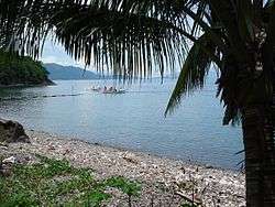
Images
 Welcome sign
 Municipal hall
 Town plaza
 Public market
References
- ↑ "Official City/Municipal 2013 Election Results". Intramuros, Manila, Philippines: Commission on Elections (COMELEC). 11 September 2013. Retrieved 11 November 2013.
- 1 2 "Province: Batangas". PSGC Interactive. Makati City, Philippines: National Statistical Coordination Board. Retrieved 11 February 2013.
- 1 2 3 4 5 "Region IV-A (CALABARZON)". Census of Population (2015): Total Population by Province, City, Municipality and Barangay (Report). PSA. Retrieved 20 June 2016.
- 1 2 "Region IV-A (CALABARZON)". Census of Population and Housing (2010): Total Population by Province, City, Municipality and Barangay (Report). NSO. Retrieved 29 June 2016.
External links
| Wikimedia Commons has media related to San Luis, Batangas. |
 |
Taal / Santa Teresita | Alitagtag | | |
| Balayan Bay | |
Bauan | ||
| ||||
| | ||||
| Bauan |
Batangas (capital) | |
| Municipalities | |
| Component cities | |
This article is issued from Wikipedia - version of the 12/2/2016. The text is available under the Creative Commons Attribution/Share Alike but additional terms may apply for the media files.