Sainte-Angèle-de-Monnoir, Quebec
| Sainte-Angèle-de-Monnoir | |
|---|---|
| Municipality | |
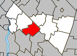 Location within Rouville RCM. | |
 Sainte-Angèle-de-Monnoir Location in southern Quebec. | |
| Coordinates: 45°23′N 73°06′W / 45.383°N 73.100°WCoordinates: 45°23′N 73°06′W / 45.383°N 73.100°W[1] | |
| Country |
|
| Province |
|
| Region | Montérégie |
| RCM | Rouville |
| Constituted | March 15, 1865 |
| Government[2][3] | |
| • Mayor | Michel Picotte |
| • Federal riding | Shefford |
| • Prov. riding | Iberville |
| Area[2][4] | |
| • Total | 45.10 km2 (17.41 sq mi) |
| • Land | 45.40 km2 (17.53 sq mi) |
|
There is an apparent contradiction between two authoritative sources | |
| Population (2011)[4] | |
| • Total | 1,812 |
| • Density | 39.9/km2 (103/sq mi) |
| • Pop 2006-2011 |
|
| • Dwellings | 700 |
| Time zone | EST (UTC−5) |
| • Summer (DST) | EDT (UTC−4) |
| Postal code(s) | J0L 1P0 |
| Area code(s) | 450 and 579 |
| Highways |
|
| Website |
www sainte-angele-de-monnoir |
Sainte-Angèle-de-Monnoir is a municipality in the Canadian province of Quebec. The population as of the Canada 2011 Census was 1,812. It is located within the Rouville Regional County Municipality in the Montérégie region about 18 kilometers east of Chambly.
Demographics
PopulationPopulation trend:[5]
|
LanguageMother tongue language (2006)[7]
|
Education
The South Shore Protestant Regional School Board previously served the municipality.[8]
See also
References
- ↑ Reference number 402077 of the Commission de toponymie du Québec (French)
- 1 2 Ministère des Affaires municipales, des Régions et de l'Occupation du territoire: Sainte-Angèle-de-Monnoir
- ↑ Parliament of Canada Federal Riding History: CHAMBLY--BORDUAS (Quebec)
- 1 2 2011 Statistics Canada Census Profile: Sainte-Angèle-de-Monnoir, Quebec
- ↑ Statistics Canada: 1996, 2001, 2006, 2011 census
- ↑ 2006 Canada Census corrections and updates
- ↑ 2006 Statistics Canada Community Profile: Sainte-Angèle-de-Monnoir, Quebec
- ↑ King, M.J. (Chairperson of the board). "South Shore Protestant Regional School Board" (St. Johns, PQ). The News and Eastern Townships Advocate. Volume 119, No. 5. Thursday December 16, 1965. p. 2. Retrieved from Google News on November 23, 2014.
 |
Marieville | Rougemont | | |
| |
Saint-Césaire | |||
| ||||
| | ||||
| Mont-Saint-Grégoire | Sainte-Brigide-d'Iberville |
| Cities | |
|---|---|
| Municipalities | |
| |
This article is issued from Wikipedia - version of the 11/13/2016. The text is available under the Creative Commons Attribution/Share Alike but additional terms may apply for the media files.