Saint-Paul-de-Jarrat
| Saint-Paul-de-Jarrat | |
|---|---|
|
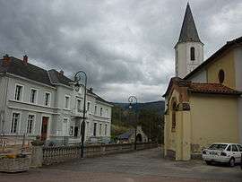
Town hall and church | |
 Saint-Paul-de-Jarrat | |
|
Location within Occitanie region  Saint-Paul-de-Jarrat | |
| Coordinates: 42°54′52″N 1°39′40″E / 42.9144°N 1.6611°ECoordinates: 42°54′52″N 1°39′40″E / 42.9144°N 1.6611°E | |
| Country | France |
| Region | Occitanie |
| Department | Ariège |
| Arrondissement | Foix |
| Canton | Foix-Rural |
| Intercommunality | Pays de Foix |
| Government | |
| • Mayor (2008–2014) | Jean-Christophe Bonrepaux |
| Area1 | 22.51 km2 (8.69 sq mi) |
| Population (2008)2 | 1,246 |
| • Density | 55/km2 (140/sq mi) |
| Time zone | CET (UTC+1) |
| • Summer (DST) | CEST (UTC+2) |
| INSEE/Postal code | 09272 / 09000 |
| Elevation |
425–1,773 m (1,394–5,817 ft) (avg. 461 m or 1,512 ft) |
|
1 French Land Register data, which excludes lakes, ponds, glaciers > 1 km² (0.386 sq mi or 247 acres) and river estuaries. 2 Population without double counting: residents of multiple communes (e.g., students and military personnel) only counted once. | |
Saint-Paul-de-Jarrat is a commune in the Ariège department in southwestern France.
Population
Inhabitants of Saint-Paul-de-Jarrat are called Saint-Paulois.
| Historical population | ||
|---|---|---|
| Year | Pop. | ±% |
| 1390 | 460 | — |
| 1765 | 1,155 | +151.1% |
| 1806 | 1,148 | −0.6% |
| 1851 | 1,549 | +34.9% |
| 1856 | 1,351 | −12.8% |
| 1872 | 1,327 | −1.8% |
| 1901 | 1,094 | −17.6% |
| 1921 | 966 | −11.7% |
| 1946 | 754 | −21.9% |
| 1962 | 877 | +16.3% |
| 1968 | 1,103 | +25.8% |
| 1975 | 1,068 | −3.2% |
| 1982 | 1,100 | +3.0% |
| 1990 | 1,261 | +14.6% |
| 1999 | 1,224 | −2.9% |
| 2006 | 1,233 | +0.7% |
| 2008 | 1,246 | +1.1% |
See also
References
| Wikimedia Commons has media related to Saint-Paul-de-Jarrat. |
This article is issued from Wikipedia - version of the 11/3/2015. The text is available under the Creative Commons Attribution/Share Alike but additional terms may apply for the media files.