Saint-Octave-de-Métis, Quebec
| Saint-Octave-de-Métis | |
|---|---|
| Parish municipality | |
 Location within La Mitis RCM | |
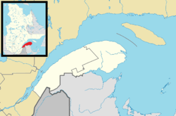 St-Octave-de-Métis Location in eastern Quebec | |
| Coordinates: 48°36′N 68°05′W / 48.6°N 68.08°WCoordinates: 48°36′N 68°05′W / 48.6°N 68.08°W[1] | |
| Country |
|
| Province |
|
| Region | Bas-Saint-Laurent |
| RCM | La Mitis |
| Constituted | April 25, 1908 |
| Government[2] | |
| • Mayor | Mylène-Julie Lavoie |
| • Federal riding | Haute-Gaspésie—La Mitis—Matane—Matapédia |
| • Prov. riding | Matane-Matapédia |
| Area[2][3] | |
| • Total | 75.20 km2 (29.03 sq mi) |
| • Land | 74.83 km2 (28.89 sq mi) |
| Population (2011)[4] | |
| • Total | 520 |
| • Density | 7.0/km2 (18/sq mi) |
| • Pop 2006-2011 |
|
| • Dwellings | 218 |
| Time zone | EST (UTC−5) |
| • Summer (DST) | EDT (UTC−4) |
| Postal code(s) | G0J 3B0 |
| Area code(s) | 418 and 581 |
| Highways |
|
Saint-Octave-de-Métis is a parish municipality in Quebec, Canada.
Demographics
In the 2011 Census, Statistics Canada originally reported that Saint-Octave-de-Métis had a population of 345 living in 142 of its 149 total dwellings, a -29.3% change from its 2006 population of 488.[5] Statistics Canada subsequently amended the 2011 census results to a population of 520 living in 210 of its 218 total dwellings, a 6.6% change from 2006.[4] With a land area of 74.83 km2 (28.89 sq mi), it had a population density of 6.95/km2 (18.00/sq mi) in 2011.[4][5]
See also
References
- ↑ Reference number 57331 of the Commission de toponymie du Québec (French)
- 1 2 Geographic code 09055 in the official Répertoire des municipalités (French)
- ↑ "(Code 2409055) Census Profile". 2011 census. Statistics Canada. 2012.
- 1 2 3 "Corrections and updates". Statistics Canada. 2012-09-19. Retrieved 2012-10-13.
- 1 2 "Population and dwelling counts, for Canada, provinces and territories, and census subdivisions (municipalities), 2011 and 2006 censuses (Quebec)". Statistics Canada. 2012-02-08. Retrieved 2012-10-13.
External links
-
 Media related to Saint-Octave-de-Métis, Quebec at Wikimedia Commons
 |
Grand-Métis | |
Métis-sur-Mer | |
| Price | |
Padoue | ||
| ||||
| | ||||
| Saint-Joseph-de-Lepage | Sainte-Angèle-de-Mérici |
| Cities & Towns | |
|---|---|
| Municipalities | |
| Parishes | |
| Villages | |
| Unorganized territories | |
| |
This article is issued from Wikipedia - version of the 12/1/2016. The text is available under the Creative Commons Attribution/Share Alike but additional terms may apply for the media files.