Saint-Dizier-les-Domaines
| Saint-Dizier-les-Domaines | |
|---|---|
|
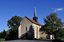
The church in Saint-Dizier-les-Domaines | |
 Saint-Dizier-les-Domaines | |
|
Location within Nouvelle-Aquitaine region  Saint-Dizier-les-Domaines | |
| Coordinates: 46°19′11″N 2°02′07″E / 46.3197°N 2.0353°ECoordinates: 46°19′11″N 2°02′07″E / 46.3197°N 2.0353°E | |
| Country | France |
| Region | Nouvelle-Aquitaine |
| Department | Creuse |
| Arrondissement | Guéret |
| Canton | Châtelus-Malvaleix |
| Intercommunality | Petite Creuse |
| Government | |
| • Mayor (2008–2014) | Jean Rapinat |
| Area1 | 15.89 km2 (6.14 sq mi) |
| Population (2008)2 | 195 |
| • Density | 12/km2 (32/sq mi) |
| Time zone | CET (UTC+1) |
| • Summer (DST) | CEST (UTC+2) |
| INSEE/Postal code | 23188 / 23270 |
| Elevation |
279–422 m (915–1,385 ft) (avg. 330 m or 1,080 ft) |
|
1 French Land Register data, which excludes lakes, ponds, glaciers > 1 km² (0.386 sq mi or 247 acres) and river estuaries. 2 Population without double counting: residents of multiple communes (e.g., students and military personnel) only counted once. | |
Saint-Dizier-les-Domaines is a commune in the Creuse department in central France.
Geography
The river Petite Creuse forms part of the commune's northeastern border.
Population
| Historical population | ||
|---|---|---|
| Year | Pop. | ±% |
| 1962 | 267 | — |
| 1968 | 325 | +21.7% |
| 1975 | 297 | −8.6% |
| 1982 | 242 | −18.5% |
| 1990 | 215 | −11.2% |
| 1999 | 199 | −7.4% |
| 2008 | 195 | −2.0% |
See also
References
| Wikimedia Commons has media related to Saint-Dizier-les-Domaines. |
This article is issued from Wikipedia - version of the 2/10/2015. The text is available under the Creative Commons Attribution/Share Alike but additional terms may apply for the media files.